osm2cdr.com
Ready map · OSM data

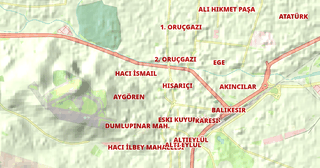
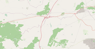
Map of Balıkesir

Elevation of Balıkesir: 307 m · 1 008 ft

Region · Turkey · 18,303 km2

A ready-made vector map with buildings, roads and features — for CAD, GIS and print. Download after signing in.

Choose a format
All 128 formats Customize your area
128 formatsOSM datadownload after signing in
N
© OpenStreetMap
Boundary · Balıkesir · OpenStreetMap
BuildingsRoadsWaterGreeneryBoundary

Map passport

18,303 km2
Area
243 104
Buildings
15 978 km
Roads
4 546
Points of interest
Typeregion
Coordinates39.81° N, 27.81° E
Elevation≈307 m
OSM data2026-10-26
Customize the map for yourself

Open the area of Balıkesir in the constructor and change layers, style, format and coordinate system for your task.

Open in constructor

Map defaults

This is how the map is built by default — every parameter can be changed in the constructor.

Format
PDF .pdfchoose
Layers
Roads, Buildings, Water, Greenery, POIchange
Style
Standard (colour)change
Detail
auto · by area sizechange
House numbers
not visible at this scalechange
Points of interest
major objects onlychange
Coordinate system
WGS 84 (auto)change
Sheet size
Relief and grid

Download the map of Balıkesir in 128 formats

The same OpenStreetMap dataset — in the format for your software. Pick by task: CAD, vector, GIS, 3D or print.

Popular formatsthe most common formats
MOST COMMON
PDFfor printing and viewing.pdf · ≈ 18.1 MB
CDRfor CorelDRAW.cdr · ≈ 2.8 MB
SVGfor Illustrator, Inkscape, web.svg · ≈ 21.2 MB
GeoJSONfor QGIS and web maps.geojson · ≈ 27.1 MB
DWGfor AutoCAD, nanoCAD, BricsCAD.dwg · ≈ 50 MB
CADdrafting and design
DWGFREE
AutoCAD.dwg · ≈ 50 MB
DXFFREE
CAD exchange.dxf · ≈ 213.2 MB
CDRFREE
CorelDRAW.cdr · ≈ 2.8 MB
DGNFREE
MicroStation.dgn · ≈ 12.4 MB
Vectorillustration and web
SVGFREE
Web · vector.svg · ≈ 21.2 MB
AIFREE
Illustrator.ai · ≈ 17.4 MB
EPSFREE
Print production.eps · ≈ 17 MB
PDFFREE
Vector · print.pdf · ≈ 18.1 MB
GISgeo-referenced data
GeoJSONFREE
GIS · data.geojson · ≈ 27.1 MB
ShapefileFREE
QGIS · ArcGIS.shp · ≈ 3.4 MB
KMLFREE
Google Earth.kml · ≈ 26.2 MB
GeoPackageFREE
GeoPackage.gpkg · ≈ 14.9 MB
3Dvolume and models
STLFREE
3D printing.stl.zip · ≈ 1.2 MB
OBJFREE
3D model.obj · ≈ 472 KB
glTFFREE
3D · web.gltf · ≈ 877 KB
DAEFREE
Collada.dae · ≈ 810 KB
Printraster and layouts
PNGFREE
Raster · transparency.png · ≈ 14.2 MB
JPGFREE
Raster.jpg · ≈ 3.6 MB
PDFFREE
Print layout.pdf · ≈ 18.1 MB
TIFFFREE
Print production.tif · ≈ 33.8 MB
Open all 128 formats

Maps of Turkey

All places within the territory — every map is ready to download.

Neighbouring places and regions

Browse to neighbouring cities, districts and regions — each has a ready-made vector map in the same formats.

Other places in Turkey

Istanbul15 701 602Kocaeli2 102 907Samsun1 371 274
All places in Turkey

Neighboring regions

Istanbul15 701 602 · RegionKocaeli2 102 907 · RegionSamsun1 371 274 · Region

About Balıkesir

Balıkesir is a spacious area of 18,303.0 km², where buildings alternate with open spaces. Green areas cover 16.1% of the territory. An extensive public transport network (482 stops) provides high mobility.

307 m · 1 008 ftElevation of Balıkesir
18 303 km²Area
15 978 kmRoads and streets
33.7 kmPedestrian ways
128formats
WGS 84coordinate system

What's inside the map of Balıkesir

The map covers the entire area of Balıkesir within administrative boundaries — 18,303 km2. Green areas cover 16.1% of the territory. Each layer can be turned on or off before download.

243 104buildings
Buildings on separate layers
commercial830
industrial1836
15 978km
Roads with classification
trunk roads1 120 km
primary roads429 km
service roads1 288 km
4 546POI
Points of interest
ATMs111
cafes322
fuel stations252
Main streets
Simav - Sındırgı YoluSavaştepe - Balıkesir YoluSimav - Dursunbey YoluBergama - İvrindi YoluMarmara Adası Çevre YoluBigadiç - Yağcılar yolu
Landmarks · 6
›Etnoğrafya Müzesi
›Ayvalık Anadolu Uygarlıkları Sergisi
›İda Madra Geoparkı
›Alibey Kudar Etnografya Müzesi
›Rahmi M. Koç Müzesi (Taksiyarhis Kilisesi)
›Akbaş Köyü Etnografya Müzesi

What the map of Balıkesir looks like

The same place in three render styles. Buildings, roads, water and greenery carry over into every format losslessly.

Blueprint (CAD) — map of Balıkesir
Blueprint (CAD)
Outlines on a dark background — for DWG and DXF
Standard vector — map of Balıkesir
Standard vector
A colour map with buildings, roads and greenery
Print layout — map of Balıkesir
Print layout
A ready layout for PDF and print production

Make a free Balıkesir map poster

City analytics

📊 Open city analytics dashboard →
Balıkesir in numbers
Area18 303 km²
Roads and streets15 978 km
Pedestrian ways33.7 km
Buildings243 104
Water bodies10
Green areas6 690.3 km²
Green share16.1%
Stations and stops482
Elevation range644 m
OSM data as of2026-03-06
What is on the map of Balıkesir
Points of interest4 546
Cafés and restaurants917
Shops2 862
Pharmacies366
Hotels15
Parks5

Streets and roads

Roads classified by type — according to OpenStreetMap data.

5763 km
tertiary roads
5176,8 km
residential streets
1288 km
service roads
1120,8 km
trunk roads
823,5 km
secondary roads
769,4 km
unclassified roads
429,5 km
primary roads
312,3 km
living streets

The street network of Balıkesir — 15 978 km of roads according to OpenStreetMap data, classified by type.

Named streets
›Simav - Sındırgı Yolu · 59,8 km
›Savaştepe - Balıkesir Yolu · 43,3 km
›Simav - Dursunbey Yolu · 40,5 km
›Bergama - İvrindi Yolu · 34,1 km
›Marmara Adası Çevre Yolu · 30,3 km
›Bigadiç - Yağcılar yolu · 28,8 km
›Gönen - Yenice Yolu · 25,3 km
›Manyas - Gönen yolu · 21,4 km

Compared to neighbours

How the place compares to neighbours within a 30-kilometre radius.

199 places within a 30 km radius to compare.

🌿 Greenerypercentile 38 of 100
🏠 Built-uppercentile 65 of 100
🛣️ Roadspercentile 0 of 100

Frequently asked questions

Open osm2cdr.com, select the target area on the map, choose a format, and start export. Most maps are ready in a few seconds.
Map of Balıkesir is available in 128 formats: CDR, DWG, DXF, SVG, AI, EPS, PDF, PNG, GeoJSON, KML, Shapefile, GeoTIFF and others.
Pick a format: all 128 formats are available, with no area limits. Download after signing in to the site; you see the price before you pay.
The service uses OpenStreetMap data, updated monthly.
Generation time depends on the area size. You will receive an email notification when ready.