PDF vs PNG — Which Is Better for Maps?
PDF is a vector format for printing at any size, PNG is raster with fixed resolution. PDF scales without loss, PNG opens faster.
| Criteria | PNG | |
|---|---|---|
| Scaling | ✓ | ✗ |
| Quick viewing | ✗ | ✓ |
| Print quality | ✓ | ✗ |
| Social media | ✗ | ✓ |
| File size | Medium | Depends on resolution |
When to use PDF
For poster printing, A3/A0, documentation, print shops.
When to use PNG
For social media, messengers, embedding in presentations.
What is PDF?
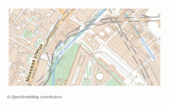
PDF was created by Adobe in 1993 and has been an open ISO standard (ISO 32000) since 2008. It describes finished pages — text, vector drawing and images placed exactly where they should appear — so a document looks the same on every screen and every printer.
A PDF is a set of numbered objects — pages, content streams, fonts, images — tied together by a cross-reference table. Page content is a sequence of drawing operators: move, line, curve, fill, show text. Vector graphics stay vector, fonts can be embedded, and optional content groups let viewers switch parts of a page on and off like layers.
Software that opens PDF
Every modern browser shows PDF without plugins, as do Adobe Acrobat Reader, macOS Preview and other PDF viewers. Adobe Illustrator, Inkscape, CorelDRAW and Affinity Designer open a vector PDF for editing.
Where PDF is strong
Nothing beats PDF for sharing and printing: the recipient needs no special software, the layout cannot shift, and print shops accept it as a matter of routine. A vector PDF keeps lines crisp at any zoom and on any sheet size.
Limitations of PDF
PDF is a final-output format. Editing is possible but clumsy, the original data structure is flattened into drawing operators, and a vector map of a very large or dense area can become heavy and slow in browser viewers — a raster PDF opens faster in that case.
What osm2cdr puts into a PDF file
osm2cdr builds the vector PDF through the QGIS print layout. Roads, buildings, water and other features are vector paths, each map layer becomes its own PDF layer that Acrobat and Illustrator can toggle, and labels stay real text with embedded fonts. Object names travel in a hidden catalogue, so Ctrl+F in a viewer jumps to a street on the map. The sheet is chosen at export, from A4 to A0, or sized automatically to the area.
What is PNG?

PNG (Portable Network Graphics) was created in 1995–1996 as a patent-free replacement for GIF and is standardised by the W3C and as ISO/IEC 15948. It is the default lossless image format of the web.
A PNG stores a grid of pixels in chunks: a header with size and colour type, compressed image data and optional metadata such as physical resolution or text. Compression is lossless, so thin lines and small lettering stay crisp, and an alpha channel allows transparency.
Software that opens PNG
Every browser, operating system and image viewer opens PNG; Photoshop, GIMP, Paint.NET, Affinity Photo, Word, PowerPoint and Google Docs accept it directly.
Where PNG is strong
It works everywhere, shows exactly what was rendered and keeps map edges and labels sharp where JPEG would smear them. Transparency makes it handy for overlays and slide designs.
Limitations of PNG
A raster has a fixed resolution: zoom in too far and pixels show, and the print size depends on the pixel count. Objects cannot be selected, restyled or measured, and high-resolution maps of large areas produce big files.
What osm2cdr puts into a PNG file
osm2cdr renders the map on the server in the chosen style and saves the sheet as an image. Sheet size and resolution are set at export, and the sheet can be picked automatically from the size of the area; if the pixel count would exceed safe limits, the resolution is lowered automatically instead of the export failing. An order arrives as a ZIP with the image plus .pgw and .prj files.
Key differences explained
At the most basic level, PDF is a fixed-layout page description format, while PNG is a lossless raster image format. On disk, PDF is a binary container of page objects, compressed content streams and embedded fonts; PNG is binary pixels compressed with DEFLATE.
Here is what the comparison table above means in practice, point by point:
- Scaling. PDF has the advantage here; PNG does not offer it.
- Quick viewing. This point goes to PNG — PDF falls short on it.
- Print quality. Only PDF covers it, so if it matters to you, PNG is not the right pick.
- Social media. PNG has the advantage here; PDF does not offer it.
- File size. PDF — medium; PNG — depends on resolution.
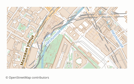
In short: choose PDF when the map has to be printed, emailed or archived and look identical on every device. Choose PNG when the map is needed as a ready picture for slides, documents, websites or social posts.
PDF or PNG: which one fits your job?
You are printing a large poster or a wall map. PDF keeps vector lines and text sharp at any sheet size, while a PNG would need an enormous pixel count to look as crisp.
You are posting a map on social media or into a chat. PNG appears inline as a picture, whereas a PDF shows up as an attachment that people have to open.
You are emailing a map to a client who may want to search for a street. The osm2cdr vector PDF keeps object names searchable with Ctrl+F, which no PNG can offer.
Pitfalls when switching between PDF and PNG
Converting PDF to PNG rasterises the page at a fixed resolution, so choose the pixel size for the final use before converting. Converting PNG to PDF only wraps the image — it does not make it vector or searchable. File size works differently too: a vector PDF of a dense city can be heavier than a PNG, while a high-resolution PNG of a big sheet can be heavier than the PDF.
If you need both, export the area twice: a PDF for printing and a PNG for sharing. They come from the same rendering of OpenStreetMap data, so the style matches, and you avoid the quality loss of turning one into the other with a screenshot or a converter.
Which to pick on osm2cdr
On osm2cdr, pick PDF for print, documents and searchable maps. Pick PNG for screens, slides, websites and social posts.
How to get PDF or PNG from OpenStreetMap
osm2cdr builds PDF and PNG directly from OpenStreetMap data — there is no need to download raw OSM extracts or install conversion tools. The steps:
- Open the osm2cdr map for PDF and find your place by name, or draw a rectangle around the area.
- Choose PDF or PNG in the format list and set the options offered for it, such as map layers, style or sheet size.
- Start the export and download the result: PDF arrives as a .pdf file; PNG arrives as a ZIP with the .png image plus .pgw and .prj files.
- Need PNG as well as PDF? Run a second export of the same area. Both start from the same OpenStreetMap data, but each keeps only what its format can hold, as described in the sections on PDF and PNG above.
Converter pages related to PDF and PNG explain each route in more detail:
Frequently asked questions
What is the main difference between PDF and PNG?
PDF is a fixed-layout page description format, whereas PNG is a lossless raster image format. In the comparison table, PDF is ahead on scaling and print quality; PNG is ahead on quick viewing and social media.
Which is better for scaling, PDF or PNG?
PDF. Nothing beats PDF for sharing and printing: the recipient needs no special software, the layout cannot shift, and print shops accept it as a matter of routine.
When does PNG beat PDF?
When quick viewing and social media matter most. It works everywhere, shows exactly what was rendered and keeps map edges and labels sharp where JPEG would smear them.
Can I convert PDF to PNG?
There is no dedicated PDF-to-PNG converter page on osm2cdr. Both formats are exported directly from OpenStreetMap data: select an area once and run the export for each format you need.
Which programs open PDF and PNG files?
PDF files open in any web browser, Adobe Acrobat Reader, macOS Preview, Foxit and SumatraPDF. PNG files open in every browser and image viewer, Photoshop, GIMP, Word and PowerPoint.
Do PDF and PNG keep real-world coordinates?
PDF pages are measured in points on paper; osm2cdr writes its vector PDF through the QGIS GeoPDF path with a layer per map layer, but most viewers simply treat it as a print sheet. PNG holds only pixels; an osm2cdr order puts a .pgw world file and a .prj next to the image in a ZIP, so GIS and CAD programs can place it on the map.