Map of Ipil
Elevation of Ipil: 28 m · 91 ft
Village · Surigao del Norte · 4K
A ready-made vector map with buildings, roads and features — for CAD, GIS and print. Download after signing in.
Ipil lies in the mountains, at about 28 m above sea level — the slopes nearby open onto wide panoramas. What is more, Ipil stands in the company of water — the runs off to one side, but within the district, and not far off lies the lake. Into the bargain Ipil is larger than most of the neighbouring villages.
Map passport
Open the area of Ipil in the constructor and change layers, style, format and coordinate system for your task.
Open in constructorMap defaults
This is how the map is built by default — every parameter can be changed in the constructor.
Download the map of Ipil in 128 formats
The same OpenStreetMap dataset — in the format for your software. Pick by task: CAD, vector, GIS, 3D or print.
Location of Ipil
Distance and direction to the nearest centres
Ipil lies 2.4 km to the south-west of San Francisco.
- Nearest city
- San Francisco — 2.4 km to the south-west
- Region centre
- Surigao del Norte — 42 km to the east
Maps of Surigao del Norte
Nearby cities and districts — every map is ready to download.
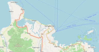
Neighbouring places and regions
Browse to neighbouring cities, districts and regions — each has a ready-made vector map in the same formats.
Regions of Philippines
About Ipil
Ipil spans 18.5 km² and contains 2,337 buildings.
Ipil map: styles and details


What's inside the map of Ipil
The map covers the entire area of Ipil within administrative boundaries. Each layer can be turned on or off before download.
What's around
Forest, water, services and roads nearby
🌳 Nature
- 🌲Forest651 m
- 🌲Forest within 5 km5.1 km²
- 💧River1.4 km
- 🌊Lake998 m
- 🏖️Sea coast50 km
🏢 Services
- 🏫School7.1 km
- 🧸Kindergarten6 km
- 🛒Shop2 km
- 💊Pharmacy5.3 km
- 🏥Hospital19 km
🛣️ Road
- 🏙️City San Francisco2.4 km SW
- 🚉Railway station50 km
Relief
★ new · from relief mapsElevation and terrain character
Elevations are computed from digital elevation models (Copernicus GLO-30). Elevation drop — 212 m.
What the map of Ipil looks like
The same place in three render styles. Buildings, roads, water and greenery carry over into every format losslessly.
Streets and roads
Roads classified by type — according to OpenStreetMap data.
The street network of Ipil — 52 km of roads according to OpenStreetMap data, classified by type.
Compared to neighbours
How the place compares to neighbours within a 30-kilometre radius.
173 places within a 30 km radius to compare.
What people who already downloaded say
Finally, maps can be downloaded as vectors. Thanks to the author!
Map: Ufa, AI
everything is really cool, I didn't expect I'd just come and download a piece of the map! thanks!!!
Map: Nizhny Novgorod, PMTiles
HUGE THANKS!!! A VERY GOOD PROGRAM!!! I was looking for a vector map where 3 countries meet - it helped a lot!!
Map: Kazakhstan and Altai, PDF
Well done! You've done a big and much-needed job!
Map: Roshchino, Leningrad Region, GeoTIFF
Ivan, thank you so much! Not just a man - a Great Man!
Map: Saratov Region, GeoJSON
ivan, you're simply a wonder. Thank you for an incredibly cool service
Map: Bogashevo near Tomsk, DXF