osm2cdr.com
Ready map · OSM data

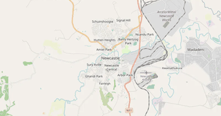
Map of Glencoe

Elevation of Glencoe: 1 296 m · 4 253 ft

City · KwaZulu-Natal · 17K

A ready-made vector map with buildings, roads and features — for CAD, GIS and print. Download after signing in.

Choose a format
All 128 formats Customize your area
128 formatsOSM datadownload after signing in
N
© OpenStreetMap
Boundary · Glencoe · OpenStreetMap
BuildingsRoadsWaterGreeneryBoundary

Map passport

19
Buildings
215 km
Roads
26
Points of interest
Typecity
Population17K
Coordinates28.17° S, 30.16° E
Elevation≈1,296 m
OSM data2026-10-26
Customize the map for yourself

Open the area of Glencoe in the constructor and change layers, style, format and coordinate system for your task.

Open in constructor

Map defaults

This is how the map is built by default — every parameter can be changed in the constructor.

Format
PDF choose
Layers
Roads, Buildings, Water, Greenery, POIchange
Style
Standard (colour)change
Detail
auto · by area sizechange
House numbers
Points of interest
all but cafés, shops and services — the editor adds thosechange
Coordinate system
WGS 84 (auto)change
Sheet size
Relief and grid

Download the map of Glencoe in 128 formats

The same OpenStreetMap dataset — in the format for your software. Pick by task: CAD, vector, GIS, 3D or print.

Popular formatsthe most common formats
MOST COMMON
PDFfor printing and viewing.pdf
CDRfor CorelDRAW.cdr
SVGfor Illustrator, Inkscape, web.svg
GeoJSONfor QGIS and web maps.geojson
DWGfor AutoCAD, nanoCAD, BricsCAD.dwg
CADdrafting and design
DWGFREE
AutoCAD.dwg
DXFFREE
CAD exchange.dxf
CDRFREE
CorelDRAW.cdr
DGNFREE
MicroStation.dgn
Vectorillustration and web
SVGFREE
Web · vector.svg
AIFREE
Illustrator.ai
EPSFREE
Print production.eps
PDFFREE
Vector · print.pdf
GISgeo-referenced data
GeoJSONFREE
GIS · data.geojson
ShapefileFREE
QGIS · ArcGIS.shp
KMLFREE
Google Earth.kml
GeoPackageFREE
GeoPackage.gpkg
3Dvolume and models
STLFREE
3D printing.stl
OBJFREE
3D model.obj
glTFFREE
3D · web.gltf
DAEFREE
Collada.dae
Printraster and layouts
PNGFREE
Raster · transparency.png
JPGFREE
Raster.jpg
PDFFREE
Print layout.pdf
TIFFFREE
Print production.tif
Open all 128 formats

Maps of KwaZulu-Natal

Nearby cities and districts — every map is ready to download.

Neighbouring places and regions

Browse to neighbouring cities, districts and regions — each has a ready-made vector map in the same formats.

Nearby

Manzini110 508 · 221 km · CityEswatini222 km · CountryLesotho244 km · CountryeMalahleni108 673 · 272 km · CityVereeniging100 000 · 277 km · CityBenoni158 777 · 287 km · CityBoksburg260 000 · 288 km · CityMaseru227 880 · 291 km · City

Neighboring countries

Botswana922 km · CountryZimbabwe1021 km · CountryMozambique1327 km · Country

About Glencoe

Glencoe is a spacious city spanning 61.9 km², where buildings alternate with open spaces.

1 296 m · 4 253 ftElevation of Glencoe
215 kmRoads and streets
19Buildings
3Water bodies
128formats
WGS 84coordinate system

What's inside the map of Glencoe

The map covers the entire area of Glencoe within administrative boundaries. Each layer can be turned on or off before download.

19buildings
Buildings on separate layers
215km
Roads with classification
primary roads23 km
service roads16 km
tertiary roads41 km
26POI
Points of interest
fuel stations1
sports pitches11
Prison2
Main streets
MainKarel Landman StreetBiggar StreetKemp StreetCelle StreetDamann Street
Landmarks · 2
›NG Kerk - Glencoe
›Site of Glencoe Loco Shed

What the map of Glencoe looks like

The same place in three render styles. Buildings, roads, water and greenery carry over into every format losslessly.

Blueprint (CAD) — map of Glencoe
Blueprint (CAD)
Outlines on a dark background — for DWG and DXF
Standard vector — map of Glencoe
Standard vector
A colour map with buildings, roads and greenery
Print layout — map of Glencoe
Print layout
A ready layout for PDF and print production
Glencoe in numbers
Roads and streets215 km
Buildings19
Water bodies3
Stations and stops1
Elevation range331 m
OSM data as of2026-03-15
What is on the map of Glencoe
Points of interest26
Shops1
Schools4

Streets and roads

Roads classified by type — according to OpenStreetMap data.

101,5 km
residential streets
41,9 km
tertiary roads
23,1 km
primary roads
21,9 km
secondary roads
16,3 km
service roads
10 km
unclassified roads

The street network of Glencoe — 215 km of roads according to OpenStreetMap data, classified by type.

Named streets
›Main · 5,1 km
›Karel Landman Street · 4,5 km
›Biggar Street · 4,5 km
›Kemp Street · 3,8 km
›Celle Street · 2,6 km
›Damann Street · 2,3 km
›De Beers Street · 2 km
›Windsor Street · 2 km

Compared to neighbours

How the place compares to neighbours within a 30-kilometre radius.

4 places within a 30 km radius to compare.

Frequently asked questions

Open osm2cdr.com, select the target area on the map, choose a format, and start export. Most maps are ready in a few seconds.
Map of Glencoe is available in 128 formats: CDR, DWG, DXF, SVG, AI, EPS, PDF, PNG, GeoJSON, KML, Shapefile, GeoTIFF and others.
Pick a format: all 128 formats are available, with no area limits. Download after signing in to the site; you see the price before you pay.
The service uses OpenStreetMap data, updated monthly.
Generation time depends on the area size. You will receive an email notification when ready.