osm2cdr.com
Ready map · OSM data

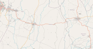
Map of Nasarawa State

Elevation of Nasarawa State: 163 m · 536 ft

Region · Nigeria · 26,405 km2

A ready-made vector map with buildings, roads and features — for CAD, GIS and print. Download after signing in.

Choose a format
All 128 formats Customize your area
128 formatsOSM datadownload after signing in
N
© OpenStreetMap
Boundary · Nasarawa State · OpenStreetMap
BuildingsRoadsWaterGreeneryBoundary

Map passport

26,405 km2
Area
254 401
Buildings
12 706 km
Roads
2 115
Points of interest
Typeregion
Coordinates8.5° N, 8.19° E
Elevation≈163 m
OSM data2026-10-26
Customize the map for yourself

Open the area of Nasarawa State in the constructor and change layers, style, format and coordinate system for your task.

Open in constructor

Map defaults

This is how the map is built by default — every parameter can be changed in the constructor.

Format
PDF .pdfchoose
Layers
Roads, Buildings, Water, Greenery, POIchange
Style
Standard (colour)change
Detail
overview (auto)change
House numbers
not visible at this scalechange
Points of interest
not visible at this scalechange
Coordinate system
WGS 84 (auto)change
Sheet size
Relief and grid

Download the map of Nasarawa State in 128 formats

The same OpenStreetMap dataset — in the format for your software. Pick by task: CAD, vector, GIS, 3D or print.

Popular formatsthe most common formats
MOST COMMON
PDFfor printing and viewing.pdf · ≈ 1.2 MB
CDRfor CorelDRAW.cdr · ≈ 180 KB
SVGfor Illustrator, Inkscape, web.svg · ≈ 1.4 MB
GeoJSONfor QGIS and web maps.geojson · ≈ 2.7 MB
DWGfor AutoCAD, nanoCAD, BricsCAD.dwg · ≈ 50 MB
CADdrafting and design
DWGFREE
AutoCAD.dwg · ≈ 50 MB
DXFFREE
CAD exchange.dxf · ≈ 189.7 MB
CDRFREE
CorelDRAW.cdr · ≈ 180 KB
DGNFREE
MicroStation.dgn · ≈ 807 KB
Vectorillustration and web
SVGFREE
Web · vector.svg · ≈ 1.4 MB
AIFREE
Illustrator.ai · ≈ 1.1 MB
EPSFREE
Print production.eps · ≈ 1.1 MB
PDFFREE
Vector · print.pdf · ≈ 1.2 MB
GISgeo-referenced data
GeoJSONFREE
GIS · data.geojson · ≈ 2.7 MB
ShapefileFREE
QGIS · ArcGIS.shp · ≈ 347 KB
KMLFREE
Google Earth.kml · ≈ 2.6 MB
GeoPackageFREE
GeoPackage.gpkg · ≈ 1.5 MB
3Dvolume and models
STLFREE
3D printing.stl.zip · ≈ 77 KB
OBJFREE
3D model.obj · ≈ 30 KB
glTFFREE
3D · web.gltf · ≈ 56 KB
DAEFREE
Collada.dae · ≈ 52 KB
Printraster and layouts
PNGFREE
Raster · transparency.png · ≈ 927 KB
JPGFREE
Raster.jpg · ≈ 236 KB
PDFFREE
Print layout.pdf · ≈ 1.2 MB
TIFFFREE
Print production.tif · ≈ 2.2 MB
Open all 128 formats

Maps of Nigeria

All places within the territory — every map is ready to download.

Neighbouring places and regions

Browse to neighbouring cities, districts and regions — each has a ready-made vector map in the same formats.

Other places in Nigeria

Oyo StateAnambra State
All places in Nigeria

About Nasarawa State

Nasarawa State is a ready-made vector map based on OpenStreetMap data. It is not an image but structured layers of buildings, roads, water bodies, greenery and points of interest that can be edited in any professional software. The territory belongs to the «Nigeria» region and covers an area of 26,405 km2 within administrative boundaries.

The map includes 254 401 buildings, 12 706 km of roads and streets and 2 115 points of interest. Each layer can be turned on or off before download, and the data preserves the original OpenStreetMap classification. Green areas cover about 0.1% of the territory.

The map works well as an underlay in AutoCAD and CorelDRAW, for loading layers into QGIS and ArcGIS, preparing printed schemes and plans, or as a basis for design and navigation. 128 formats are available — from DWG, DXF and SVG to GeoJSON, Shapefile and 3D models, in the WGS 84 coordinate system.

163 m · 536 ftElevation of Nasarawa State
26 405.5 km²Area
12 706 kmRoads and streets
254 401Buildings
128formats
WGS 84coordinate system

What's inside the map of Nasarawa State

The map covers the entire area of Nasarawa State within administrative boundaries — 26,405 km2. Green areas cover 0.1% of the territory. Each layer can be turned on or off before download.

254 401buildings
Buildings on separate layers
commercial10
12 706km
Roads with classification
trunk roads401 km
primary roads495 km
service roads249 km
2 115POI
Points of interest
bars48
cafes121
fuel stations79
Main streets
Abaji to Nassarawa RoadLoko to Nassarawa RoadKeffi to Kachia RoadLafia to Shendam RoadNassarawa to Keffi RoadA3
Landmarks · 5
›John Castle
›Awwaliyya Mosque
›Evangelical Reformed Church of Christ (ERCC), GraceLand
›Football viewing centre
›New life Baptist church

What the map of Nasarawa State looks like

The same place in three render styles. Buildings, roads, water and greenery carry over into every format losslessly.

Blueprint (CAD) — map of Nasarawa State
Blueprint (CAD)
Outlines on a dark background — for DWG and DXF
Standard vector — map of Nasarawa State
Standard vector
A colour map with buildings, roads and greenery
Print layout — map of Nasarawa State
Print layout
A ready layout for PDF and print production

Make a free Nasarawa State map poster

Nasarawa State in numbers
Area26 405.5 km²
Roads and streets12 706 km
Buildings254 401
Water bodies7
Green areas41.9 km²
Green share0.1%
Stations and stops2
Elevation range544 m
OSM data as of2026-03-06
What is on the map of Nasarawa State
Points of interest2 115
Cafés and restaurants248
Shops1 391
Pharmacies140
Hotels4

Streets and roads

Roads classified by type — according to OpenStreetMap data.

4970,9 km
unclassified roads
3872,1 km
residential streets
1944,8 km
tertiary roads
760,6 km
secondary roads
495,4 km
primary roads
401,5 km
trunk roads
249,4 km
service roads
11,2 km
living streets

The street network of Nasarawa State — 12 706 km of roads according to OpenStreetMap data, classified by type.

Named streets
›Abaji to Nassarawa Road · 100,3 km
›Loko to Nassarawa Road · 71,2 km
›Keffi to Kachia Road · 58,4 km
›Lafia to Shendam Road · 53,6 km
›Nassarawa to Keffi Road · 40,5 km
›A3 · 32,1 km
›Loko-Oweto Bridge · 3,7 km
›Shehu Shagari Crescent · 3,2 km

Compared to neighbours

How the place compares to neighbours within a 30-kilometre radius.

5 places within a 30 km radius to compare.

Frequently asked questions

Open osm2cdr.com, select the target area on the map, choose a format, and start export. Most maps are ready in a few seconds.
Map of Nasarawa State is available in 128 formats: CDR, DWG, DXF, SVG, AI, EPS, PDF, PNG, GeoJSON, KML, Shapefile, GeoTIFF and others.
Pick a format: all 128 formats are available, with no area limits. Download after signing in to the site; you see the price before you pay.
The service uses OpenStreetMap data, updated monthly.
Generation time depends on the area size. You will receive an email notification when ready.