osm2cdr.com
Ready map · OSM data

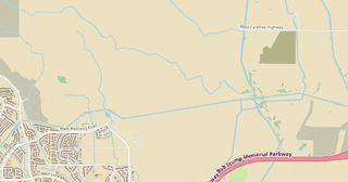
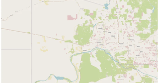
Map of Mesa

Elevation of Mesa: 420 m · 1 377 ft

City · Arizona · 504K · 343 km2

A ready-made vector map with buildings, roads and features — for CAD, GIS and print. Download after signing in.

Choose a format
All 128 formats Customize your area
128 formatsOSM datadownload after signing in
N
© OpenStreetMap
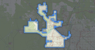
Boundary · Mesa · OpenStreetMap
BuildingsRoadsWaterGreeneryBoundary

Map passport

343 km2
Area
159 088
Buildings
6 072 km
Roads
6 720
Points of interest
Typecity
Population504K
Coordinates33.4° N, 111.72° W
Elevation≈420 m
OSM data2026-10-26
Customize the map for yourself

Open the area of Mesa in the constructor and change layers, style, format and coordinate system for your task.

Open in constructor

Map defaults

This is how the map is built by default — every parameter can be changed in the constructor.

Format
PDF choose
Layers
Roads, Buildings, Water, Greenery, POIchange
Style
Standard (colour)change
Detail
auto · by area sizechange
House numbers
not visible at this scalechange
Points of interest
major objects onlychange
Coordinate system
WGS 84 (auto)change
Sheet size
Relief and grid

Download the map of Mesa in 128 formats

The same OpenStreetMap dataset — in the format for your software. Pick by task: CAD, vector, GIS, 3D or print.

Popular formatsthe most common formats
MOST COMMON
PDFfor printing and viewing.pdf · ≈ 26 MB
CDRfor CorelDRAW.cdr · ≈ 5.8 MB
SVGfor Illustrator, Inkscape, web.svg · ≈ 44.6 MB
GeoJSONfor QGIS and web maps.geojson · ≈ 102.8 MB
DWGfor AutoCAD, nanoCAD, BricsCAD.dwg · ≈ 50 MB
CADdrafting and design
DWGFREE
AutoCAD.dwg · ≈ 50 MB
DXFFREE
CAD exchange.dxf · ≈ 122.6 MB
CDRFREE
CorelDRAW.cdr · ≈ 5.8 MB
DGNFREE
MicroStation.dgn · ≈ 26 MB
Vectorillustration and web
SVGFREE
Web · vector.svg · ≈ 44.6 MB
AIFREE
Illustrator.ai · ≈ 36.6 MB
EPSFREE
Print production.eps · ≈ 35.7 MB
Vector PDFFREE
Vector · print.pdf · ≈ 38.1 MB
GISgeo-referenced data
GeoJSONFREE
GIS · data.geojson · ≈ 102.8 MB
ShapefileFREE
QGIS · ArcGIS.shp · ≈ 25.3 MB
KMLFREE
Google Earth.kml · ≈ 193.5 MB
GeoPackageFREE
GeoPackage.gpkg · ≈ 64.7 MB
3Dvolume and models
STLFREE
3D printing.stl.zip · ≈ 2.5 MB
OBJFREE
3D model.obj · ≈ 993 KB
glTFFREE
3D · web.gltf · ≈ 1.8 MB
DAEFREE
Collada.dae · ≈ 1.7 MB
Printraster and layouts
PNGFREE
Raster · transparency.png · ≈ 29.9 MB
JPGFREE
Raster.jpg · ≈ 7.6 MB
Vector PDFFREE
Print layout.pdf · ≈ 38.1 MB
TIFFFREE
Print production.tif · ≈ 71.1 MB
Open all 128 formats

Maps of Arizona

Nearby cities and districts — every map is ready to download.

Neighbouring places and regions

Browse to neighbouring cities, districts and regions — each has a ready-made vector map in the same formats.

Regions of United States

California39 576 757Texas29 145 505New York20 201 249Pennsylvania13 078 751Illinois12 812 508Ohio11 883 304Georgia11 180 878North Carolina11 046 024Michigan10 140 459Tennessee7 227 750Indiana6 924 275Missouri6 245 466Wisconsin5 960 975Colorado5 957 493Minnesota5 793 151Alabama5 024 279Louisiana4 597 740Kentucky4 588 372Oklahoma3 963 516Iowa3 241 488Arkansas3 088 354Kansas2 970 606Nebraska2 005 465Maine1 405 012Virginia8 811 195Washington7 958 180Mississippi2 943 045South Carolina5 478 831South Dakota924 669Utah3 503 613
United States — all regions

Nearby

Scottsdale246 068 · 21 km · CityPeoria203 252 · 51 km · CityGoodyear121 116 · 61 km · CityYuma103 559 · 279 km · CityHenderson310 390 · 418 km · CityEnterprise221 831 · 431 km · CityParadise191 238 · 433 km · CitySunrise Manor205 618 · 434 km · City

Similar cities worldwide

Pingliang504 265Toulouse504 078Agadir504 768Surakarta503 421Sangli502 800Hulunbeiershi506 114

About Mesa

Mesa features high building density: 464 buildings per km² — significantly above average for cities of this size. Green areas cover only 4.5% — the city is heavily urbanized. An extensive public transport network (584 stops) provides high mobility.

420 m · 1 377 ftElevation of Mesa
342.8 km²Area
6 072 kmRoads and streets
0.7 kmPedestrian ways
128formats
WGS 84coordinate system

What's inside the map of Mesa

The map covers the entire area of Mesa within administrative boundaries — 343 km2. Green areas cover 4.5% of the territory. Each layer can be turned on or off before download.

159 088buildings
Buildings on separate layers
residential36499
commercial503
industrial214
6 072km
Roads with classification
trunk roads0 km
primary roads211 km
service roads2 792 km
6 720POI
Points of interest
cafes63
benches445
beauty salons131
Main streets
East Main StreetEast Baseline RoadEast Brown RoadEast Broadway RoadEast McKellips RoadEast Southern Avenue
Landmarks · 6
›Mesa Contemporary Arts Museum
›Engine 2355
›Vertuccio Farms
›T38 Talon
›ASU Polytechnic
›82nd Training Wing, Williams Air Force Base

What the map of Mesa looks like

The same place in three render styles. Buildings, roads, water and greenery carry over into every format losslessly.

Blueprint (CAD) — map of Mesa
Blueprint (CAD)
Outlines on a dark background — for DWG and DXF
Standard vector — map of Mesa
Standard vector
A colour map with buildings, roads and greenery
Print layout — map of Mesa
Print layout
A ready layout for PDF and print production

Make a free Mesa map poster

City analytics

📊 Open city analytics dashboard →
Mesa in numbers
Area342.8 km²
Roads and streets6 072 km
Pedestrian ways0.7 km
Buildings159 088
Water bodies9
Green areas34.8 km²
Green share4.5%
Stations and stops584
Elevation range653 m
OSM data as of2026-03-15
What is on the map of Mesa
Points of interest6 720
Cafés and restaurants531
Shops1 586
Pharmacies52
Hotels6
Parks5

Streets and roads

Roads classified by type — according to OpenStreetMap data.

2792,9 km
service roads
2173,9 km
residential streets
322,7 km
secondary roads
266,7 km
tertiary roads
211,6 km
primary roads
144,1 km
motorways
99,2 km
unclassified roads
52,7 km
cycleways

The street network of Mesa — 6 072 km of roads according to OpenStreetMap data, classified by type.

Named streets
›East Main Street · 30,5 km
›East Baseline Road · 25,9 km
›East Brown Road · 23,8 km
›East Broadway Road · 23,5 km
›East McKellips Road · 22,7 km
›East Southern Avenue · 22,6 km
›South Ellsworth Road · 21 km
›South Sossaman Road · 19,9 km

Compared to neighbours

How the place compares to neighbours within a 30-kilometre radius.

16 places within a 30 km radius to compare.

🌿 Greenerypercentile 11 of 100
🏠 Built-uppercentile 62 of 100
🛣️ Roadspercentile 19 of 100

Frequently asked questions

Open osm2cdr.com, select the target area on the map, choose a format, and start export. Most maps are ready in a few seconds.
Map of Mesa is available in 128 formats: CDR, DWG, DXF, SVG, AI, EPS, PDF, PNG, GeoJSON, KML, Shapefile, GeoTIFF and others.
Pick a format: all 128 formats are available, with no area limits. Download after signing in to the site; you see the price before you pay.
The service uses OpenStreetMap data, updated monthly.
Generation time depends on the area size. You will receive an email notification when ready.