osm2cdr.com
Ready map · OSM data

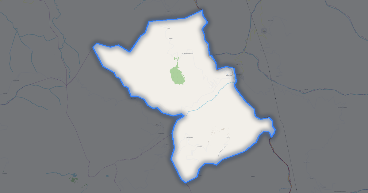
Map of Amazonas

Region · Peru · 375K · 39,210 km2

A ready-made vector map with buildings, roads and features — for CAD, GIS and print. Free, no registration.

Choose a format
Download · PDF, ≈ 704 KB
All 140 formats Customize your area
133 formatsOSM datano registrationfree
N
© OpenStreetMap
Boundary · Amazonas · OpenStreetMap
BuildingsRoadsWaterGreeneryBoundary

Map passport

39,210 km2
Area
44 344
Buildings
6 572 km
Roads
3 041
Points of interest
Typeregion
Population375K
Coordinates5.07° S, 78.05° W
Elevation≈620 m
OSM data2026-08-24
Customize the map for yourself

Open the area of Amazonas in the constructor and change layers, style, format and coordinate system for your task.

Open in constructor

Map defaults

This is how the map is built by default — every parameter can be changed in the constructor.

Format
PDF choose
Layers
Roads, Buildings, Water, Greenery, POIchange
Style
Standard (colour)change
Detail
overview (auto)change
House numbers
not visible at this scalechange
Points of interest
not visible at this scalechange
Coordinate system
WGS 84 (auto)change
Sheet size
Relief and grid

Download the map of Amazonas in 140 formats

The same OpenStreetMap dataset — in the format for your software. Pick by task: CAD, vector, GIS, 3D or print.

Popular formatsthe most common formats
MOST COMMON
PDFfor printing and viewing.pdf · ≈ 906 KB
CDRfor CorelDRAW.cdr · ≈ 138 KB
SVGfor Illustrator, Inkscape, web.svg · ≈ 1 MB
GeoJSONfor QGIS and web maps.geojson · ≈ 1.9 MB
DWGfor AutoCAD, nanoCAD, BricsCAD.dwg · ≈ 389 KB
CADdrafting and design
DWGFREE
AutoCAD.dwg · ≈ 442 KB
DXFFREE
CAD exchange.dxf · ≈ 3.6 MB
CDRFREE
CorelDRAW.cdr · ≈ 157 KB
DGNFREE
MicroStation.dgn · ≈ 704 KB
Vectorillustration and web
SVGFREE
Web · vector.svg · ≈ 1.2 MB
AIFREE
Illustrator.ai · ≈ 989 KB
EPSFREE
Print production.eps · ≈ 966 KB
PDFFREE
Vector · print.pdf · ≈ 1 MB
GISgeo-referenced data
GeoJSONFREE
GIS · data.geojson · ≈ 2.2 MB
ShapefileFREE
QGIS · ArcGIS.shp · ≈ 290 KB
KMLFREE
Google Earth.kml · ≈ 2.2 MB
GeoPackageFREE
GeoPackage.gpkg · ≈ 1.2 MB
3Dvolume and models
STLFREE
3D printing.stl · ≈ 67 KB
OBJFREE
3D model.obj · ≈ 26 KB
glTFFREE
3D · web.gltf · ≈ 49 KB
DAEFREE
Collada.dae · ≈ 45 KB
Printraster and layouts
PNGFREE
Raster · transparency.png · ≈ 809 KB
JPGFREE
Raster.jpg · ≈ 206 KB
PDFFREE
Print layout.pdf · ≈ 1 MB
TIFFFREE
Print production.tif · ≈ 1.9 MB
Open all 140 formats

Maps of Peru

All places within the territory — every map is ready to download.

Neighbouring places and regions

Browse to neighbouring cities, districts and regions — each has a ready-made vector map in the same formats.

Other places in Peru

Ancash1 063 459Lima10 628 470Cusco1 171 403Junín1 225 474Puno1 268 441Loreto883 510Arequipa1 382 730Cajamarca1 387 809Piura1 676 315La Libertad1 778 080San Martín813 381Ayacucho616 176Huánuco762 223Lambayeque1 197 260Ica711 932Huancavelica454 797Apurímac404 190Ucayali432 159Pasco280 449Tacna329 322Moquegua161 533Madre de Dios109 555Tumbes200 306Yunguyo19 051Callao
All places in Peru

Similar regions

Autonomous Republic of Adjara376 016Kastamonu375 592Masaya375 083Innlandet377 556Putumayo378 483Jönköping County368 963

Neighboring regions

Ancash1 063 459 · RegionLima10 628 470 · RegionCusco1 171 403 · RegionJunín1 225 474 · RegionPuno1 268 441 · RegionLoreto883 510 · RegionArequipa1 382 730 · RegionCajamarca1 387 809 · RegionPiura1 676 315 · RegionLa Libertad1 778 080 · Region

Major cities nearby

Zumba140 kmPalanda150 kmZumbi149 kmSan Francisco del Vergel126 kmGuayzimi132 kmPaquisha139 kmSan Carlos de las Minas142 km
Map of Amazonas
Amazonas
Peru · 375K

About Amazonas

Amazonas is a ready-made vector map based on OpenStreetMap data. It is not an image but structured layers of buildings, roads, water bodies, greenery and points of interest that can be edited in any professional software. The territory belongs to the «Peru» region and covers an area of 39,210 km2 within administrative boundaries.

The map includes 44 344 buildings, 6 572 km of roads and streets and 3 041 points of interest. Each layer can be turned on or off before download, and the data preserves the original OpenStreetMap classification. Green areas cover about 1.9% of the territory.

The map works well as an underlay in AutoCAD and CorelDRAW, for loading layers into QGIS and ArcGIS, preparing printed schemes and plans, or as a basis for design and navigation. More than 130 formats are available — from DWG, DXF and SVG to GeoJSON, Shapefile and 3D models, in the WGS 84 coordinate system.

44 344buildings
6 572 kmroads and streets
3 041features
140formats
WGS 84coordinate system

What's inside the map of Amazonas

The map covers the entire area of Amazonas within administrative boundaries — 39,210 km2. Green areas cover 1.9% of the territory. Each layer can be turned on or off before download.

44 344buildings
Buildings on separate layers
commercial1
industrial1
6 572km
Roads with classification
trunk roads647 km
primary roads479 km
service roads53 km
3 041POI
Points of interest
banks16
fuel stations30
benches18
Main streets
Carretera Huaylla BelénCarretera Nuevo Tingo - ColcamarA Nuevo ParaisoCarretera Nogalcucho - KuelapSanta CruzCarretera Colcamar
Landmarks · 6
Museo del sarcófago de Karajia
Museo Jalca Grande
Museo de Leymebamba
Museo de Lámud
Salas de Exposición "Gilberto Tenorio Ruiz"
Museo Etnohistórico Religioso Santa Ana

What the map of Amazonas looks like

The same place in three render styles. Buildings, roads, water and greenery carry over into every format losslessly.

Blueprint (CAD) — map of Amazonas
Blueprint (CAD)
Outlines on a dark background — for DWG and DXF
Standard vector — map of Amazonas
Standard vector
A colour map with buildings, roads and greenery
Print layout — map of Amazonas
Print layout
A ready layout for PDF and print production

Infrastructure of Amazonas

What's on the territory according to OpenStreetMap data.

99
Dining
58
Shops
15
Hotels
30
Transport
5
Parks
6
Water

Density and saturation

How many features there are per square kilometre — according to OpenStreetMap data.

1
bld/km²
0,2
km/km²
0
POI/km²
1,9%
greenery

How the map is used

The same dataset for Amazonas — for different tasks: from drafting to 3D printing.

Architecture and design
An underlay and building outlines for drawings and layouts.
DWG / DXF
Design and illustration
A vector map base for posters, schemes and identity design.
SVG / AI
GIS and analysis
Geo-referenced layers for QGIS, ArcGIS and spatial analysis.
GeoJSON / SHP
3D printing and models
Relief of buildings and terrain for printing and visualization.
STL
Navigation and tracks
Map data for navigators and route apps.
Garmin
Print and publishing
A ready map layout for print production.
PDF

Landmarks

Museums, monuments and notable places of Amazonas according to OpenStreetMap data — each with a link to the map.

🏛️
Museo del sarcófago de Karajia
MuseumOSM
🏛️
Museo Jalca Grande
MuseumOSM
🏛️
Museo de Leymebamba
MuseumOSM
🏛️
Museo de Lámud
MuseumOSM
🏛️
Salas de Exposición "Gilberto Tenorio Ruiz"
MuseumOSM
🏛️
Museo Etnohistórico Religioso Santa Ana
MuseumOSM
🏛️
Centro de interpretación Fortaleza de Kuelap
MuseumOSM
Lanche - Gran Vilaya Complex
AttractionOSM
Lanche - Gran Vilaya Complex
AttractionOSM
Ponguito
AttractionOSM
Diablo Huasi
AttractionOSM
Las fuentes del Inca
AttractionOSM
Peña del Sol
AttractionOSM
Pasa Breve
AttractionOSM
La Boveda
AttractionOSM

Nature and green areas

Parks, squares and water bodies of Amazonas according to OpenStreetMap data — everything is carried into the map as separate layers.

1499,8
km² of greenery
1,9%
green coverage
5
parks
6
water bodies
Parks and squares
Pampas de Higos Urco · 2 ha
Plaza de Armas Héroes del Cenepa · 1 ha
Plaza de Armas · 1 ha
Plaza de Armas de Pedro Castro · 1 ha
Water bodies
Río Santiago · lake
Laguna Pomacochas · lake
Río Marañón · river
Río Cenepa · river
Rio Nieva · river
Río Utcubamba · river

Public transport

Stops and stations according to OpenStreetMap data.

30
bus stops

Public transport of Amazonas includes 30 bus stops. All stops and stations are included in the map as a separate layer.

Streets and roads

Roads classified by type — according to OpenStreetMap data.

2046 km
unclassified roads
1610,3 km
tertiary roads
1188 km
residential streets
647,1 km
trunk roads
525,8 km
secondary roads
479,9 km
primary roads
53,6 km
service roads
21,7 km
pedestrian zones

The street network of Amazonas — 6 572 km of roads according to OpenStreetMap data, classified by type.

Named streets
Carretera Huaylla Belén · 68 km
Carretera Nuevo Tingo - Colcamar · 31,2 km
A Nuevo Paraiso · 14,1 km
Carretera Nogalcucho - Kuelap · 13,2 km
Santa Cruz · 11,6 km
Carretera Colcamar · 10,9 km
Jirón Amazonas · 9,2 km
Jirón Ramón Castilla · 8,4 km

Restaurants and cafés

Food and drink venues according to OpenStreetMap data.

10
restaurants
10
cafés
2
bars
3
fast food

In Amazonas, OpenStreetMap records 99 food and drink venues — restaurants, cafés, bars and fast-food outlets.

Notable venues
Restaurante El Sabor Amazónico
El Piurano
Jhorssrg
Polleria El Caribe
Aracely
Heydi
Rinconcito Huanquino
La Purquilla - restaurante

Shops and retail

Retail according to OpenStreetMap data.

58
shops

In Amazonas, OpenStreetMap records 58 shops and retail outlets. Main categories: Convenience, Bakeries, Travel Agencies, Laundry, Gifts, Chemist.

Convenience20Bakeries8Travel Agencies8Laundry4Gifts3Chemist2Mobile Phones2Confectionery2Pet Shops1Shops1

Education

Schools, universities and libraries according to OpenStreetMap data.

298
schools
1
universities
201
kindergartens

Schools: Institución Educativa No. 17818, Institución Educativa No. 16329, Institución Educativa Ing. Oscar Ramiro Altamirano Quispe, Institución Educativa Rvdo. Manuel Garcia Rendueles, Institución Educativa No. 16787, Institución Educativa No. 17261, Institución Educativa Teniente Coronel Carlos Antonio Arias Huapaya, Institución Educativa No. 16740. Universities: Fe y Alegria 62.

Healthcare

Hospitals, pharmacies and clinics according to OpenStreetMap data.

3
hospitals
11
pharmacies
358
clinics

Hospitals of Amazonas: Hospital Santa María de Nieva, Hospital de Apoyo I Santiago Apostol de Utcubamba, Puesto de salud Quinjalca.

Where to stay

Hotels, hostels and guest houses according to OpenStreetMap data.

15
accommodation places
Hotels and guest houses
Hostal Palco · Hotel
Hotel tribal · Hotel
IMACITA
Camping la Choza
Gladysmar · Apartments
Playa y cielo
Hospedaje Nuevo Tingo · Guest house
El castillo · Hotel

What's on the map

Each layer of the Amazonas map can be turned on or off before download.

Map layers
Buildings: 44 344
Roads: 6 572 km
Points of interest: 3 041
Green areas: 1499,8 km²

Key figures

A summary based on OpenStreetMap data for Amazonas.

Buildings44 344
Commercial buildings1
Roads6 572 km
Green areas1499,8 km²
Green coverage1,9%
Food and drink venues99
Shops58
Points of interest3 041
Bus stops30
Hospitals3
Pharmacies11
Landmarks15

Compared to neighbours

How the place compares to neighbours within a 30-kilometre radius.

55 places within a 30 km radius to compare.

🛣️ Roadspercentile 0 of 100

Frequently asked questions

Open osm2cdr.com, select the target area on the map, choose a format, and start export. Most maps are ready in 1-5 minutes.
Map of Amazonas is available in 140 formats: CDR, DWG, DXF, SVG, AI, EPS, PDF, PNG, GeoJSON, KML, Shapefile, GeoTIFF and others.
Yes. The full map of Amazonas is free to export during Open Beta — all 140 formats, no area limits, no registration.
The service uses OpenStreetMap data, updated monthly.
Generation time depends on the area size. You will receive an email notification when ready.