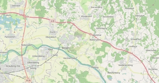
Download Bogen map in Shapefile format
A map built from OpenStreetMap data, ready to download
Customize the map
Open this place's area in the constructor and adjust everything to your needs
Open in constructor →Map passport
What this map contains by default
This is how the map is built as-is — every setting can be changed in the constructor.
.shpAbout Shapefile
Map of Bogen in Shapefile: 6 410 buildings, 263 km of roads, 217 points of interest, 20% green areas — in the WGS 84 coordinate system, units are meters.
Which layers are in the file
This file for the selected area contains:
- Roads
- Buildings
- Water
- Greenery
- Points of interest
What the file carries
The Shapefile file for Bogen: the parts come as a set of files inside a ZIP archive, the file is binary — it is opened by a program, not by an editor, each layer is a separate file inside the archive, OpenStreetMap tags are kept as feature attributes.
File size
The expected size of the Shapefile file for Bogen is about 1.2 MB; the exact size depends on the chosen layers and area.
Shapefile file passport
Estimated from the place's OSM data; exact figures are in the file after the build.
- .shp sets in the archive (one per layer): 16
- Features by geometry type (estimated): points 217, lines ≈ 1 316, polygons 6 461
- Most common tags of the place: highway=service ≈ 345, building=residential 341, highway=residential ≈ 285, highway=unclassified ≈ 282, highway=tertiary ≈ 170, highway=motorway ≈ 105, highway=secondary ≈ 88, bench 69, highway=cycleway ≈ 40, building=industrial 31
- DBF fields of the “Roads” layer: osm_id, access, highway, lanes, name, oneway, ref, surface
- DBF fields of the “Buildings” layer: osm_id, addr_housenumber, addr_street, amenity, building, building_levels, height, name, roof_height, roof_shape, shop
- DBF fields of the “Water” layer: osm_id, landuse, name, natural, water
- DBF fields of the “Greenery” layer: osm_id, landuse, leisure, name, natural
- Field names longer than 10 characters: 4 — addr_housenumber → addr_house, addr_street → addr_stree, building_levels → building_l, roof_height → roof_heigh
Losses: DBF field names truncated to 10 characters: 4; no mixed geometries in one .shp — points, lines and polygons go to separate files.
Build recipe: ZIP: per layer .shp, .shx, .dbf, .prj and .cpg (UTF-8), WGS 84 (EPSG:4326) by default, frame 12 × 9.0 km, simplification tolerance 56 m.
Coordinate systems
WGS 84 (EPSG:4326), selectable in the wizard
| Category | GIS |
| File extension | .shp |
| Tier | Open Beta |
How to use Shapefile for Bogen
- QGIS (free) — unpack the ZIP and drag the geometry files you need into the program window, several layers at once if you like.
- ArcGIS Pro or ArcMap — Add Data and pick the layer; the projection is picked up automatically from the description file.
- GeoPandas — read_file with the path to the layer, then the usual work with the table and the geometry in Python.
Programs that open Shapefile
FAQ: Shapefile for Bogen
Can I open Shapefile in QGIS?
Yes, QGIS is the best free editor for Shapefiles. Just drag the ZIP into the QGIS window.
What attributes are preserved?
Names, object types (highway, building), population, area, and more.
What projection is used?
WGS84 (EPSG:4326) -- the standard projection for GPS and web maps.
Why are there several folders in the archive instead of one file?
A shapefile stores only one geometry type, so roads (lines), buildings (polygons) and points of interest cannot live in one file. Each layer is exported as its own shapefile in its own folder, and they are all collected into one ZIP.
Why are the field names cut off?
That is a limitation of the dBASE table: a field name is no longer than ten characters, and long names get truncated. If full attribute names matter — take GeoPackage or GeoJSON, they have no such limit.