
Download Söderhamn map in DXF format
A map built from OpenStreetMap data, ready to download
Customize the map
Open this place's area in the constructor and adjust everything to your needs
Open in constructor →Map passport
What this map contains by default
This is how the map is built as-is — every setting can be changed in the constructor.
About DXF
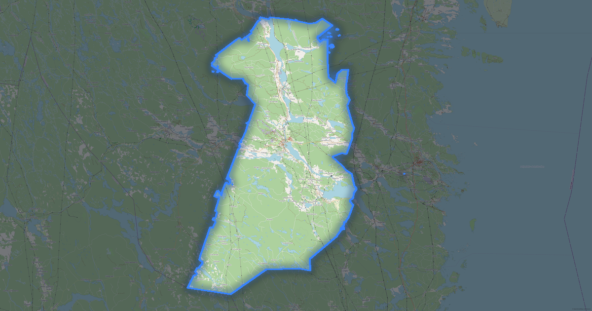
Map of Söderhamn in DXF: 3 230 buildings as closed polylines on dedicated layers, 227 km of roads classified by type, 100% green areas — in the WGS 84 coordinate system, ready to open in AutoCAD, BricsCAD, nanoCAD. Every feature type on its own layer, units are meters.
Which layers are in the file
This file for the selected area contains:
- Roads
- Buildings
- Water
- Greenery
What the file carries
The DXF file for Söderhamn: features are split into named layers, the feature name and its OpenStreetMap link are written into the drawing (XDATA), the full tag set is not carried.
File size
The expected size of the DXF file for Söderhamn is about 5.4 MB; the exact size depends on the chosen layers and area.
DXF file passport
Estimated from the place's OSM data; exact figures are in the file after the build.
- Layers: 6
- Entities: LWPOLYLINE 4 486, HATCH 3 349, TEXT 160
- Units: metres; coordinate system UTM 33N (EPSG:32633)
- EXTMIN = 582 461 E, 6 768 177 N; EXTMAX = 653 470 E, 6 825 757 N
Losses: not in the file: Points of interest 615; the full OSM tag set — objects: 4 486 (the file keeps the name, OSM link, address and type).
Build recipe: 1:1 model in metres, frame 69 × 55 km, landscape orientation, geometry not simplified, symbology for 1:58 056.
How it is built in the file
The longest street of Söderhamn in OSM data is Flygvägen: 5.5 km (all segments summed, including those beyond the place frame). In the DXF drawing it lies on the roads layer as many polylines, one per OSM segment, not a single line. In the default coordinate system (UTM) one drawing unit is one metre. The next longest is Södra Tvärleden: 4.4 km.
Coordinate systems
WGS 84 (EPSG:4326), selectable in the wizard
| Category | CAD |
| File extension | .dxf |
| Tier | Open Beta |
How many times DXF was built in the last 90 days
- Söderhamn
- 0
- Gävleborg County
- 0
- Whole site
- 2648
- Median file size
- 0.5 MB
- Median build time
- 2.5 s
Medians are based on all builds on the site
How to use DXF for Söderhamn
- AutoCAD, BricsCAD, NanoCAD, KOMPAS-3D — File → Open; to use the map as a base plan, insert it as an external reference rather than into the current drawing.
- LibreCAD and FreeCAD (free) — open DXF directly, without ODA converters and plugins.
- If a ZIP was downloaded — unpack it and keep map.dxf and map.prj together: the .prj file is the coordinate system you chose.
How to open the drawing: units are metres (projected coordinates, not degrees). If the screen is empty after opening, the file is not empty: use Zoom Extents (show all; in AutoCAD, the ZOOM → E command or a double click of the mouse wheel).
Programs that open DXF
DXF format reviews
4.6 out of 5 · 45 reviews
آیا می توانید همین کار را در نقشهای گوگل انجام دهید؟آیا می توانید دقت منحنی میزان ها را بیشتر کنید؟ایا سطح توپوگرافی و DEM دقیق تری به دست آورد؟08.2026
FAQ: DXF for Söderhamn
What is the difference between DXF and DWG?
DXF is an open text format for CAD interchange. DWG is AutoCAD's proprietary binary format.
Can I open DXF in KOMPAS-3D?
Yes, KOMPAS-3D fully supports DXF file import.
Are colors and layers preserved?
Yes, all layer, color, and line type information is preserved.
Why did a ZIP archive download instead of a .dxf file?
That happens when you explicitly chose a coordinate system: inside the archive are map.dxf and map.prj with the description of the projection. The DXF format itself does not store the projection inside, so it travels in a separate companion file — as with a shapefile.
What units does the drawing arrive in?
In meters by default: in most countries the UTM zone of the ordered area's center, and in several countries the national grid (British National Grid, Lambert-93, State Plane in the US and others). The scale is not distorted, and distances and areas are measured with a ruler right away. Web Mercator is only a fallback — near the poles, for very wide areas and across the antimeridian. Need a local system? Pick it at export.
Other formats for Söderhamn
All 128 formats for Söderhamn →
DXF for nearby places



Maps other customers made in this format (DXF)
خريطة Sharm el-Sheikh
★★★★★
Bogorodskoe
★★★★★
Donetsk
★★★★★