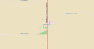
Download Grass Patch map in PostScript format
A map built from OpenStreetMap data, ready to download
Customize the map
Open this place's area in the constructor and adjust everything to your needs
Open in constructor →Map passport
What this map contains by default
This is how the map is built as-is — every setting can be changed in the constructor.
About PostScript
Map of Grass Patch in PostScript: 32 buildings, 28 km of roads, 16 points of interest, 8% green areas — in the WGS 84 coordinate system, units are meters.
Which layers are in the file
This file for the selected area contains:
- Roads
- Buildings
- Greenery
- Points of interest
Geometry by layer
- Roads — lines with width and colour by road class
- Buildings — filled building outlines
- Greenery — filled area outlines of green zones
- Points of interest — icons and category labels
What the file carries
The PostScript file for Grass Patch: features are split into named layers, OpenStreetMap tags are not kept — geometry and styling remain.
File size
The expected size of the PostScript file for Grass Patch is about 394 KB; the exact size depends on the chosen layers and area.
Coordinate systems
WGS 84 (EPSG:4326), selectable in the wizard
Units
Meters (projected in the chosen coordinate system)
| Category | GIS |
| File extension | .ps |
| Tier | Open Beta |
How many times PostScript was built in the last 90 days
- Grass Patch
- 0
- Western Australia
- 0
- Whole site
- 8
- Median file size
- 12.5 MB
- Median build time
- 11.7 s
Medians are based on all builds on the site
How to use PostScript for Grass Patch
- Ghostscript (free) — both viewing and conversion: ps2pdf map.ps map.pdf gives you a PDF, and calling gs with -r300 rasterizes the sheet at the resolution you need.
- GSview on Windows or Evince on Linux — open the .ps directly and look at the page without converting it.
- Adobe Distiller — the regular prepress route: PostScript in, PDF with font and color control out.
Programs that open PostScript
FAQ: PostScript for Grass Patch
How does PS differ from EPS?
EPS is PostScript with an extra BoundingBox wrapper for embedding inside other documents. PS is a full multi-page document. They are close cousins technically.
Can I open .ps on Windows without Adobe Reader?
Yes — GSview (free) or Ghostscript converts PS to PDF in one command: ps2pdf input.ps output.pdf.
Is PostScript obsolete?
On the web, yes. For pre-press, RIP servers, and the LaTeX pipeline, it is still a standard. Most office-grade printers understand PostScript natively.
Are layers preserved in .ps?
PostScript has no native layer concept (unlike AI/PDF). The map is rendered as a single vector stream.
What sheet size do I get?
297x210 mm by default — that is A4 in landscape orientation; raster elements are drawn at 300 DPI. The sheet size is set at export time, so the map can be rebuilt for A3 or a non-standard size.