
OpenDRIVE (ASAM)
Price before paymentOpenDRIVE — автономды жүргізудегі жол желісін сипаттауға арналған ASAM стандарты. Ол жол геометриясын, жолақтарды, қиылыстарды, дабылдарды және жол таңбаларын қамтиды. CARLA, VTD, RoadRunner симуляторларында және ADAS сынауында қолданылады.
OpenStreetMap data as of 26 October 2026 · 25 days ago
Негізгі мүмкіндіктер
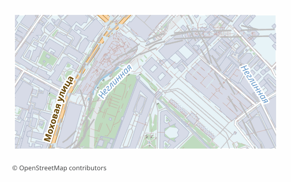
OpenDRIVE форматы туралы
OpenDRIVE is a standard by the ASAM association describing a road network the way autonomous driving simulators understand it: not just lines, but roads with lanes, their width, speed limits, junctions and the links between them. The .xodr file is XML, read by CARLA, esmini, RoadRunner and Vires VTD.
Exporting OSM into OpenDRIVE is what you need when a scenario has to be checked on the real geometry of a specific city rather than on a synthetic proving ground: an ADAS scenario prototype, a teaching task, a route demonstration in a simulator. A ready network is built automatically instead of drawing roads by hand in an editor.
The implementation is simplified: the road plan is built from straight segments following the OSM geometry (arcs and clothoids are not used), the number of lanes, the road type and the speed are substituted by the highway tag (motorway, for example, gets three lanes and 110 km/h, residential gets one and 40), and the default lane width is 3.5 meters. Junctions are determined by clustering road ends: three or more within a five-meter radius become a junction with links between the incoming roads, and highway=traffic_signals points turn into signals. There is no elevation profile — the road is flat. That is enough for a prototype and for running a scenario in, but it is not an HD map of survey accuracy.
OpenDRIVE файлдарын қандай бағдарлама ашады
Келесі бағдарламалар мен қосымшалар OSM2CDR-дан экспортталған OpenDRIVE (ASAM) (.xodr) файлдарын ашып, өңдеп, олармен жұмыс істей алады:
Format specifications
- Open standard
- 3D coordinates supported
- Lossless (no quality loss)
- Stores feature attributes
- Output: 1 file
- ASAM OpenDRIVE 1.7 (.xodr). Road network for autonomous-driving simulators (CARLA, esmini, Vires VTD).
OpenDRIVE карталарын кім пайдаланады
OpenDRIVE форматын қалай экспорттауға болады
Экспорттан кейін қалай ашу керек
- CARLA — put the .xodr into the project and launch it in standalone OpenDRIVE mode: the simulator generates the three-dimensional scene from the road description itself.
- esmini — quick viewing and checking: the odrviewer utility opens the file and shows lanes and junctions without building a full scene.
- MATLAB RoadRunner — import the road network and refine it by hand: add markings, signs, an elevation profile, ramps.
- Any XML editor — the file is text: you can see how many roads, junctions and signals came out and adjust parameters selectively.
- Before a serious scenario — run the file through your tool's validator: junction connectivity is built from the distance between road ends and needs fixing at complex interchanges.
OpenDRIVE (ASAM) карта экспорттарын алыңыз
OpenStreetMap-тан кәсіби OpenDRIVE карталарын жүктеп алыңыз. Лезде жасалады, кез келген аумақ.
Жиі қойылатын сұрақтар
What people who already downloaded say
Finally, maps can be downloaded as vectors. Thanks to the author!
Map: Ufa, AI
everything is really cool, I didn't expect I'd just come and download a piece of the map! thanks!!!
Map: Nizhny Novgorod, PMTiles
HUGE THANKS!!! A VERY GOOD PROGRAM!!! I was looking for a vector map where 3 countries meet - it helped a lot!!
Map: Kazakhstan and Altai, PDF
Well done! You've done a big and much-needed job!
Map: Roshchino, Leningrad Region, GeoTIFF
Ivan, thank you so much! Not just a man - a Great Man!
Map: Saratov Region, GeoJSON
ivan, you're simply a wonder. Thank you for an incredibly cool service
Map: Bogashevo near Tomsk, DXF
Қатысты форматтар
Жиі бірге экспортталады
Related Articles
ASAM OpenDRIVE (.xodr): the standard — and a ready file from OSM
The ASAM XML standard for lane-level road networks, read by CARLA, IPG CarMaker and NVIDIA DriveSim. Plus: export a read
usecaseTransport Simulation Formats: OpenDRIVE, SUMO, Lanelet2
OpenDRIVE, SUMO, Lanelet2 and ROS for transport simulation and autonomous driving. Export from OpenStreetMap.