
HDF5 (Hierarchical Data Format v5)
Preis vor der ZahlungHDF5 ist ein binärer, selbstbeschreibender Container für wissenschaftliche Daten mit einem Dateisystem in der Datei: Gruppen (Ordner), Datensätze (Arrays), Attribute (Metadaten). Auf osm2cdr funktioniert der .h5-Export ehrlich so: Jeder OSM-Layer wird zu einer HDF5-Gruppe mit den Datensätzen longitude und latitude (Zentroide der Objekte) sowie je einem Datensatz pro Attributfeld als Zeichenketten. Es ist ein selbstbeschreibender Container aus Koordinaten und Attributen, kein gerastertes Scoring-Raster und kein DEM-Würfel — solche Layer berechnet der Exporter nicht. Geschrieben über h5py; lesbar mit h5py, HDFView, MATLAB, R, IDL.
OpenStreetMap data as of 5 October 2026 · 21 days ago
Hauptmerkmale
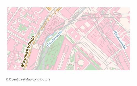
Alle Kartenbeispiele nach Format
Über das Format HDF5
HDF5 ist ein binärer Container für wissenschaftliche Daten, aufgebaut wie ein Dateisystem in einer einzigen Datei: Gruppen übernehmen die Rolle von Ordnern, Datensätze die von Arrays, Attribute die von Metadaten. Das Format betreut die HDF Group; gelesen wird es von Python, MATLAB, R und IDL, und es ist darauf ausgelegt, dass die Daten auch ohne Begleitdokumentation verständlich bleiben.
Eine OpenStreetMap-Karte exportiert man nach .h5, wenn sie anschließend eine wissenschaftliche oder technische Pipeline durchläuft: Gerechnet wird mit Arrays, und gebraucht wird eine einzige selbstbeschreibende Datei statt eines Stapels Shapefiles. Besonders praktisch, wenn in derselben Datei bereits Ihre eigenen Messwerte liegen — HDF5 hält heterogene Daten problemlos in einer Hierarchie.
Darin steckt je eine Gruppe pro OSM-Layer. In der Gruppe liegen die Datensätze longitude und latitude mit den Zentroiden der Objekte sowie je ein Zeichenketten-Datensatz pro Attributfeld; die Koordinaten sind als float64 gespeichert, die Attribute als Zeichenketten variabler Länge in UTF-8. In der Wurzel und in den Gruppen stehen Metadaten: Titel, Quelle, Ausdehnung, Objektanzahl, Geometrietyp.
Ehrlich zu den Grenzen: Das ist ein Container aus Koordinaten und Attributen, kein Rasterwürfel. Die Geometrie ist auf Zentroide reduziert — Gebäudeumrisse und Straßenlinien stecken nicht in der Datei, analytische Raster (Dichte, Bewertungen, Relief) berechnet der Exporter nicht. Geschrieben wird über h5py; ist die Bibliothek nicht verfügbar, greifen Fallbacks bis hin zu gzip-JSON mit derselben logischen Struktur.
Programme zum Öffnen von HDF5-Dateien
Die folgenden Programme können HDF5 (Hierarchical Data Format v5)-Dateien (.h5) öffnen, bearbeiten und verarbeiten, die aus OSM2CDR exportiert wurden:
Format-Spezifikationen
- Offener Standard
- Nur 2D
- Verlustfrei
- Speichert Objektattribute
- Ausgabe: 1 Datei
- One HDF5 group per layer holding lon/lat centroid datasets plus one string dataset per attribute; a self-describing container, not a gridded raster cube. Fallback to gzip-JSON.
Wer nutzt HDF5-Karten
So exportieren Sie HDF5
Nach dem Export öffnen
- HDFView (kostenlos, HDF Group) — die Datei öffnen und den Baum aus Gruppen und Datensätzen, Werte und Attribute ansehen, ganz ohne zu programmieren.
- Python — h5py.File("export.h5"); der Aufruf visit(print) zeigt die gesamte Hierarchie, und f["buildings"]["longitude"][:] gibt das Koordinatenarray zurück.
- pandas — die Datensätze einer Gruppe haben dieselbe Länge, deshalb lassen sich die Spalten longitude und latitude sowie die Attribute direkt zu einem DataFrame zusammensetzen.
- MATLAB und R — die Funktionen h5read und h5info in MATLAB sowie das Paket rhdf5 in R lesen die Datei ohne zusätzliche Treiber.
- Übernahme ins GIS — aus den Zentroiden lässt sich leicht ein Punkt-Layer bauen: die Koordinaten als CSV speichern und in QGIS als Textlayer mit Koordinaten einbinden.
Beliebte Karten in HDF5
HDF5 (Hierarchical Data Format v5)-Kartenexport
Laden Sie professionelle HDF5-Karten aus OpenStreetMap herunter. Beliebiges Gebiet, der Preis wird vor der Zahlung angezeigt.