
PDF (vector — Portable Document Format)
Price before paymentPDF হলো দেখা ও মুদ্রণের জন্য একটি সর্বজনীন ফরম্যাট। PDF-এ ভেক্টর মানচিত্র যেকোনো জুম স্তরে সমস্ত বিবরণ ধরে রাখে এবং কোনো অতিরিক্ত সফটওয়্যার ছাড়াই যেকোনো ডিভাইসে খোলে।
OpenStreetMap data as of 26 October 2026 · 24 days ago
মূল বৈশিষ্ট্য
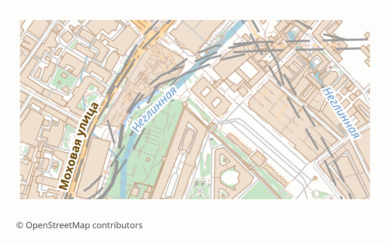
PDF ফরম্যাট সম্পর্কে
PDF (ISO 32000) is the format that opens everywhere: in a browser, on a phone, in any operating system, with nothing to install. The vector variant stores the map not as a picture but as geometry: road lines, building outlines and labels stay independent objects.
Two practical consequences follow. The map can be enlarged without losing crispness — in print the lines stay thin and even on any sheet size, from A4 to a poster. And it can be edited: the file opens in Illustrator, Inkscape or CorelDRAW as ordinary vector graphics, where objects can be recoloured and moved.
The file is assembled through the QGIS print layout in vector mode: labels stay text with embedded fonts — they show up in a document search and can be selected, not just looked at. The sheet size is chosen at export time (A4-A0) or picked automatically from the area of the region.
Vector PDF has a limit: the more objects there are, the heavier the file and the longer it takes to open — a map of a whole region can noticeably lag in a browser viewer. For such cases there is raster PDF: it opens instantly regardless of how dense the development is, but does not scale without losing crispness.
কোন প্রোগ্রাম PDF ফাইল খোলে
নিম্নলিখিত প্রোগ্রাম ও অ্যাপ্লিকেশনগুলি OSM2CDR থেকে এক্সপোর্ট করা PDF (vector — Portable Document Format) (.pdf) ফাইল খুলতে, সম্পাদনা করতে ও এর সাথে কাজ করতে পারে:
Format specifications
- Open standard
- 2D only
- Lossless (no quality loss)
- No attributes
- Output: 1 file
- PDF (ISO 32000). Map layers are separate PDF layers (Optional Content Groups), toggled in the Layers panel of Acrobat or Illustrator: vector paths, live text, embedded fonts. Print-ready at 300 DPI. In raster mode (pdf_dpi) there are no layers: one picture. Layer blend modes (multiply, screen, etc.) are not carried over -- the site styles do not use them; translucency is plain alpha (/ca), no /BM.
কারা PDF মানচিত্র ব্যবহার করেন
কীভাবে PDF এক্সপোর্ট করবেন
এক্সপোর্টের পর কীভাবে খুলবেন
- Any browser, Acrobat Reader, Preview on macOS or SumatraPDF — open and look; a document search will find street and place names, because the labels remained text.
- Adobe Illustrator or Inkscape (free) — open it as vector graphics: recolour layers, remove what you do not need, add your own labels, a frame and a legend.
- CorelDRAW — import the PDF for further prepress work, if the layout is being put together there.
- Printing — in the print dialog turn off "fit to page" and print at 100% scale, otherwise the stated map scale will no longer match the sheet.
- A print house — for offset, ask for the file in the PDF/X profile: we deliver it as a separate format, with the parameters that printing requires already written in.
PDF (vector — Portable Document Format) মানচিত্র এক্সপোর্ট পান
OpenStreetMap থেকে পেশাদার মানের PDF মানচিত্র ডাউনলোড করুন। যেকোনো এলাকার জন্য তাৎক্ষণিক প্রস্তুতি।
প্রায়শই জিজ্ঞাসিত প্রশ্ন
অন্যান্য ফরম্যাটের সাথে তুলনা করুন
What people who already downloaded say
Finally, maps can be downloaded as vectors. Thanks to the author!
Map: Ufa, AI
everything is really cool, I didn't expect I'd just come and download a piece of the map! thanks!!!
Map: Nizhny Novgorod, PMTiles
HUGE THANKS!!! A VERY GOOD PROGRAM!!! I was looking for a vector map where 3 countries meet - it helped a lot!!
Map: Kazakhstan and Altai, PDF
Well done! You've done a big and much-needed job!
Map: Roshchino, Leningrad Region, GeoTIFF
Ivan, thank you so much! Not just a man - a Great Man!
Map: Saratov Region, GeoJSON
ivan, you're simply a wonder. Thank you for an incredibly cool service
Map: Bogashevo near Tomsk, DXF
সম্পর্কিত ফরম্যাট
প্রায়ই একসাথে এক্সপোর্ট করা হয়
Related Articles
PDF — Complete Guide: Adobe History 1993-2025, How to Open, How to Export an OpenStreetMap Map
Deep guide to PDF: what's inside the portable document format, evolution from Adobe to ISO, which programs open it, pros
guideRussia Map Download: Vector, PDF or A4 for Print — Which One to Choose
Which Russia map to download for the job: vector or raster PDF, SVG, AI or CDR, an A4 sheet or an atlas. What a whole-co
guideFigure-Ground Map (Schwarzplan): a Black Building Plan of a City for an Architecture Competition
What a figure-ground map (Schwarzplan, plan de masse) is, why competitions ask for it and how to build one from OpenStre