Выберите область карты
Найдите место и нарисуйте область — или загрузите свой файл.
Область · не выбрана
📁
Перетащите файл сюда
или нажмите, чтобы выбрать
.osm .pbf .geojson .kml .kmz .gpx .shp .zip · до 50 МБ
📄
i
Загрузите свой файл — мы определим область и проведём вас по тем же шагам. Доступны ГИС, САПР, векторные и растровые форматы вывода.
Что показать на карте?
Выберите общий уровень — точную настройку слоёв сделаем на следующем шаге.
📍 Сначала выберите область на шаге 1
Уровень наполненности
Только границы
недоступно на этой площади
Контурная
недоступно на этой площади

Чистая
недоступно на этой площади
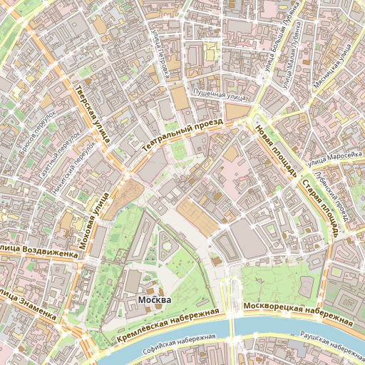
Обычнаяпо умолчанию
недоступно на этой площади

Подробная
недоступно на этой площади

Максимум
недоступно на этой площади
Обычная — дороги, вода, зелень, здания и основные подписи.
Слои карты
Что именно рисуем. Можно оставить «По умолчанию» или включить/выключить группы.
Готовые наборы слоёв

Минимальный
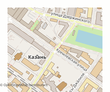
По умолчанию

Подробный

Все
База карты
Транспорт2/8▾
Дороги и улицы11
Пешеходные пути7
Железные дороги11
Парковки4
Общественный транспорт6
Здания и инфраструктура12/37▸
Природа41/41▸
Землепользование и границы20/27▸
Дополнительно
Инфраструктура0/45▸
Подписи и места11/11▸
Особые (военные)0/7▸
Ремёсла и офисы0/31▸
Телекоммуникации0/5▸
Водная инфраструктура0/9▸
Городская мебель0/13▸
Зимние виды спорта0/6▸
Реклама и информация0/11▸
Точки интереса (кафе, магазины, музеи) — на следующем шаге.
Номера домов
Для очень больших областей (≥25 000 км²) здания и адреса автоматически гасятся.
Точки интереса на карте
Кафе, магазины, музеи, аптеки… По умолчанию выключены — карта чище.
Быстрый выбор
Категории
Загружаем категории…
Выбрано точек интереса: 0 из 154 видов.
Язык подписей
Названия улиц и мест на выбранном языке там, где OpenStreetMap их знает; иначе — местный.
Частые языки
Если на карте нет подписи на выбранном языке
Подписи берутся из данных OpenStreetMap. Если на выбранном языке у объекта нет названия — будет показано местное или английское.
В превью пока не отражается — увидите в готовом файле.
Рельеф и слои поверх карты
Высоты из Copernicus GLO-30 (30 м). Всё по умолчанию выключено.
Рельеф

Без рельефапо умолчанию

Добавить горизонтали (рельеф)

Отмывка рельефа (теневая подложка)

Гипсометрия (раскраска высот)
Примеры на горном районе у озера Рица, Кавказ

Мягкая природная

Топографическая

Арктическая

Приглушённая зелёная

Сепия (старинная)

Ч/б
Прозрачность применяется к итоговому файлу — на превью карты она не отображается.
Поверх карты
Координатная сетка
Доступно только в векторных форматах: SVG, DXF, DWG, KML.
Выбранный формат растровый — координатная сетка не попадёт в файл. Выберите SVG, DXF, DWG или KML.
Кадастровая основа
Доступность зависит от области
Кадастровая основа накладывается только в растровых форматах: PNG, JPEG, GeoTIFF, PDF, SVG. Покрытие: Нидерланды и Франция (открытые кадастровые WMS). Кадастр России недоступен.
Кадастр накладывается картинкой и попадает только в растровые форматы: PNG, JPEG, GeoTIFF, TIFF, COG. В векторные (PDF, SVG, DXF, DWG, GeoJSON…) он не войдёт.
Для 3D-форматов рельеф превращается в 3D-меш — его параметры на шаге «Формат».
Рельеф, сетку и кадастр в превью пока не видно — они появятся в готовом файле.
Стиль оформления
Сначала структура карты, затем цвет поверх неё.
Обновляем превью под новый стиль…
Картографическая основа · структура карты
OSM2CDR ✓Наша основа
PositronСветлая, минимальная
Ч/б печатьКонтурная, под печать
Цветовой пресет · цвет поверх
Для профи детализация, цвета, линии
Детализация
По умолчанию система сама подбирает детализацию под площадь и формат. Сдвиньте влево, чтобы загрубить (легче файл), или вправо для большей детализации (заметно лишь на небольших областях).
Цвета и линии
Тонкая правка цветов и линий в превью пока не видна — применится в готовом файле.
Лист и масштаб
Один лист — для печати на формате; атлас — много страниц с нахлёстом.
Карта не влезает на один лист — разобьём область на страницы с указателем.
Размер листа
Рулоны (плоттер)
Ширина фиксированная, длина — по вашей области.
Для цифровых форматов (SVG, GeoJSON…) размер листа не требуется — он применится только к печатным.
Как задать масштаб 1:100 … 1:1 000 000
Оставьте пустым — масштаб подберётся под размер листа автоматически.
Размер страницы
Ориентация
Листов: —
Размер: —
Время: —
Масштаб: —
В каком формате скачать?
Начните с быстрого старта или профиля — или выберите вручную из полного каталога ниже.
Идеи карт
Быстрый старт
Готовые профили
Для чего вам нужна карта?
Полный каталог форматов
По запросу форматов не найдено
Параметры 3D · для выбранного формата
Система координат
По умолчанию — мировой стандарт WGS 84. Меняйте, только если знаете, что нужно.
Система координат важна, если карта пойдёт в ГИС или САПР — там она должна совпасть с вашими остальными данными. Для печати и постеров подойдёт вариант по умолчанию.
Рекомендуемая система
WGS 84 (EPSG:4326)по умолчанию
Мировой стандарт широта/долгота — подходит для большинства задач.
Мировой стандарт широта/долгота — подходит для большинства задач.
Web Mercator (EPSG:3857)
Для веб-карт и тайлов (Google/OSM-совместимая).
Для веб-карт и тайлов (Google/OSM-совместимая).
9700+
систем координат в справочнике
Для специалистов свой EPSG · proj4 / WKT · поправки
Параметры пересчёта (datum shift / NTv2) применяются под вашу ответственность за лицензию
grid-файла. Для форматов без проекции (например, чистый SVG) шаг не применяется.
Справочник систем координат
Поиск ищет среди всех 9744 систем
Для профи
Тонкая настройка рендера и свои точки на карте. Шаг необязательный — можно пропустить.
Настройки рендера
Толщину дорог, размер подписей и контуры зданий можно настроить и в блоке «Для профи» на шаге «Стиль» — если задать в обоих местах, значения сложатся. Рекомендуем настраивать здесь.
Свои точки
Ваша карта готова
Вот что получится. Дайте имя и скачайте — любую строку рецепта можно изменить.
Превью показывает данные OpenStreetMap для этой области. Экспорт будет построен из вашего файла.
Имя попадёт в файл и в историю экспортов. Впишите своё.
- Область—
- НаполненностьОбычная
- Слои—
- POI—
- Язык подписейМестный
- Рельеф / поверхБез рельефа
- СтильOSM2CDR · Стандартный
- ЛистОдин лист · Авто
- ФорматSVG
- ПроекцияWGS 84 (EPSG:4326)
Впишите название, чтобы продолжить
Впишите название, чтобы продолжить