Bản đồ Telemark
Khu vực · Norway · 177K · 16,158 km2
A ready-made vector map with buildings, roads and features — for CAD, GIS and print. Free, no registration.
Hộ chiếu bản đồ
Mở khu vực Telemark trong trình tạo và thay đổi lớp, phong cách, định dạng và hệ tọa độ cho tác vụ của bạn.
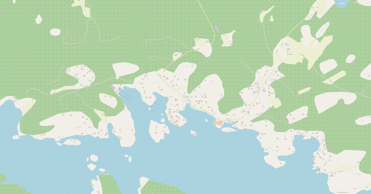
Mở trong trình tạoMặc định của bản đồ
Đây là cách bản đồ được dựng theo mặc định — mọi tham số đều có thể thay đổi trong trình tạo.
Tải bản đồ Telemark ở 134 định dạng
Cùng một bộ dữ liệu OpenStreetMap — ở định dạng phù hợp với phần mềm của bạn. Chọn theo tác vụ: CAD, vector, GIS, 3D hay in ấn.
Bản đồ Norway
Tất cả địa điểm trong lãnh thổ — mỗi bản đồ đều sẵn sàng tải xuống.
Thành phố lớn · 48


Thành phố · 9


Làng xã và khu dân cư · 268


Địa điểm và vùng lân cận
Chuyển tới các thành phố, quận huyện và vùng lân cận — mỗi nơi đều có bản đồ vector dựng sẵn ở cùng các định dạng.
Các địa điểm khác tại Norway
Lân cận
Các khu vực tương tự

Về Telemark
Chân dung Phân tích: Telemark Telemark là một thành phố rộng rãi trải dài 16,157.8 km², nơi các công trình xen kẽ với không gian thoáng đãng. Mảng xanh chiếm 44.4% diện tích — một trong những con số tốt nhất trong các thành phố lớn. Mạng lưới giao thông công cộng rộng khắp (3,491 điểm dừng) mang lại khả năng di chuyển cao.
Điểm mạnh 26/100 Độ phủ xanh Độ phủ xanh chưa đủ 9/100 Giáo dục Ít cơ sở giáo dục 9/100 Tính kết nối Mạng lưới đường kết nối kém Sự thật Thú vị 🛣️ Tổng chiều dài đường của Telemark (13,058 km) là tương đương một chuyến khứ hồi từ Moskva đến Vladivostok. 🏗️ Ở Telemark có 1.06 tòa nhà trên mỗi cư dân. 🌳 Mỗi cư dân của Telemark có 71,763 m² không gian xanh.
🍽️ Telemark có khoảng 495 nhà hàng và quán cà phê — 2.8 trên 1.000 cư dân.
Bản đồ Telemark có gì bên trong
Bản đồ bao phủ toàn bộ lãnh thổ của Telemark trong ranh giới hành chính — 16,158 km2. Khu vực cây xanh chiếm 44.4% lãnh thổ. Mỗi lớp có thể bật hoặc tắt trước khi tải xuống.
Bản đồ Telemark trông như thế nào
Cùng một địa điểm ở ba phong cách kết xuất. Công trình, đường sá, mặt nước và cây xanh được chuyển sang mọi định dạng mà không mất chất lượng.
Điểm đánh giá địa điểm
Các chỉ số tổng hợp từ dữ liệu OpenStreetMap: mức độ tiện lợi để sinh sống, đi bộ, dùng giao thông và cây xanh ở đây.
Hạ tầng của Telemark
Những gì có trên lãnh thổ theo dữ liệu OpenStreetMap.
Mật độ và độ dày đặc
Có bao nhiêu đối tượng trên mỗi ki-lô-mét vuông — theo dữ liệu OpenStreetMap.
Bản đồ được dùng như thế nào
Cùng một bộ dữ liệu cho Telemark — cho nhiều tác vụ khác nhau: từ vẽ kỹ thuật đến in 3D.
Địa danh nổi bật
Bảo tàng, tượng đài và những nơi nổi bật của Telemark theo dữ liệu OpenStreetMap — mỗi nơi đều có liên kết tới bản đồ.
Thiên nhiên và khu vực cây xanh
Công viên, quảng trường và thủy vực của Telemark theo dữ liệu OpenStreetMap — tất cả được chuyển vào bản đồ thành các lớp riêng.
Giao thông công cộng
Điểm dừng và nhà ga theo dữ liệu OpenStreetMap.
Giao thông công cộng của Telemark bao gồm 3 439 điểm dừng xe buýt, 18 ga đường sắt và 34 điểm dừng tàu điện. Tất cả điểm dừng và nhà ga được đưa vào bản đồ thành một lớp riêng.
Phố và đường sá
Đường sá được phân loại theo kiểu — theo dữ liệu OpenStreetMap.
Mạng lưới đường phố của Telemark — 13 059 km đường theo dữ liệu OpenStreetMap, được phân loại theo kiểu.
Nhà hàng và quán cà phê
Các điểm ăn uống theo dữ liệu OpenStreetMap.
Tại Telemark, OpenStreetMap ghi nhận 256 điểm ăn uống — nhà hàng, quán cà phê, quán bar và điểm thức ăn nhanh.
Cửa hàng và bán lẻ
Bán lẻ theo dữ liệu OpenStreetMap.
Tại Telemark, OpenStreetMap ghi nhận 548 cửa hàng và điểm bán lẻ. Danh mục chính: Siêu thị, Đại lý ô tô, Quần áo, Thương mại, Sửa xe, Cắt tóc.
Giáo dục
Trường học, đại học và thư viện theo dữ liệu OpenStreetMap.
Trường học: Sandøya montessoriskole, Stathelle barneskole, Bamble ungdomsskole, Bamble videregående skole, Rugtvedt skole, Rønholt skole, Kilebygda montessoriskole, Brevik oppvekstsenter. Đại học: Seljord folkehøgskule. Thư viện: Bamble bibliotek og litteraturhus, Skien bibliotek, Klyve filial, Porsgrunn bibliotek, Skien bibliotek, Gulset avdeling, Skien bibliotek, Siljan bibliotek, Rjukan bibliotek, Hovin filial, Rjukan bibliotek.
Y tế
Bệnh viện, nhà thuốc và phòng khám theo dữ liệu OpenStreetMap.
Bệnh viện của Telemark: Sykehuset Telemark, Porsgrunn, Sykehuset Telemark - seksjon for sykelig overvekt.
Nơi lưu trú
Khách sạn, nhà nghỉ và nhà khách theo dữ liệu OpenStreetMap.
Trên bản đồ có gì
Mỗi lớp của bản đồ Telemark có thể bật hoặc tắt trước khi tải xuống.
Các con số chính
Tổng hợp dựa trên dữ liệu OpenStreetMap cho Telemark.
So với các vùng lân cận
Địa điểm này so với các vùng lân cận trong bán kính 30 ki-lô-mét như thế nào.
Trong bán kính 30 km có 217 địa điểm để so sánh.