osm2cdr.ru
N
© OpenStreetMap
Boundary · Chad · OpenStreetMap
BuildingsRoadsWaterGreeneryBoundary
Ready map · OSM data

Map of Chad

Country · 10.3M · 1.3M km2

A ready-made vector map with buildings, roads and features — for CAD, GIS and print. Instant download, no registration.

Choose a format
Download · DWG, ≈ 300.6 MB
All 133 formats Customize your area
133 formatsOSM datano registrationready instantly

Map passport

1.3M km2
Area
31 365
Buildings
112 458 km
Roads
4 771
Points of interest
Customize the map for yourself

Open the area of Chad in the constructor and change layers, style, format and coordinate system for your task.

Open in constructor

Map defaults

This is how the map is built by default — every parameter can be changed in the constructor.

Format
DWG .dwgchoose
Layers
Roads, Buildings, Water, Greenery, POIchange
Style
Standard (colour)change
Detail
auto · by area sizechange
House numbers
Points of interest
all categorieschange
Coordinate system
WGS 84 (auto)change
Sheet size
Relief and grid

Download the map of Chad in 133 formats

The same OpenStreetMap dataset — in the format for your software. Pick by task: CAD, vector, GIS, 3D or print.

Popular formatsthe most common formats
MOST COMMON
PDFдля печати и просмотра.pdf · ≈ 12 MB
CDRдля CorelDRAW.cdr · ≈ 18 MB
SVGдля Illustrator, Inkscape, веб.svg · ≈ 18 MB
GeoJSONдля QGIS и веб-карт.geojson · ≈ 429.4 MB
DWGдля AutoCAD, nanoCAD, BricsCAD.dwg · ≈ 300.6 MB
CADdrafting and design
DWGFREE
AutoCAD.dwg · ≈ 300.6 MB
DXFFREE
CAD exchange.dxf · ≈ 322.1 MB
CDRFREE
CorelDRAW.cdr · ≈ 18 MB
DGNFREE
MicroStation.dgn · ≈ 214.7 MB
Vectorillustration and web
SVGFREE
Web · vector.svg · ≈ 18 MB
AIFREE
Illustrator.ai · ≈ 15 MB
EPSFREE
Print production.eps · ≈ 15 MB
PDFFREE
Vector · print.pdf · ≈ 12 MB
GISgeo-referenced data
GeoJSONFREE
GIS · data.geojson · ≈ 429.4 MB
ShapefileFREE
QGIS · ArcGIS.shp · ≈ 214.7 MB
KMLFREE
Google Earth.kml · ≈ 386.5 MB
GeoPackageFREE
GeoPackage.gpkg · ≈ 257.7 MB
3Dvolume and models
STLFREE
3D printing.stl · ≈ 536.8 MB
OBJFREE
3D model.obj · ≈ 644.2 MB
glTFFREE
3D · web.gltf · ≈ 601.2 MB
DAEFREE
Collada.dae · ≈ 687.1 MB
Printraster and layouts
PNGFREE
Raster · transparency.png · ≈ 7.5 MB
JPGFREE
Raster.jpg · ≈ 4.5 MB
PDFFREE
Print layout.pdf · ≈ 12 MB
TIFFFREE
Print production.tif · ≈ 536.8 MB
Open all 133 formats

Maps of Chad

All places within the territory — every map is ready to download.

Vùng · 23

Thành phố lớn · 100

N'Djaména انجمينا
N'Djaména انجمينا
City · 1.1M
Konto Barde
Konto Barde
City
Konto Gerenge
Konto Gerenge
City
Konto Kado
Konto Kado
City
Konto Molo
Konto Molo
City
Le Canton Mabrone
Le Canton Mabrone
City
Le Canton Traoné
Le Canton Traoné
City
Moundou موندو
Moundou موندو
City · 137K
Sarh سارة
Sarh سارة
City · 113K
Bol بول
Bol بول
City · 112K
Abéché أبشي
Abéché أبشي
City · 78K
Mongo مونقو
Mongo مونقو
City · 40K
Pala بالا
Pala بالا
City · 40K
Am Timan أم تيمان
Am Timan أم تيمان
City · 38K
Koumra قمرة
Koumra قمرة
City · 38K
Ati أتي
Ati أتي
City · 35K
Bongor
Bongor
City · 30K
Massaguet مساقط
Massaguet مساقط
City · 29K
Doba
Doba
City · 24K
Fada فادا
Fada فادا
City · 23K
Amdjarass أم جرس
Amdjarass أم جرس
City · 20K
Oum Hadjer أم هاجر
Oum Hadjer أم هاجر
City · 20K
Laï لادي
Laï لادي
City · 20K
Massakory مسكوري
Massakory مسكوري
City · 16K
Faya-Largeau فايا لارجو
City · 14K
أدري Adré
أدري Adré
City · 12K
Biltine بلتن
Biltine بلتن
City · 11K
Gama
Gama
City · 34K
Koukou Angarana كوكو أنغرانا
City · 5K
Salal
Salal
City · 16K
Goz Amer
Goz Amer
City · 9K
Gassire قسيري
Gassire قسيري
City · 8K
Ngaragou
Ngaragou
City · 5K
Dogdoré دوجوري
Dogdoré دوجوري
City · 5K
Gaoui
Gaoui
City
Massenya ماسينيا
Massenya ماسينيا
City · 3K
Aouzou
Aouzou
City · 1K
Daboua
Daboua
City · 1K
Tataverom
Tataverom
City · 500
Daguessa داقيسا
Daguessa داقيسا
Village · 14K
Dibekir
Dibekir
Village · 8K
Ngara
Ngara
Village · 8K
Koutou - Guelmbage
Koutou - Guelmbage
Village · 5K
Ablelaye
Ablelaye
Village · 3K
Doroti 1
Doroti 1
Village · 2K
Diouroup
Diouroup
Village · 2K
Tioro
Tioro
Village · 2K
Maria Kourou (site idp)
Village · 3K
Site Idps Ngacha
Site Idps Ngacha
Village · 3K
Bao
Bao
Village · 1K
Faya serra al goz
Faya serra al goz
Village · 1K
Kiskawa
Kiskawa
Village · 1K
Toumoussary
Toumoussary
Village · 1K
Oulet-Béli
Oulet-Béli
Village · 1K
Baladja
Baladja
Village · 1K
Kadamalia (Keiri Karamelia)
Village · 1K
Amladoba
Amladoba
Village · 1K
Site IDPs Koloa
Site IDPs Koloa
Village · 2K
Abir Biri
Abir Biri
Village · 1K
Wandalou
Wandalou
Village · 1K
Samingué
Samingué
Village · 1K
Amdjame
Amdjame
Village · 1K
Ardilik
Ardilik
Village · 1K
Bokasse
Bokasse
Village · 1K
Fourkoulom
Fourkoulom
Village · 1K
Goz Mabilé قوز مابيلي
Village · 1K
Nibek Kaliary
Nibek Kaliary
Village · 990
Hile Bechir
Hile Bechir
Village · 954
Antchi Tchoulouma
Antchi Tchoulouma
Village · 949
Mimi
Mimi
Village · 902
Mogororo 1
Mogororo 1
Village · 850
Judée
Judée
Village · 1K
Djoua
Djoua
Village · 809
Damre Ouaddai
Damre Ouaddai
Village · 781
Lapia
Lapia
Village · 1K
Nyanyulta
Nyanyulta
Village · 710
Boude Alhadj Issa
Boude Alhadj Issa
Village · 1K
Kolla Kime (site idp)
Village · 1K
Lolée Tchoukou (site idp) / Loliya 2
Village · 1K
Tataveron (site IDP)
Village · 1K
Am-N'Djamena
Am-N'Djamena
Village · 568
Djimeze
Djimeze
Village · 505
Djaolani
Djaolani
Village · 800
Site deChabreye
Site deChabreye
Village · 800
Birbarka Harasse
Birbarka Harasse
Village · 796
Kachkacha Dabakai
Kachkacha Dabakai
Village · 423
Boude (site idp)
Boude (site idp)
Village · 700
Pokoro
Pokoro
Village · 700
Yarom (site idp)
Yarom (site idp)
Village · 700
Amhidjerate
Amhidjerate
Village · 398
Roudjalrado
Roudjalrado
Village · 375
Benate
Benate
Village · 325
Gourikadkout
Gourikadkout
Village · 526
Amhidjerate Habilé
Amhidjerate Habilé
Village · 303
Kapiram Daya
Kapiram Daya
Village · 300
Dal janjah (site idp)
Village · 500
Kangalia
Kangalia
Village · 500
Kaya
Kaya
Village · 500
Mbarga (site idp)
Mbarga (site idp)
Village · 500
Ngasha Koura
Ngasha Koura
Village · 500

Neighbouring places and regions

Browse to neighbouring cities, districts and regions — each has a ready-made vector map in the same formats.

Similar countries

Dominican Republic10 464 474Guinea10 187 320Czechia10 516 707Hungary9 730 772Belgium11 035 948Tajikistan9 506 000

Neighboring countries

Central African Republic1000 km · CountryNiger1020 km · CountryCameroon20 549 221 · 1269 km · CountryNigeria1334 km · Country
31 365buildings
112 458 kmroads and streets
4 771features
133formats
WGS 84coordinate system

What's inside the map of Chad

The map covers the entire area of Chad within administrative boundaries — 1.3M km2. Green areas cover 13% of the territory. Each layer can be turned on or off before download.

31 365buildings
Buildings on separate layers
residential534
commercial42
industrial41
112 458km
Roads with classification
магистрали2 367 km
главные дороги2 474 km
проезды651 km
4 771POI
Points of interest
банки90
заправки164
гостиницы73
Main streets
طريق اروبو - كفرةطريق أونيانقا - الكفرةطريق ربيانةRoute Nationale Mongo - Melfi - Sarhطريق اروبوAm Timan - Kerfi Rd طريق ام تيمان - كرفي
Landmarks · 6
Musée de Gaoui
تركو
متحف ساره الإقليمي
Palais Royal de Léré القصر الملكي في ليري
Musée national المتحف الوطني
chateau

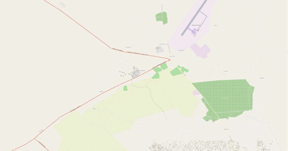
What the map of Chad looks like

The same place in three render styles. Buildings, roads, water and greenery carry over into every format losslessly.

Blueprint (CAD) — map of Chad
Blueprint (CAD)
Outlines on a dark background — for DWG and DXF
Standard vector — map of Chad
Standard vector
A colour map with buildings, roads and greenery
Print layout — map of Chad
Print layout
A ready layout for PDF and print production

Place scores

Composite indices from OpenStreetMap data: how comfortable it is to live here, walk, use transit and greenery.

Livability
3Room to grow
A composite index out of 100
Walkability
10/100
Room to grow
Greenery
10/100
Room to grow

Infrastructure of Chad

What's on the territory according to OpenStreetMap data.

237
Dining
585
Shops
238
Hotels
63
Transport
19
Parks
1 148
Water

Density and saturation

How many features there are per square kilometre — according to OpenStreetMap data.

0
bld/km²
0,1
km/km²
0
POI/km²
13%
greenery

How the map is used

The same dataset for Chad — for different tasks: from drafting to 3D printing.

Architecture and design
An underlay and building outlines for drawings and layouts.
DWG / DXF
Design and illustration
A vector map base for posters, schemes and identity design.
SVG / AI
GIS and analysis
Geo-referenced layers for QGIS, ArcGIS and spatial analysis.
GeoJSON / SHP
3D printing and models
Relief of buildings and terrain for printing and visualization.
STL
Navigation and tracks
Map data for navigators and route apps.
Garmin
Print and publishing
A ready map layout for print production.
PDF

Landmarks

Museums, monuments and notable places of Chad according to OpenStreetMap data — each with a link to the map.

🏛️
Musée de Gaoui
MuseumOSM
🏛️
تركو
MuseumOSM
🏛️
متحف ساره الإقليمي
MuseumOSM
🏛️
Palais Royal de Léré القصر الملكي في ليري
MuseumOSM
🏛️
Musée national المتحف الوطني
MuseumOSM
🏛️
Musée National المتحف الوطني
MuseumOSM
🏰
chateau
CastleOSM
🏰
Ali Hafis
CastleOSM
🏰
EMAT
CastleOSM
🏰
Palais du Chef de canton
CastleOSM
🏰
Soultana
CastleOSM
🏰
Palais Royal de Guetallet
CastleOSM
🏰
Colonial Castle
CastleOSM
🏰
chateau
CastleOSM
🏰
Palais du Sultant du Kanem قصر سلطان كانم
CastleOSM
🏰
Palais du Chef de Canton Elfas
CastleOSM
Château d'eau
AttractionOSM
Bottle Rock
AttractionOSM
Couveuse OWIYANA
AttractionOSM
Connection
AttractionOSM
Jardin public
AttractionOSM
Five Arch Rock
AttractionOSM
GOZ NÂSSANE
AttractionOSM
Pont
AttractionOSM

Nature and green areas

Parks, squares and water bodies of Chad according to OpenStreetMap data — everything is carried into the map as separate layers.

260725,4
km² of greenery
13%
green coverage
19
parks
1 148
water bodies
Parks and squares
Reserve de Douguia محمية دوقيا · 46 ha
Place de la Nation ساحة الأمة · 4 ha
Place de la Nation ساحة الأمة · 2 ha
Terrain Zene Bada منتزه زين بادا · 1 ha
Jardin Botanique حديقة نباتية · 1 ha
Water bodies
Lac Tchad بحيرة تشاد · lake
Rahat Abranga · lake
Lac Fitri بحيرة فيتري · lake
Ter Baro · lake
Iro بحيرة إيرو · lake
Logone · river
Chari شاري · river
Bahr Salamat · river

Public transport

Stops and stations according to OpenStreetMap data.

62
bus stops
1
tram stops

Public transport of Chad includes 62 bus stops and 1 tram stops. All stops and stations are included in the map as a separate layer.

Streets and roads

Roads classified by type — according to OpenStreetMap data.

68691,6 km
прочие дороги
16699,7 km
улицы и проезды
13122,8 km
дороги местного значения
8404,4 km
дороги областного значения
2474,9 km
главные дороги
2367,3 km
магистрали
651,7 km
проезды
40,6 km
жилые зоны

The street network of Chad — 112 458 km of roads according to OpenStreetMap data, classified by type.

Named streets
طريق اروبو - كفرة · 424,6 km
طريق أونيانقا - الكفرة · 403,4 km
طريق ربيانة · 289,2 km
Route Nationale Mongo - Melfi - Sarh · 229,5 km
طريق اروبو · 190,8 km
Am Timan - Kerfi Rd طريق ام تيمان - كرفي · 163,7 km
Sarh - Kyabe - Am Timan · 131,7 km
Route nationale N'Djaména - Massakory - Faya-Largeau · 130,4 km

Restaurants and cafés

Food and drink venues according to OpenStreetMap data.

109
restaurants
25
cafés
77
bars
26
fast food

In Chad, OpenStreetMap records 237 food and drink venues — restaurants, cafés, bars and fast-food outlets.

Shops and retail

Retail according to OpenStreetMap data.

585
shops

In Chad, OpenStreetMap records 585 shops and retail outlets. Main categories: Tạp hóa, Vật liệu xây dựng, Siêu thị, Ki-ốt, Đại lý du lịch, Cắt tóc.

Tạp hóa91Vật liệu xây dựng38Siêu thị33Ki-ốt32Đại lý du lịch32Cắt tóc28Quần áo23Tiệm bánh21Sửa xe18Tạp hóa tổng hợp13

Education

Schools, universities and libraries according to OpenStreetMap data.

409
schools
76
universities
11
libraries
23
kindergartens

Schools: "HAROUN GODY DE MATAYA", Adoum Younousmi, Africa Avenir School Complex, Agora, Al Afrah (École du Jardin ), Albouhaira البحيرة, Ancienne école d'Arkoum, Boulevard de 40 Metres شارع 40 متر. Universities: Académie Royale, CEG ADOUM DALLAH, CEG Agro-Pastoral, CEG de Beureuh, CEG de Moussoro الكلية العامة موسورو, Centre de Langue Américaine, Centre de formation professionnelle de Beureuh, College Donzonga كلية دونزونقا. Libraries: Alliance biblique du Tchad, Bibliothèque, Bibliothèque Nationale مكتبة الوطنية, Bibliothèque المكتبة, CEFOD, Centre Catholique Universitaire, Centre de Lecture et d'Animation Culturelle (CLAC), Institut Français du Tchad المعهد الفرنسي تشاد.

Healthcare

Hospitals, pharmacies and clinics according to OpenStreetMap data.

197
hospitals
82
pharmacies
176
clinics

Hospitals of Chad: Adventist Hospital Bere, Ancien Hopital de Kyabe, Ancien Hôpital de Goré, Baptist Health Center Complex, Birak, CMU, CS KOULKIME (Mackaye), CS NGUELEA (Mackaye).

Where to stay

Hotels, hostels and guest houses according to OpenStreetMap data.

238
accommodation places
Hotels and guest houses
Guest house CRF Bongor · Guest house
Résidence
Mackaye · Guest house
Guest Bongor · Guest house
Canp Donnet
Djidi Touka · Guest house
Marché Dabantchali (Mackaye)
Camping Douguia تخييم دوقيا · Hotel

What's on the map

Each layer of the Chad map can be turned on or off before download.

Map layers
Buildings: 31 365
Roads: 112 458 km
Points of interest: 4 771
Green areas: 260725,4 km²

Key figures

A summary based on OpenStreetMap data for Chad.

Buildings31 365
Residential buildings534
Commercial buildings42
Roads112 458 km
Green areas260725,4 km²
Green coverage13%
Food and drink venues237
Shops585
Points of interest4 771
Bus stops62
Hospitals197
Pharmacies82
Landmarks200

About Chad

Chad is a ready-made vector map based on OpenStreetMap data. It is not an image but structured layers of buildings, roads, water bodies, greenery and points of interest that can be edited in any professional software. The map territory covers an area of 1.3M km2 within administrative boundaries.

The map includes 31 365 buildings, 112 458 km of roads and streets and 4 771 points of interest. Each layer can be turned on or off before download, and the data preserves the original OpenStreetMap classification. Green areas cover about 13% of the territory.

The map works well as an underlay in AutoCAD and CorelDRAW, for loading layers into QGIS and ArcGIS, preparing printed schemes and plans, or as a basis for design and navigation. More than 130 formats are available — from DWG, DXF and SVG to GeoJSON, Shapefile and 3D models, in the WGS 84 coordinate system.

Compared to neighbours

How the place compares to neighbours within a 30-kilometre radius.

0 places within a 30 km radius to compare.

Frequently asked questions

Mở osm2cdr.ru, chọn vùng mong muốn trên bản đồ, chọn định dạng và bắt đầu xuất. Hầu hết bản đồ sẽ sẵn sàng trong 1–5 phút.
Bản đồ Chad có sẵn ở hơn 133 định dạng: CDR, DWG, DXF, SVG, AI, EPS, PDF, PNG, GeoJSON, KML, Shapefile, GeoTIFF và các định dạng khác.
Yes. The full map of Chad is free to export during Open Beta — all 133 formats, no area limits, no registration.
Dịch vụ sử dụng dữ liệu OpenStreetMap, được cập nhật thường xuyên.
Đối với "country" thường mất 1–3 phút, và lên đến 10 phút cho các lãnh thổ lớn.