
S-57 Electronic Navigational Chart cell
Price before paymentbetaS-57 is the International Hydrographic Organization (IHO) standard for Electronic Navigational Charts (ENC): a binary ISO/IEC 8211 cell with an object and attribute catalogue. We build a real .000 cell with the GDAL S57 driver: DEPARE depth areas between standard isobaths (2, 5, 10, 20, 30, 50, 100, 200 m and deeper), DEPCNT depth contours, SOUNDG soundings, LNDARE land and the COALNE coastline from the NOAA ETOPO 2022 relief model (public domain), plus buildings, roads, railways, lakes, rivers and land regions from OpenStreetMap. The sources are recorded in the cell COMT field. Depth resolution is about 30 arc-seconds (up to 900 m): overview data for OpenCPN and GIS, not an official chart and not for navigation.
OpenStreetMap data as of 26 October 2026 · 24 days ago
ਮੁੱਖ ਵਿਸ਼ੇਸ਼ਤਾਵਾਂ
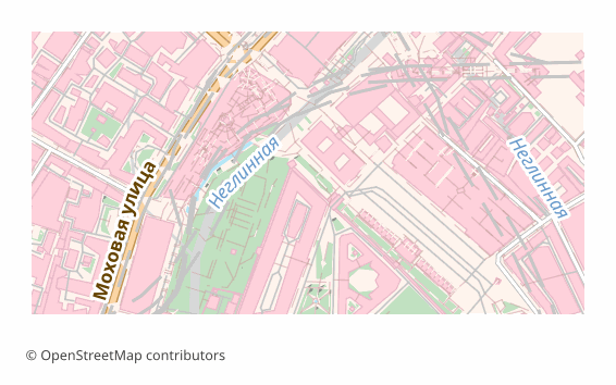
S-57 ENC ਫਾਰਮੈਟ ਬਾਰੇ
S-57 is the International Hydrographic Organization standard for electronic navigational charts. It is not a picture or a set of lines but a binary ISO/IEC 8211 file with a strict catalogue of maritime objects: depth areas, contours, soundings, land, coastline — each with its own class code and S-57 attributes.
We build a real .000 cell with the GDAL S57 driver. Depths come from the NOAA ETOPO 2022 global relief model (public domain): DEPARE depth areas between standard isobaths of 2, 5, 10, 20, 30, 50, 100, 200 m and deeper, DEPCNT contour lines, SOUNDG soundings, LNDARE land and the COALNE coastline. Buildings, roads, railways, lakes, rivers and land regions come from OpenStreetMap. Both sources are recorded in the cell COMT field.
To be honest about the limits: ETOPO 2022 depths have a step of about 30 arc-seconds, up to 900 m. This is an overview chart for OpenCPN, QGIS and training, not an official hydrographic-office ENC: there are no buoys, lights, fairways or notices to mariners, and it is not fit for navigation.
S-57 ENC ਫਾਈਲਾਂ ਕਿਹੜਾ ਪ੍ਰੋਗਰਾਮ ਖੋਲ੍ਹਦਾ ਹੈ
ਹੇਠ ਲਿਖੇ ਪ੍ਰੋਗਰਾਮ ਅਤੇ ਐਪਲੀਕੇਸ਼ਨਾਂ OSM2CDR ਤੋਂ ਐਕਸਪੋਰਟ ਕੀਤੀਆਂ S-57 Electronic Navigational Chart cell (.000) ਫਾਈਲਾਂ ਨੂੰ ਖੋਲ੍ਹ ਸਕਦੀਆਂ ਹਨ, ਸੰਪਾਦਿਤ ਕਰ ਸਕਦੀਆਂ ਹਨ ਅਤੇ ਉਹਨਾਂ ਨਾਲ ਕੰਮ ਕਰ ਸਕਦੀਆਂ ਹਨ:
Format specifications
- Open standard
- 2D only
- Lossless (no quality loss)
- Stores feature attributes
- Output: 1 file
- A single ISO/IEC 8211 S-57 cell (.000) written by the GDAL S57 driver: DEPARE/DEPCNT/SOUNDG/LNDARE/COALNE from NOAA ETOPO 2022 depths (~30 arc-seconds) plus OSM buildings, roads, railways, lakes, rivers and land regions; sources in DSID COMT. Overview data, not for navigation.
S-57 ENC ਨਕਸ਼ੇ ਕੌਣ ਵਰਤਦਾ ਹੈ
S-57 ENC ਕਿਵੇਂ ਐਕਸਪੋਰਟ ਕਰੀਏ
ਐਕਸਪੋਰਟ ਤੋਂ ਬਾਅਦ ਕਿਵੇਂ ਖੋਲ੍ਹਣਾ ਹੈ
- OpenCPN — add the folder with the .000 file to the chart directories: the cell shows depth shading, contours and soundings.
- QGIS — drop the .000 file into the window: the GDAL S57 driver splits it into DEPARE, DEPCNT, SOUNDG, LNDARE, COALNE and the object layers.
- ogrinfo — ogrinfo -so file.000 lists the object classes and their counts; ogr2ogr converts the cell to GeoPackage or Shapefile.
- The depth and land sources sit in the COMT field of the DSID record, together with the NOAA and OpenStreetMap licences for the map credit.
- For real passages use official hydrographic-office charts: our cell is overview data.
S-57 Electronic Navigational Chart cell ਨਕਸ਼ਾ ਐਕਸਪੋਰਟ ਪ੍ਰਾਪਤ ਕਰੋ
OpenStreetMap ਤੋਂ ਪੇਸ਼ੇਵਰ S-57 ENC ਨਕਸ਼ੇ ਡਾਊਨਲੋਡ ਕਰੋ। ਤੁਰੰਤ ਤਿਆਰੀ, ਕੋਈ ਵੀ ਖੇਤਰ।
ਅਕਸਰ ਪੁੱਛੇ ਜਾਣ ਵਾਲੇ ਸਵਾਲ
What people who already downloaded say
Finally, maps can be downloaded as vectors. Thanks to the author!
Map: Ufa, AI
everything is really cool, I didn't expect I'd just come and download a piece of the map! thanks!!!
Map: Nizhny Novgorod, PMTiles
HUGE THANKS!!! A VERY GOOD PROGRAM!!! I was looking for a vector map where 3 countries meet - it helped a lot!!
Map: Kazakhstan and Altai, PDF
Well done! You've done a big and much-needed job!
Map: Roshchino, Leningrad Region, GeoTIFF
Ivan, thank you so much! Not just a man - a Great Man!
Map: Saratov Region, GeoJSON
ivan, you're simply a wonder. Thank you for an incredibly cool service
Map: Bogashevo near Tomsk, DXF