osm2cdr.ru
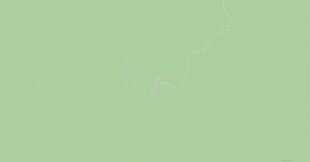
Map of .
.
Javier
N
© OpenStreetMap
Boundary · Javier · OpenStreetMap
BuildingsRoadsWaterGreeneryBoundary
Ready map · OSM data

Map of .

Village · Javier

A ready-made vector map with buildings, roads and features — for CAD, GIS and print. Instant download, no registration.

Choose a format
Download · DWG
All 133 formats Customize your area
133 formatsOSM datano registrationready instantly

Map passport

187
Buildings
23 km
Roads
1
Points of interest
Customize the map for yourself

Open the area of . in the constructor and change layers, style, format and coordinate system for your task.

Open in constructor

Map defaults

This is how the map is built by default — every parameter can be changed in the constructor.

Format
DWG .dwgchoose
Layers
Roads, Buildings, Water, Greenery, POIchange
Style
Standard (colour)change
Detail
auto · by area sizechange
House numbers
Points of interest
all categorieschange
Coordinate system
WGS 84 (auto)change
Sheet size
Relief and grid

Download the map of . in 133 formats

The same OpenStreetMap dataset — in the format for your software. Pick by task: CAD, vector, GIS, 3D or print.

Popular formatsthe most common formats
MOST COMMON
PDFfor printing and viewing.pdf
CDRfor CorelDRAW.cdr
SVGfor Illustrator, Inkscape, web.svg
GeoJSONfor QGIS and web maps.geojson
DWGfor AutoCAD, nanoCAD, BricsCAD.dwg
CADdrafting and design
DWGFREE
AutoCAD.dwg
DXFFREE
CAD exchange.dxf
CDRFREE
CorelDRAW.cdr
DGNFREE
MicroStation.dgn
Vectorillustration and web
SVGFREE
Web · vector.svg
AIFREE
Illustrator.ai
EPSFREE
Print production.eps
PDFFREE
Vector · print.pdf
GISgeo-referenced data
GeoJSONFREE
GIS · data.geojson
ShapefileFREE
QGIS · ArcGIS.shp
KMLFREE
Google Earth.kml
GeoPackageFREE
GeoPackage.gpkg
3Dvolume and models
STLFREE
3D printing.stl
OBJFREE
3D model.obj
glTFFREE
3D · web.gltf
DAEFREE
Collada.dae
Printraster and layouts
PNGFREE
Raster · transparency.png
JPGFREE
Raster.jpg
PDFFREE
Print layout.pdf
TIFFFREE
Print production.tif
Open all 133 formats

Maps of Javier

Nearby cities and districts — every map is ready to download.

Neighbouring places and regions

Browse to neighbouring cities, districts and regions — each has a ready-made vector map in the same formats.

Other places in Leyte

Ormoc230 998Baybay111 848Palo76 213Hilongos64 514Abuyog61 216Kananga59 696Palompon58 313Tanauan57 455Alangalang57 185Carigara54 656Burauen52 511Villaba42 859Jaro43 758Dulag48 992Leyte40 397Isabel46 781Bato38 505Albuera47 151Dagami36 178Barugo34 497Matalom32 586Babatngon28 823Mahaplag27 865Tabango33 868Capoocan33 721Inopacan21 389Calubian31 646Merida31 574San Isidro30 722Hindang20 849
All places in Leyte

Regions of Philippines

Quezon City2 936 116Davao City1 848 947Manila1 780 148Caloocan1 661 584Zamboanga City1 018 849Cebu City965 332Taguig886 722Pasig803 159Cebu3 400 522Cagayan de Oro741 617Isabela1 733 048Masbate910 813Cagayan1 284 676Valenzuela714 978Camarines Sur2 063 314Palawan968 795Bohol1 412 726Zamboanga del Norte1 067 067General Santos697 315Parañaque689 992Iloilo2 082 616Pangasinan3 188 540Quezon1 950 459Bacolod624 787Las Piñas615 549Oriental Mindoro919 504Negros Oriental1 492 038Zamboanga del Sur1 045 126Samar806 179Muntinlupa552 225
Philippines — all regions

Neighboring regions

Palau21 680 · 1059 km · CountryPhilippines1155 km · CountryMalaysia1224 km · CountryBrunei1316 km · Country
187buildings
23 kmroads and streets
1features
133formats
WGS 84coordinate system

What's inside the map of .

The map covers the entire area of . within administrative boundaries. Green areas cover 100% of the territory. Each layer can be turned on or off before download.

187buildings
Buildings on separate layers
residential50
23km
Roads with classification
tertiary roads7 km
secondary roads8 km
residential streets0 km
1POI
Points of interest
schools1
Main streets
La Paz-Javier-Bito Road

What the map of . looks like

The same place in three render styles. Buildings, roads, water and greenery carry over into every format losslessly.

Blueprint (CAD) — map of .
Blueprint (CAD)
Outlines on a dark background — for DWG and DXF
Standard vector — map of .
Standard vector
A colour map with buildings, roads and greenery
Print layout — map of .
Print layout
A ready layout for PDF and print production

Place scores

Composite indices from OpenStreetMap data: how comfortable it is to live here, walk, use transit and greenery.

Livability
3Room to grow
A composite index out of 100
Greenery
10/100
Room to grow
Connectivity
27/100
Developing

How the map is used

The same dataset for . — for different tasks: from drafting to 3D printing.

Architecture and design
An underlay and building outlines for drawings and layouts.
DWG / DXF
Design and illustration
A vector map base for posters, schemes and identity design.
SVG / AI
GIS and analysis
Geo-referenced layers for QGIS, ArcGIS and spatial analysis.
GeoJSON / SHP
3D printing and models
Relief of buildings and terrain for printing and visualization.
STL
Navigation and tracks
Map data for navigators and route apps.
Garmin
Print and publishing
A ready map layout for print production.
PDF

Nature and green areas

Parks, squares and water bodies of . according to OpenStreetMap data — everything is carried into the map as separate layers.

94,5
km² of greenery
100%
green coverage

Streets and roads

Roads classified by type — according to OpenStreetMap data.

8,7 km
secondary roads
7,2 km
tertiary roads
6,8 km
unclassified roads
0,4 km
residential streets

The street network of . — 23 km of roads according to OpenStreetMap data, classified by type.

Named streets
La Paz-Javier-Bito Road · 8,7 km

Education

Schools, universities and libraries according to OpenStreetMap data.

1
schools

Schools: Cancayang Elementary School.

What's on the map

Each layer of the . map can be turned on or off before download.

Map layers
Buildings: 187
Roads: 23 km
Points of interest: 1
Green areas: 94,5 km²

Key figures

A summary based on OpenStreetMap data for ..

Buildings187
Residential buildings50
Roads23 km
Green areas94,5 km²
Green coverage100%
Points of interest1

About .

. is a ready-made vector map based on OpenStreetMap data. It is not an image but structured layers of buildings, roads, water bodies, greenery and points of interest that can be edited in any professional software. The territory belongs to the «Javier» region.

The map includes 187 buildings, 23 km of roads and streets and 1 points of interest. Each layer can be turned on or off before download, and the data preserves the original OpenStreetMap classification. Green areas cover about 100% of the territory.

The map works well as an underlay in AutoCAD and CorelDRAW, for loading layers into QGIS and ArcGIS, preparing printed schemes and plans, or as a basis for design and navigation. More than 130 formats are available — from DWG, DXF and SVG to GeoJSON, Shapefile and 3D models, in the WGS 84 coordinate system.

Compared to neighbours

How the place compares to neighbours within a 30-kilometre radius.

420 places within a 30 km radius to compare.

🏠 Built-uppercentile 60 of 100
🛣️ Roadspercentile 97 of 100

Frequently asked questions

Open osm2cdr.com, select the target area on the map, choose a format, and start export. Most maps are ready in 1-5 minutes.
Map of . is available in 133 formats: CDR, DWG, DXF, SVG, AI, EPS, PDF, PNG, GeoJSON, KML, Shapefile, GeoTIFF and others.
Yes. The full map of . is free to export during Open Beta — all 133 formats, no area limits, no registration.
The service uses OpenStreetMap data, updated monthly.
Generation time depends on the area size. You will receive an email notification when ready.