osm2cdr.com
Ready map · OSM data

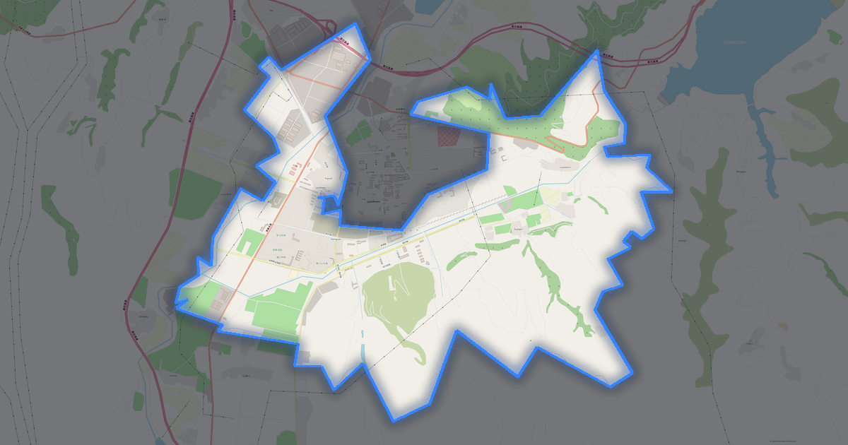
Map of Pingliang

City · Gansu · 11,116 km2

A ready-made vector map with buildings, roads and features — for CAD, GIS and print. Download after signing in.

Choose a format
Download · PDF, ≈ 7.7 MB
All 140 formats Customize your area
133 formatsOSM datadownload after signing in
N
© OpenStreetMap
Boundary · Pingliang · OpenStreetMap
BuildingsRoadsWaterGreeneryBoundary

Map passport

11,116 km2
Area
6 231
Buildings
13 961 km
Roads
1 097
Points of interest
Typecity
Coordinates35.31° N, 106.65° E
OSM data2026-08-24
Customize the map for yourself

Open the area of Pingliang in the constructor and change layers, style, format and coordinate system for your task.

Open in constructor

Map defaults

This is how the map is built by default — every parameter can be changed in the constructor.

Format
PDF choose
Layers
Roads, Buildings, Water, Greenery, POIchange
Style
Standard (colour)change
Detail
auto · by area sizechange
House numbers
not visible at this scalechange
Points of interest
major objects onlychange
Coordinate system
WGS 84 (auto)change
Sheet size
Relief and grid

Download the map of Pingliang in 140 formats

The same OpenStreetMap dataset — in the format for your software. Pick by task: CAD, vector, GIS, 3D or print.

Popular formatsthe most common formats
MOST COMMON
PDFfor printing and viewing.pdf · ≈ 701 KB
CDRfor CorelDRAW.cdr · ≈ 107 KB
SVGfor Illustrator, Inkscape, web.svg · ≈ 820 KB
GeoJSONfor QGIS and web maps.geojson · ≈ 1.3 MB
DWGfor AutoCAD, nanoCAD, BricsCAD.dwg · ≈ 28.2 MB
CADdrafting and design
DWGFREE
AutoCAD.dwg · ≈ 50 MB
DXFFREE
CAD exchange.dxf · ≈ 95.9 MB
CDRFREE
CorelDRAW.cdr · ≈ 1.7 MB
DGNFREE
MicroStation.dgn · ≈ 7.7 MB
Vectorillustration and web
SVGFREE
Web · vector.svg · ≈ 13.2 MB
AIFREE
Illustrator.ai · 12.7 MB
EPSFREE
Print production.eps · ≈ 10.6 MB
PDFFREE
Vector · print.pdf · ≈ 11.3 MB
GISgeo-referenced data
GeoJSONFREE
GIS · data.geojson · ≈ 16.9 MB
ShapefileFREE
QGIS · ArcGIS.shp · ≈ 2.1 MB
KMLFREE
Google Earth.kml · ≈ 16.3 MB
GeoPackageFREE
GeoPackage.gpkg · ≈ 9.3 MB
3Dvolume and models
STLFREE
3D printing.stl · ≈ 757 KB
OBJFREE
3D model.obj · ≈ 294 KB
glTFFREE
3D · web.gltf · ≈ 547 KB
DAEFREE
Collada.dae · ≈ 505 KB
Printraster and layouts
PNGFREE
Raster · transparency.png · ≈ 8.9 MB
JPGFREE
Raster.jpg · ≈ 2.3 MB
PDFFREE
Print layout.pdf · ≈ 11.3 MB
TIFFFREE
Print production.tif · ≈ 21.1 MB
Open all 140 formats

Maps of Gansu

All places within the territory — every map is ready to download.

Neighbouring places and regions

Browse to neighbouring cities, districts and regions — each has a ready-made vector map in the same formats.

Other places in Gansu

Lanzhou3 688 400TianshuiQingyang2 179 716LongnanDatong TownHongcheng TownKushui TownShuping TownWushengyi TownShangchuanzhenShichuanHeishichuanJinyaLiancheng TownLinxiaQinchuanJiayuguan312 663HuazhuangHepingPing'anHekou TownshipHonggu136 101Yongdeng101 100Chengguan TownXincheng TownQingcheng69 900Gaolan67 700Yuzhongxian61 600DongchuanFulongping
All places in Gansu

Regions of China

Hong KongAnhuiChongqingFujianGuangdongGuangxiGuizhouHainanHebeiHeilongjiangHenanHubeiHunanInner MongoliaJiangsuJiangxiJilinLiaoningNingxiaQinghaiShaanxiShandongShanxiSichuanTibetXinjiangYunnanZhejiangShanghaiBeijing
China — all regions

Nearby

Qingyang2 673 100 · 104 km · CityGuyuan1 142 142 · 85 km · CityYuanzhou471 329 · 82 km · City
Map of Pingliang
Pingliang
Gansu

About Pingliang

Analytical Portrait: Pingliang Pingliang is a spacious city spanning 11,115.9 km², where buildings alternate with open spaces. Green areas cover 24.0% of the city. An extensive public transport network (154 stops) provides high mobility.

Strengths 64/100 Connectivity Average road network connectivity 49/100 Green Coverage Moderate green coverage 19/100 Safety Safety infrastructure needs improvement Interesting Facts 🛣️ The total road length of Pingliang (13,960 km) is like a round trip from Moscow to Vladivostok.

6 231buildings
13 961 kmroads and streets
1 097features
140formats
WGS 84coordinate system

What's inside the map of Pingliang

The map covers the entire area of Pingliang within administrative boundaries — 11,116 km2. Green areas cover 24% of the territory. Each layer can be turned on or off before download.

6 231buildings
Buildings on separate layers
commercial9
industrial23
13 961km
Roads with classification
trunk roads629 km
primary roads608 km
service roads276 km
1 097POI
Points of interest
car dealerships8
fuel stations98
shopping malls7
Main streets
正宁 - 平泉环县 - 泾川崆峒大道泾河大道河崔路旧312国道
Landmarks · 6
›平凉市博物馆
›皇甫谧文化园
›平东工委纪念馆
›华亭县博物馆
›古镇游乐射击场
›华亭县玄峰山牧场

What the map of Pingliang looks like

The same place in three render styles. Buildings, roads, water and greenery carry over into every format losslessly.

Blueprint (CAD) — map of Pingliang
Blueprint (CAD)
Outlines on a dark background — for DWG and DXF
Standard vector — map of Pingliang
Standard vector
A colour map with buildings, roads and greenery
Print layout — map of Pingliang
Print layout
A ready layout for PDF and print production

Infrastructure of Pingliang

What's on the territory according to OpenStreetMap data.

3
Dining
79
Shops
16
Hotels
154
Transport
20
Parks
47
Water

Density and saturation

How many features there are per square kilometre — according to OpenStreetMap data.

1
bld/km²
1,3
km/km²
0
POI/km²
24%
greenery

How the map is used

The same dataset for Pingliang — for different tasks: from drafting to 3D printing.

Architecture and design
An underlay and building outlines for drawings and layouts.
DWG / DXF
Design and illustration
A vector map base for posters, schemes and identity design.
SVG / AI
GIS and analysis
Geo-referenced layers for QGIS, ArcGIS and spatial analysis.
GeoJSON / SHP
3D printing and models
Relief of buildings and terrain for printing and visualization.
STL
Navigation and tracks
Map data for navigators and route apps.
Garmin
Print and publishing
A ready map layout for print production.
PDF

Landmarks

Museums, monuments and notable places of Pingliang according to OpenStreetMap data — each with a link to the map.

🏛️
平凉市博物馆
MuseumOSM
🏛️
皇甫谧文化园
MuseumOSM
🏛️
平东工委纪念馆
MuseumOSM
🏛️
华亭县博物馆
MuseumOSM
⭐
古镇游乐射击场
AttractionOSM
⭐
华亭县玄峰山牧场
AttractionOSM
⭐
崆峒山
AttractionOSM
🗿
吴焕先烈士纪念馆
MonumentOSM
🎭
平凉剧院
TheatreOSM
⛪
站院清真寺
Place of worshipOSM
⛪
香山寺
Place of worshipOSM
⛪
七里店清真寺
Place of worshipOSM
⛪
辛家河滩清真寺
Place of worshipOSM
⛪
东台清真寺
Place of worshipOSM
⛪
东郊清真大寺
Place of worshipOSM
⛪
泾河路清真寺
Place of worshipOSM
⛪
清真寺
Place of worshipOSM
⛪
韩家沟石窟
Place of worshipOSM
⛪
武康王庙
Place of worshipOSM
⛪
城西清真寺
Place of worshipOSM
⛪
大云寺
Place of worshipOSM
⛪
高平清真寺
Place of worshipOSM
⛪
旅平清真寺
Place of worshipOSM
⛪
秦陇清真寺
Place of worshipOSM

Nature and green areas

Parks, squares and water bodies of Pingliang according to OpenStreetMap data — everything is carried into the map as separate layers.

5322,4
km² of greenery
24%
green coverage
20
parks
47
water bodies
Parks and squares
›紫荆山公园 · 88 ha
›龙隐寺公园 · 59 ha
›荆山森林公园 · 27 ha
›双凤山公园 · 19 ha
›南山生态公园 · 18 ha
Water bodies
›东峡水库 · lake
›小盘河水库 · lake
›弹筝湖 · lake
›高坪水库 · lake
›张峡水库 · lake
›泾河 · river
›葫芦河 · river
›黑河 · river

Public transport

Stops and stations according to OpenStreetMap data.

135
bus stops
19
rail stations

Public transport of Pingliang includes 135 bus stops and 19 rail stations. All stops and stations are included in the map as a separate layer.

Streets and roads

Roads classified by type — according to OpenStreetMap data.

6069,7 km
unclassified roads
2391,2 km
tertiary roads
1484,7 km
residential streets
1414,2 km
secondary roads
1071,2 km
motorways
629,6 km
trunk roads
608,8 km
primary roads
276,2 km
service roads

The street network of Pingliang — 13 961 km of roads according to OpenStreetMap data, classified by type.

Named streets
›正宁 - 平泉 · 86,8 km
›环县 - 泾川 · 28,1 km
›崆峒大道 · 23,7 km
›泾河大道 · 23,3 km
›崆峒大道 · 19,8 km
›河崔路 · 16,9 km
›旧312国道 · 12,7 km
›旧国道312 · 12,6 km

Restaurants and cafés

Food and drink venues according to OpenStreetMap data.

2
restaurants
1
cafés

In Pingliang, OpenStreetMap records 3 food and drink venues — restaurants, cafés, bars and fast-food outlets.

Notable venues
›餐饮楼

Shops and retail

Retail according to OpenStreetMap data.

79
shops

In Pingliang, OpenStreetMap records 79 shops and retail outlets. Main categories: Clothes, Car Dealers, Malls, Jewelry, Convenience, Shoes.

Clothes30Car Dealers8Malls7Jewelry7Convenience6Shoes5Baby Goods2Mobile Phones2Bedding1Tea1

Education

Schools, universities and libraries according to OpenStreetMap data.

362
schools
4
universities
1
libraries
23
kindergartens

Schools: 东大街小学, 二天门小学, 农业学校, 华亭第二中学, 南台回民小学, 双明村小学, 城关初中, 大岭小学. Universities: 平凉市亚东职业学校, 甘肃医学院, 静宁县职教中心简介. Libraries: 图书馆.

Healthcare

Hospitals, pharmacies and clinics according to OpenStreetMap data.

15
hospitals

Hospitals of Pingliang: 华亭县第一人民医院, 崇信县中医院, 平凉市人民医院, 平凉市妇幼保健院, 平凉第二人民医院, 泾川县中医医院, 泾川县人民医院, 灵台县人民医院.

Where to stay

Hotels, hostels and guest houses according to OpenStreetMap data.

16
accommodation places
Hotels and guest houses
›平凉宾馆 · Hotel
›五味宫酒店 · Hotel
›平凉新裕商务宾馆 · Hotel
›7天连锁酒店 · Hotel
›平凉新都酒店 · Hotel
›和颐至格酒店 · Hotel
›平凉天正大酒店 · Hotel
›金三角宾馆 · Hotel

What's on the map

Each layer of the Pingliang map can be turned on or off before download.

Map layers
›Buildings: 6 231
›Roads: 13 961 km
›Points of interest: 1 097
›Green areas: 5322,4 km²

Key figures

A summary based on OpenStreetMap data for Pingliang.

Buildings6 231
Commercial buildings9
Roads13 961 km
Green areas5322,4 km²
Green coverage24%
Food and drink venues3
Shops79
Points of interest1 097
Bus stops135
Rail stations19
Hospitals15
Landmarks35

Frequently asked questions

Open osm2cdr.com, select the target area on the map, choose a format, and start export. Most maps are ready in a few seconds.
Map of Pingliang is available in 140 formats: CDR, DWG, DXF, SVG, AI, EPS, PDF, PNG, GeoJSON, KML, Shapefile, GeoTIFF and others.
Pick a format: all 140 formats are available, with no area limits. Download after signing in to the site; you see the price before you pay.
The service uses OpenStreetMap data, updated monthly.
Generation time depends on the area size. You will receive an email notification when ready.