
Adobe Photoshop PSD
Open BetaPSD ಎಂಬುದು ಪದರ ಬೆಂಬಲದ ಸಹಿತ Adobe Photoshop ನ ಸ್ಥಳೀಯ ಸ್ವರೂಪ. ನಕ್ಷೆಯನ್ನು ರಸ್ತೆಗಳು, ಕಟ್ಟಡಗಳು, ನೀರು ಮತ್ತು ಲೇಬಲ್ಗಳಿಗೆ ಪ್ರತ್ಯೇಕ ಪದರಗಳ ಸಹಿತ ರಫ್ತು ಮಾಡಲಾಗುತ್ತದೆ. ಗ್ರಾಫಿಕ್ ವಿನ್ಯಾಸ ಮತ್ತು ನಂತರದ ಸಂಸ್ಕರಣೆಗೆ ಸೂಕ್ತ.
ಪ್ರಮುಖ ವೈಶಿಷ್ಟ್ಯಗಳು
PSD ಫಾರ್ಮ್ಯಾಟ್ ಬಗ್ಗೆ
PSD is the native format of Adobe Photoshop: a raster image split into layers with transparency. It is opened not only by Photoshop itself — Affinity Photo, GIMP, Krita and the browser-based Photopea read PSD with its layers and let you work with each of them separately.
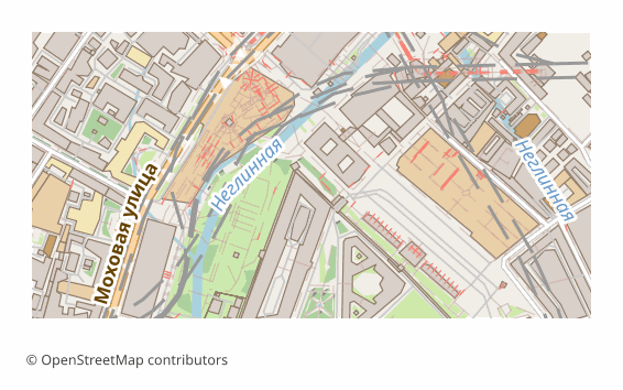
A map is exported to PSD when it will be drawn on rather than calculated with: a poster, a cover, an infographic, a presentation background, an illustration for a publication. Layers let you recolor the water, mute the buildings, hide the labels and add your own — without touching the rest of the map.
What is inside: five thematic layers, bottom to top — Water, Green areas (greenery and land use), Buildings, Roads (roads, rails, transport), Labels (captions and names). Each one is drawn on a transparent background, so the lower ones show through the upper ones. The sheet is 297x210 mm at 300 DPI by default, and the image side is capped at 6000 pixels so the file stays openable.
Worth knowing up front: the layers are raster — pixels, not editable vector outlines, so you cannot drag a node of a road. For vector editing take SVG or PDF. And one more thing: if the layer assembly library is unavailable on the server, you will get the same sheet as a single layer — the map is the same, it is just not split into layers.
PSD ಫೈಲ್ಗಳನ್ನು ಯಾವ ಪ್ರೋಗ್ರಾಮ್ ತೆರೆಯುತ್ತದೆ
OSM2CDR ನಿಂದ ಎಕ್ಸ್ಪೋರ್ಟ್ ಮಾಡಲಾದ Adobe Photoshop PSD (.psd) ಫೈಲ್ಗಳನ್ನು ಈ ಕೆಳಗಿನ ಪ್ರೋಗ್ರಾಮ್ಗಳು ಮತ್ತು ಅಪ್ಲಿಕೇಶನ್ಗಳು ತೆರೆಯಬಹುದು, ಸಂಪಾದಿಸಬಹುದು ಮತ್ತು ಬಳಸಬಹುದು:
Format specifications
- Proprietary format
- 2D only
- Lossless (no quality loss)
- No attributes
- Output: 1 file
- Adobe Photoshop .psd, layered raster. Each map layer rasterised to a separate Photoshop layer. Opens in Photoshop, GIMP, Affinity Photo.
PSD ನಕ್ಷೆಗಳನ್ನು ಯಾರು ಬಳಸುತ್ತಾರೆ
PSD ಅನ್ನು ಹೇಗೆ ಎಕ್ಸ್ಪೋರ್ಟ್ ಮಾಡುವುದು
ರಫ್ತಿನ ನಂತರ ಹೇಗೆ ತೆರೆಯುವುದು
- Adobe Photoshop — File > Open; the Water, Green areas, Buildings, Roads and Labels layers will appear in the Layers panel, and each one can be recolored, hidden and blurred separately.
- Affinity Photo — opens PSD with layers natively, bought once and without a subscription.
- GIMP (free) — File > Open, the layer structure is preserved; saving back to PSD is done through File > Export As.
- Photopea — works right in the browser, its interface is close to Photoshop: drag the file into the window, nothing to install.
- If you need vector editing — download the same map as SVG or PDF: there roads and buildings stay curves, while in PSD they are already pixels.
PSD ನಲ್ಲಿ ಜನಪ್ರಿಯ ನಕ್ಷೆಗಳು
Adobe Photoshop PSD ನಕ್ಷೆ ಎಕ್ಸ್ಪೋರ್ಟ್ಗಳನ್ನು ಪಡೆಯಿರಿ
OpenStreetMap ನಿಂದ ವೃತ್ತಿಪರ PSD ನಕ್ಷೆಗಳನ್ನು ಡೌನ್ಲೋಡ್ ಮಾಡಿ. ತಕ್ಷಣದ ರಚನೆ, ಯಾವುದೇ ಪ್ರದೇಶ.
ಪದೇ ಪದೇ ಕೇಳಲಾಗುವ ಪ್ರಶ್ನೆಗಳು
ಸಂಬಂಧಿತ ಫಾರ್ಮ್ಯಾಟ್ಗಳು
ಸಾಮಾನ್ಯವಾಗಿ ಒಟ್ಟಿಗೆ ಎಕ್ಸ್ಪೋರ್ಟ್ ಮಾಡಲಾಗುತ್ತದೆ
Related Articles
OpenStreetMap in Photoshop: a map in PSD with layers, not a screenshot
A map screenshot in Photoshop isn't editable — roads, water and buildings are flattened into one raster. The fix: downlo
formatPSD (Photoshop Document) format: cartographic editorial — OSM export for print graphics
PSD from Adobe 1990: layered raster, blend modes, smart objects, .psd vs .psb, cartographic editorial pipeline.
tutorialMaps in Photoshop: Creating Art Posters from OpenStreetMap
How to create an art poster from an OSM map in Photoshop. PSD import with layers, color grading, effects, and A3/A2 prin