
KOMPAS (flat 2D DXF drawing)
Price before paymentCDW হলো রুশ KOMPAS-3D CAD সিস্টেমের নেটিভ ফরম্যাট। আমাদের সেবা OpenStreetMap ডেটাকে সড়ক, ভবন, জলাশয় ও অবকাঠামোর জন্য পৃথক স্তরসহ একটি ফাইলে রূপান্তর করে। আউটপুট KOMPAS-3D, KOMPAS-Graphic ও সামঞ্জস্যপূর্ণ CAD সরঞ্জামে খোলে।
OpenStreetMap data as of 26 October 2026 · 25 days ago
মূল বৈশিষ্ট্য
KOMPAS ফরম্যাট সম্পর্কে
KOMPAS-3D is a Russian CAD system by ASCON, the de facto standard in domestic mechanical engineering and design: it is what people draft with at plants and what universities teach. An OpenStreetMap map is needed there as a base plan — the context of the site, the streets and buildings around the object being designed.
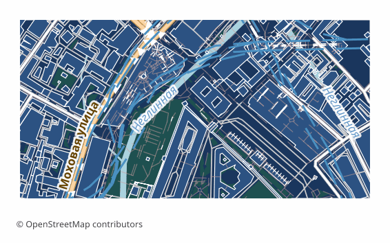
The export delivers a flat 2D DXF drawing prepared specifically for KOMPAS: lines, outlines and labels in plan, with no volume. Version R2007 and newer with UTF-8 encoding, so Russian layer names and labels read without corruption, the units are metric, and the layers are named in Russian. KOMPAS opens such a file with its standard command and saves it into its own .cdw or .frw in one step — the content of the drawing does not change in the process.
The map is laid out across layers: roads, buildings, water, vegetation, points of interest, boundaries. The ones you do not need are switched off in the layer manager, and the rest stay as a base plan on top of which you do your own work. The geometry is vector — it can be measured, snapped to and built upon.
If a coordinate system was explicitly chosen at export time, a ZIP arrives along with the drawing: the file itself and a .prj describing the projection — so the georeferencing is visible to GIS tools as well. Without an explicit choice, a single drawing file is delivered.
কোন প্রোগ্রাম KOMPAS ফাইল খোলে
নিম্নলিখিত প্রোগ্রাম ও অ্যাপ্লিকেশনগুলি OSM2CDR থেকে এক্সপোর্ট করা KOMPAS (flat 2D DXF drawing) (.dxf) ফাইল খুলতে, সম্পাদনা করতে ও এর সাথে কাজ করতে পারে:
Format specifications
- Proprietary format
- 2D only
- Lossless (no quality loss)
- Stores feature attributes
- Output: 1 file
- A flat 2D DXF R2007+ (UTF-8) drawing with no volume, for KOMPAS-Graphic / KOMPAS-3D: metric units, CAD layer structure, Cyrillic labels. KOMPAS opens it as a drawing and saves it as native .cdw / .frw itself.
কারা KOMPAS মানচিত্র ব্যবহার করেন
কীভাবে KOMPAS এক্সপোর্ট করবেন
এক্সপোর্টের পর কীভাবে খুলবেন
- KOMPAS-Graphic or KOMPAS-3D, including LT and Home — File → Open, pick the DXF file (it opens as a drawing); in the import dialog keep the metric units, then Save As .cdw or .frw.
- Checking the layers — in the document manager switch off everything unnecessary, leaving only the base plan you need, and lock it against accidental edits.
- Inserting into your own drawing — rather than copying the objects, it is handier to insert the map as an external fragment so it does not mix with your geometry.
- If labels display incorrectly — make sure the file is opened as DXF version R2007 or newer: that is the version that stores text in UTF-8.
- nanoCAD, AutoCAD and other CAD systems — the same file opens in them too, if the project is not run in KOMPAS alone.
KOMPAS (flat 2D DXF drawing) মানচিত্র এক্সপোর্ট পান
OpenStreetMap থেকে পেশাদার মানের KOMPAS মানচিত্র ডাউনলোড করুন। যেকোনো এলাকার জন্য তাৎক্ষণিক প্রস্তুতি।
প্রায়শই জিজ্ঞাসিত প্রশ্ন
What people who already downloaded say
Finally, maps can be downloaded as vectors. Thanks to the author!
Map: Ufa, AI
everything is really cool, I didn't expect I'd just come and download a piece of the map! thanks!!!
Map: Nizhny Novgorod, PMTiles
HUGE THANKS!!! A VERY GOOD PROGRAM!!! I was looking for a vector map where 3 countries meet - it helped a lot!!
Map: Kazakhstan and Altai, PDF
Well done! You've done a big and much-needed job!
Map: Roshchino, Leningrad Region, GeoTIFF
Ivan, thank you so much! Not just a man - a Great Man!
Map: Saratov Region, GeoJSON
ivan, you're simply a wonder. Thank you for an incredibly cool service
Map: Bogashevo near Tomsk, DXF