
GeoPackage (GPKG)
Price before paymentGeoPackage قالبی امروزی از OGC برای ذخیرهٔ دادههای جغرافیایی در یک فایل مبتنی بر SQLite است. جایگزینی برای Shapefile قدیمی، با پشتیبانی از لایههای برداری و رستری در یک ظرف.
OpenStreetMap data as of 26 October 2026 · 18 days ago
ویژگیهای کلیدی
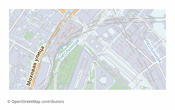
دربارهٔ قالب GeoPackage
GeoPackage is an OGC standard adopted in 2014. Under the hood it is an ordinary SQLite database in which layers, geometry and metadata are laid out by the standard's rules. A single .gpkg file can hold any number of vector layers, rasters, styles and tables without geometry.
It was devised as the replacement for the shapefile, and it cured all of its ailments: field names of any length, UTF-8 with no tricks, no set of companion files that must never be separated, and no two-gigabyte limit. Today GeoPackage is the default format in QGIS and the standard exchange unit in many organizations.
Each map layer becomes a separate table with its own OpenStreetMap attributes and a spatial index that is built automatically. Coordinates are WGS84 (EPSG:4326). All of it in one file: convenient to send, to put in the cloud or to take with you into the field.
You can also work with it as a database: a .gpkg opens in any SQLite client, and ordinary SQL queries apply to the layers.
چه برنامهای فایلهای GeoPackage را باز میکند
برنامهها و نرمافزارهای زیر میتوانند فایلهای GeoPackage (GPKG) (.gpkg) صادرشده از OSM2CDR را باز و ویرایش کنند و با آنها کار کنند:
Format specifications
- Open standard
- 3D coordinates supported
- Lossless (no quality loss)
- Stores feature attributes
- Output: 1 file
- OGC GeoPackage (SQLite). Single .gpkg file contains all layers. Direct import in QGIS 3.x, ArcGIS Pro, GDAL/OGR.
چه کسانی از نقشههای GeoPackage استفاده میکنند
چگونه GeoPackage را خروجی بگیریم
نحوه باز کردن پس از خروجی
- QGIS (free) — drag the .gpkg into the program window; a list of layers appears, tick the ones you need. Edits are saved right into that same file.
- ArcGIS Pro — Add Data, choose the .gpkg: the feature classes connect as if from a geodatabase.
- ogr2ogr — ogrinfo -so map.gpkg shows the list of layers, and ogr2ogr -f PostgreSQL PG:"..." map.gpkg loads them all into PostGIS in one command.
- Python — geopandas.read_file("map.gpkg", layer="roads"); the list of layers comes from fiona.listlayers.
- Field apps — QField, Mergin Maps and the like take a .gpkg as an offline source: one file on the phone, and the map works with no network.
خروجی نقشهٔ GeoPackage (GPKG) را دریافت کنید
نقشههای حرفهای GeoPackage را از OpenStreetMap دانلود کنید. تولید آنی برای هر ناحیه.
پرسشهای متداول
مقایسه با قالبهای دیگر
قالبهای مرتبط
قالبهایی که اغلب همراه با هم خروجی گرفته میشوند
Related Articles
GeoPackage — Modern SQLite Format for GIS: What It Is and How to Export from OpenStreetMap
Deep guide to GeoPackage: open OGC standard on SQLite, single-file ecosystem for vector, raster, tiles and QML styles, S
usecaseMap of Nature Reserves and National Parks from OSM
Nature reserves and national parks from OpenStreetMap: how they are tagged, which layers to enable and which format to p
formatQGIS Project QGZ vs QGS: What Is Inside and How to Build It
Inside QGIS project files: the XML of QGS, the ZIP with QGD in QGZ, relative layer paths, styles, layouts and a project