Layer difference
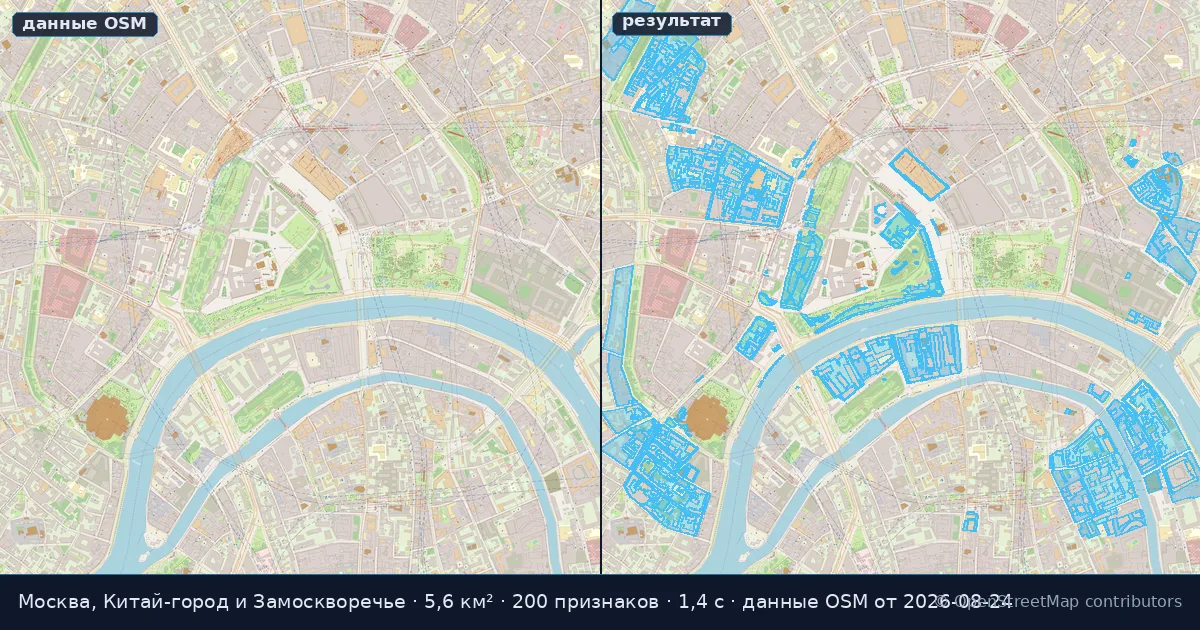
Subtracts from the features of layer A everything that is covered by layer B.
Parameters and limits
| API name | Type | Required | Default | Range or allowed values |
|---|---|---|---|---|
| layer_a | one of the listed values | yes | — | buildings | roads | poi | water | green_areas | railways | boundaries | landuse | waterways |
| layer_b | one of the listed values | yes | — | buildings | roads | poi | water | green_areas | railways | boundaries | landuse | waterways |
The table is generated from the tool's own parameter contract: API names, types, defaults and the ranges its validator accepts.
Input, output and limits
The input is a rectangular bounding box in WGS84 plus one of nine data layers; some tools also take a point. The output is GeoJSON, JSON metrics or a GeoTIFF.
| Layer | What it holds |
|---|---|
| buildings | buildings |
| roads | roads and streets |
| poi | points of interest: services, shops, tourism |
| water | water bodies |
| green_areas | green areas: parks, forests, lawns |
| railways | railways |
| boundaries | administrative boundaries |
| landuse | land use |
| waterways | waterways |
Every tool in the section is free. The bounding box may cover up to 100 km². Rate limits are 10 requests per minute per tool run and 30 requests per minute for reading the catalogue. Without signing in you get up to 10 successful calculations a day; after that the service asks you to register and answers 402 with the code login_required. A box larger than the allowed area is also 402, and an unknown tool id is 404.
When the API refuses
| Code | Reason |
|---|---|
| 400 | A parameter failed the tool's own check (the answer carries a validation_errors list) or the bbox does not hold four numbers. |
| 402 | The bounding box is larger than 100 km² — or a visitor who is not signed in has used up 10 calculations for the day and the answer asks them to sign in (login_required). |
| 403 | Access guard: every tool is free today, so this refusal reaches nobody. |
| 404 | There is no tool with that identifier. |
| 429 | Rate limit exceeded: 10 requests per minute per tool run. |
Calculate right here
Access
The tool is free. Visitors who are not signed in get 10 calculations a day; after signing in there is no daily cap. The bounding box may cover up to 100 km². OpenStreetMap data: snapshot of 2026-08-24.
Example call
curl -X POST https://osm2cdr.com/api/geo-analysis/difference \
  -H 'Content-Type: application/json' \
  -d '{"bbox":[37.6,55.74,37.64,55.76],"params":{"layer_a":"landuse","layer_b":"buildings"}}'
The same in Python
import requests

r = requests.post(
    "https://osm2cdr.com/api/geo-analysis/difference",
    json={'bbox': [37.6, 55.74, 37.64, 55.76], 'params': {'layer_a': 'landuse', 'layer_b': 'buildings'}},
)
print(r.json()["meta"])
Full parameter schema: GET /api/geo-analysis/difference/schema
Example response
{
  "tool": "difference",
  "meta": {
    "elapsed_ms": 1408,
    "feature_count": 200,
    "method": "postgis_sql",
    "data_snapshot": "2026-08-24"
  },
  "result": {
    "feature_count": 200,
    "geometry_type": "MultiPolygon",
    "properties": {
      "name": null,
      "osm_id": -15686311
    }
  }
}
The numbers come from the run that baked the sample above. A live answer also carries meta.quota — how many calculations the visitor has left for today. The response is shown as an excerpt; the full result is larger.