
KML (Keyhole Markup Language)
Price before paymentKML হলো ভার্চুয়াল গ্লোবে জিওডেটা ভিজ্যুয়ালাইজেশনের জন্য Google Earth-এর ফরম্যাট। উপস্থাপনা, শিক্ষামূলক প্রকল্প ও ক্লায়েন্টের সঙ্গে যোগাযোগের জন্য উপযুক্ত।
OpenStreetMap data as of 26 October 2026 · 24 days ago
মূল বৈশিষ্ট্য
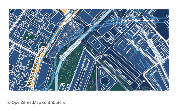
KML ফরম্যাট সম্পর্কে
KML is a language for describing geographic data, invented for Google Earth and later adopted as an OGC standard. The file is text: inside are placemarks, lines, outlines, their styles and labels. It opens with a double click in Google Earth and attaches in Google My Maps, QGIS and ArcGIS.
OpenStreetMap maps are exported to KML when the result has to be shown to another person: a client, colleagues, students. The features land on the globe, a click shows their properties, and the file itself can be sent by email — the recipient needs no GIS, Google Earth is enough.
In the file all the layers are laid out in folders named after the layers, each feature keeps its OSM tags in the ExtendedData block, and lines and fills get a color and a width. Coordinates are WGS84, as the specification requires. Roads, water and greenery lie on the ground surface, while buildings are extruded into volume: height is taken from the height tag, or computed from the floor count in building:levels at 3.5 meters per floor, and if neither is present the house gets six meters.
In Google Earth such an export looks like a three-dimensional city right away. If you do not need the volume, switch the buildings layer off in the tree on the left. For sending by email KMZ is handier — the same document in compressed form.
কোন প্রোগ্রাম KML ফাইল খোলে
নিম্নলিখিত প্রোগ্রাম ও অ্যাপ্লিকেশনগুলি OSM2CDR থেকে এক্সপোর্ট করা KML (Keyhole Markup Language) (.kml) ফাইল খুলতে, সম্পাদনা করতে ও এর সাথে কাজ করতে পারে:
Format specifications
- Open standard
- 3D coordinates supported
- Lossless (no quality loss)
- Stores feature attributes
- Output: 1 file
- KML 2.2 (OGC). Direct import in Google Earth, Google Maps, ArcGIS, QGIS. Altitude mode: clampToGround.
কারা KML মানচিত্র ব্যবহার করেন
কীভাবে KML এক্সপোর্ট করবেন
এক্সপোর্টের পর কীভাবে খুলবেন
- Google Earth Pro (free) — File → Open, pick the .kml; on the left the layers will show as folders that can be switched on and off.
- Google My Maps — create a map, choose Import and upload the file: you get a web map with a link to share.
- QGIS (free) — Layer → Add Vector Layer; KML is read by the driver that ships with GDAL, and from there the data converts to a shapefile or GeoPackage.
- ArcGIS Pro — the KML To Layer tool turns the file into a geodata layer.
- Checking the volume — tilt the view in Google Earth: the buildings will appear as solid boxes above the surface.
KML (Keyhole Markup Language) মানচিত্র এক্সপোর্ট পান
OpenStreetMap থেকে পেশাদার মানের KML মানচিত্র ডাউনলোড করুন। যেকোনো এলাকার জন্য তাৎক্ষণিক প্রস্তুতি।
প্রায়শই জিজ্ঞাসিত প্রশ্ন
অন্যান্য ফরম্যাটের সাথে তুলনা করুন
What people who already downloaded say
Finally, maps can be downloaded as vectors. Thanks to the author!
Map: Ufa, AI
everything is really cool, I didn't expect I'd just come and download a piece of the map! thanks!!!
Map: Nizhny Novgorod, PMTiles
HUGE THANKS!!! A VERY GOOD PROGRAM!!! I was looking for a vector map where 3 countries meet - it helped a lot!!
Map: Kazakhstan and Altai, PDF
Well done! You've done a big and much-needed job!
Map: Roshchino, Leningrad Region, GeoTIFF
Ivan, thank you so much! Not just a man - a Great Man!
Map: Saratov Region, GeoJSON
ivan, you're simply a wonder. Thank you for an incredibly cool service
Map: Bogashevo near Tomsk, DXF
সম্পর্কিত ফরম্যাট
প্রায়ই একসাথে এক্সপোর্ট করা হয়
Related Articles
KML — Complete Guide: Keyhole History 2001-2026, How to Open, How to Make an OSM Map in Google Earth
Deep guide to KML: what's inside the Keyhole/Google XML format, OGC standardization history, which programs open it, pro
guideMap to DWG from Google Maps: Why There's No Direct Export and How to Get a Drawing of Any Area
Google Maps doesn't export to DWG: there is no export button and a screenshot is a raster with no scale. How to get a re
tutorialKMZ to PDF: Printing a Google Earth Map with Scale and Legend
How to turn KMZ or KML into a print-ready PDF: a Google Earth Pro image, a QGIS layout with scale bar and legend, an onl