
EPS (Encapsulated PostScript)
Price before paymentEPS হলো মুদ্রণ উৎপাদন ও প্রকাশনার জন্য একটি পেশাদার ভেক্টর ফরম্যাট। CMYK রং সমর্থন করে এবং ছাপাখানা ও প্রকাশনা সংস্থার জন্য আদর্শ।
OpenStreetMap data as of 26 October 2026 · 24 days ago
মূল বৈশিষ্ট্য
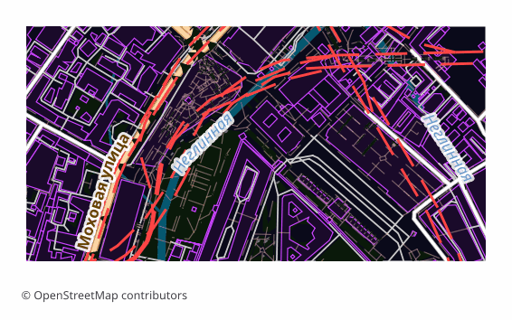
EPS ফরম্যাট সম্পর্কে
EPS (Encapsulated PostScript) is Adobe's vector format from the late 1980s, built on the PostScript page description language. It was conceived as an "embeddable picture" for layout work: the file carries its own BoundingBox and drops into an InDesign or QuarkXPress page as a finished object. Over three decades EPS became the common language of prepress — almost any print shop accepts it.
Maps are exported to EPS when they are meant to be printed rather than viewed on screen: a directions map in a booklet, a site plan on a poster, an inset in a travel guide, a background for a label. Vectors scale without any loss of quality, so the same file works for a business card and for a banner alike.
The output is a single .eps file: a map page assembled in a QGIS layout and translated into PostScript Level 3 through Ghostscript. Raster elements are rendered at 300 DPI, the default sheet is A4 landscape. PostScript has no transparency, so semi-transparent fills are converted in advance into the equivalent opaque color over the page background — the picture matches what you saw on screen, and the vector stays a vector.
Color arrives in the model the layout was built in, that is, in RGB. Conversion to CMYK, applying a print profile and setting up overprint happen later in prepress — in Illustrator, InDesign or Scribus, tuned to a particular print shop and paper.
কোন প্রোগ্রাম EPS ফাইল খোলে
নিম্নলিখিত প্রোগ্রাম ও অ্যাপ্লিকেশনগুলি OSM2CDR থেকে এক্সপোর্ট করা EPS (Encapsulated PostScript) (.eps) ফাইল খুলতে, সম্পাদনা করতে ও এর সাথে কাজ করতে পারে:
Format specifications
- Open standard
- 2D only
- Lossless (no quality loss)
- No attributes
- Output: 1 file
- Encapsulated PostScript (Ghostscript eps2write) in RGB — the conversion to CMYK is a prepress step. Labels arrive as Type 3 bitmap glyphs, not editable text, which makes the file markedly heavier than PDF — take PDF or AI if the text must stay editable. Opens in Illustrator, CorelDRAW, Inkscape.
কারা EPS মানচিত্র ব্যবহার করেন
কীভাবে EPS এক্সপোর্ট করবেন
এক্সপোর্টের পর কীভাবে খুলবেন
- Adobe Illustrator — File → Open; the map opens as an editable vector, and from there you can edit labels and add your own graphics.
- CorelDRAW — Import (Ctrl+I); if it matters that label typefaces stay exactly as they are, choose the option that imports text as curves.
- InDesign, QuarkXPress, Scribus — don't "open" it, Place it on the page: EPS lands as an illustration with its own BoundingBox and does not disturb your layout.
- Inkscape (free) — opens EPS if Ghostscript is installed on the system; if it isn't, it is easier to download SVG or PDF from us — the content is exactly the same.
- Before sending to a print shop — convert the document to CMYK and check with your printer about the profile, the resolution of raster inserts and overprint requirements: inside the EPS itself the colors stay as the layout was built.
EPS (Encapsulated PostScript) মানচিত্র এক্সপোর্ট পান
OpenStreetMap থেকে পেশাদার মানের EPS মানচিত্র ডাউনলোড করুন। যেকোনো এলাকার জন্য তাৎক্ষণিক প্রস্তুতি।
প্রায়শই জিজ্ঞাসিত প্রশ্ন
অন্যান্য ফরম্যাটের সাথে তুলনা করুন
What people who already downloaded say
Finally, maps can be downloaded as vectors. Thanks to the author!
Map: Ufa, AI
everything is really cool, I didn't expect I'd just come and download a piece of the map! thanks!!!
Map: Nizhny Novgorod, PMTiles
HUGE THANKS!!! A VERY GOOD PROGRAM!!! I was looking for a vector map where 3 countries meet - it helped a lot!!
Map: Kazakhstan and Altai, PDF
Well done! You've done a big and much-needed job!
Map: Roshchino, Leningrad Region, GeoTIFF
Ivan, thank you so much! Not just a man - a Great Man!
Map: Saratov Region, GeoJSON
ivan, you're simply a wonder. Thank you for an incredibly cool service
Map: Bogashevo near Tomsk, DXF
সম্পর্কিত ফরম্যাট
প্রায়ই একসাথে এক্সপোর্ট করা হয়
Related Articles
EPS — Encapsulated PostScript: Maps for Old-School Print Workflows
Deep guide to EPS: PDF's predecessor from Adobe, versions 1.2-3.0 since 1987, how to make an EPS map from OpenStreetMap
tutorialExport OpenStreetMap to Illustrator: a clean vector map in a couple of minutes
How to get an OpenStreetMap map into Adobe Illustrator as real vectors: which format to download, how to open it, and wh
comparisonWhich Map Format to Choose for Print and Design: PDF, SVG, AI, EPS, CDR
Decision tree for choosing an OSM map format for design and typography print: PDF, SVG, AI, EPS, CDR, PNG, TIFF. Step by