
TIFF (Tagged Image File Format)
Price before paymentTIFF ಎಂಬುದು ನಷ್ಟರಹಿತ ಸಂಕೋಚನದ ಸಹಿತ ಉನ್ನತ-ಗುಣಮಟ್ಟದ ರಾಸ್ಟರ್ ಸ್ವರೂಪ. ವೃತ್ತಿಪರ ಮುದ್ರಣ ಮತ್ತು ಆರ್ಕೈವಲ್ ನಕ್ಷೆ ಸಂಗ್ರಹಣೆಗೆ ಸೂಕ್ತ. ಉನ್ನತ ರೆಸಲ್ಯೂಶನ್ ಮತ್ತು CMYK ಬಣ್ಣಗಳನ್ನು ಬೆಂಬಲಿಸುತ್ತದೆ.
OpenStreetMap data as of 26 October 2026 · 17 days ago
ಪ್ರಮುಖ ವೈಶಿಷ್ಟ್ಯಗಳು
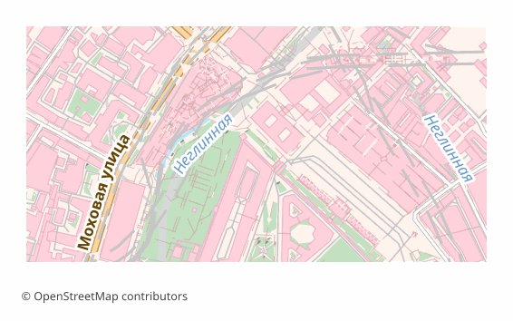
TIFF ಫಾರ್ಮ್ಯಾಟ್ ಬಗ್ಗೆ
TIFF is a raster format that has stayed the working standard of print and archives since the 1980s: lossless compression, any image dimensions, support for high resolutions. It is opened by Photoshop, GIMP, Affinity Photo, the standard macOS viewer and just about any image editor.
A map is exported to TIFF when you need a final shot for printing or long-term storage: a poster for the wall, an illustration for a book, an appendix to a report. Unlike JPEG, TIFF loses no pixels when re-saved, so the file calmly survives several rounds of edits.
The output is a single .tiff rendered through QGIS at 300 DPI (the value can be changed at export time). This is an image and nothing more: layers, labels and objects are already flattened and cannot be edited. There is no georeferencing inside — if the map has to go into a GIS on top of other data, take GeoTIFF.
TIFF ಫೈಲ್ಗಳನ್ನು ಯಾವ ಪ್ರೋಗ್ರಾಮ್ ತೆರೆಯುತ್ತದೆ
OSM2CDR ನಿಂದ ಎಕ್ಸ್ಪೋರ್ಟ್ ಮಾಡಲಾದ TIFF (Tagged Image File Format) (.tiff) ಫೈಲ್ಗಳನ್ನು ಈ ಕೆಳಗಿನ ಪ್ರೋಗ್ರಾಮ್ಗಳು ಮತ್ತು ಅಪ್ಲಿಕೇಶನ್ಗಳು ತೆರೆಯಬಹುದು, ಸಂಪಾದಿಸಬಹುದು ಮತ್ತು ಬಳಸಬಹುದು:
Format specifications
- Open standard
- 2D only
- Lossless (no quality loss)
- No attributes
- Output: 1 file
- TIFF 6.0 baseline (no georeferencing). For high-resolution print exports. Opens in Photoshop, GIMP, Lightroom.
TIFF ನಕ್ಷೆಗಳನ್ನು ಯಾರು ಬಳಸುತ್ತಾರೆ
TIFF ಅನ್ನು ಹೇಗೆ ಎಕ್ಸ್ಪೋರ್ಟ್ ಮಾಡುವುದು
ರಫ್ತಿನ ನಂತರ ಹೇಗೆ ತೆರೆಯುವುದು
- Photoshop and Affinity Photo — File → Open; check the size in pixels and the resolution, and for a print house convert the file to CMYK or simply download a CMYK TIFF from us.
- GIMP — opens TIFF with no plugins; handy for adding a caption, an inset or a frame before printing.
- InDesign, Word, LibreOffice — place it as an illustration; make sure the picture is not stretched beyond 100%, otherwise the effective resolution drops.
- The print house — check their requirements in advance: usually CMYK and 300 DPI at the final size are needed; an RGB file gets converted by the printer itself and the color may drift.
- QGIS — if georeferencing turns out to be needed, a TIFF can be referenced by hand (Raster → Georeferencer), or the map can be re-downloaded as GeoTIFF.
TIFF (Tagged Image File Format) ನಕ್ಷೆ ಎಕ್ಸ್ಪೋರ್ಟ್ಗಳನ್ನು ಪಡೆಯಿರಿ
OpenStreetMap ನಿಂದ ವೃತ್ತಿಪರ TIFF ನಕ್ಷೆಗಳನ್ನು ಡೌನ್ಲೋಡ್ ಮಾಡಿ. ತಕ್ಷಣದ ರಚನೆ, ಯಾವುದೇ ಪ್ರದೇಶ.
ಪದೇ ಪದೇ ಕೇಳಲಾಗುವ ಪ್ರಶ್ನೆಗಳು
ಸಂಬಂಧಿತ ಫಾರ್ಮ್ಯಾಟ್ಗಳು
ಸಾಮಾನ್ಯವಾಗಿ ಒಟ್ಟಿಗೆ ಎಕ್ಸ್ಪೋರ್ಟ್ ಮಾಡಲಾಗುತ್ತದೆ
Related Articles
TIFF — Aldus and Adobe Extensible Raster Format for Print and Archival
TIFF is a tag-based raster format from Aldus (1986, Adobe 1994): TIFF 6.0 (1992), multi-page, lossless LZW/Deflate, BigT
guideDownload a GeoTIFF by coordinates: a base map for exactly the area you need
How to download a GeoTIFF map by coordinates: what a georeferenced raster is, how to set the area bounds, choose a coord
usecaseMaps for Academic Papers: Standards and Formats
How to prepare maps for dissertations: scale, legends, PDF/SVG format, fonts. Step-by-step guide with examples for acade