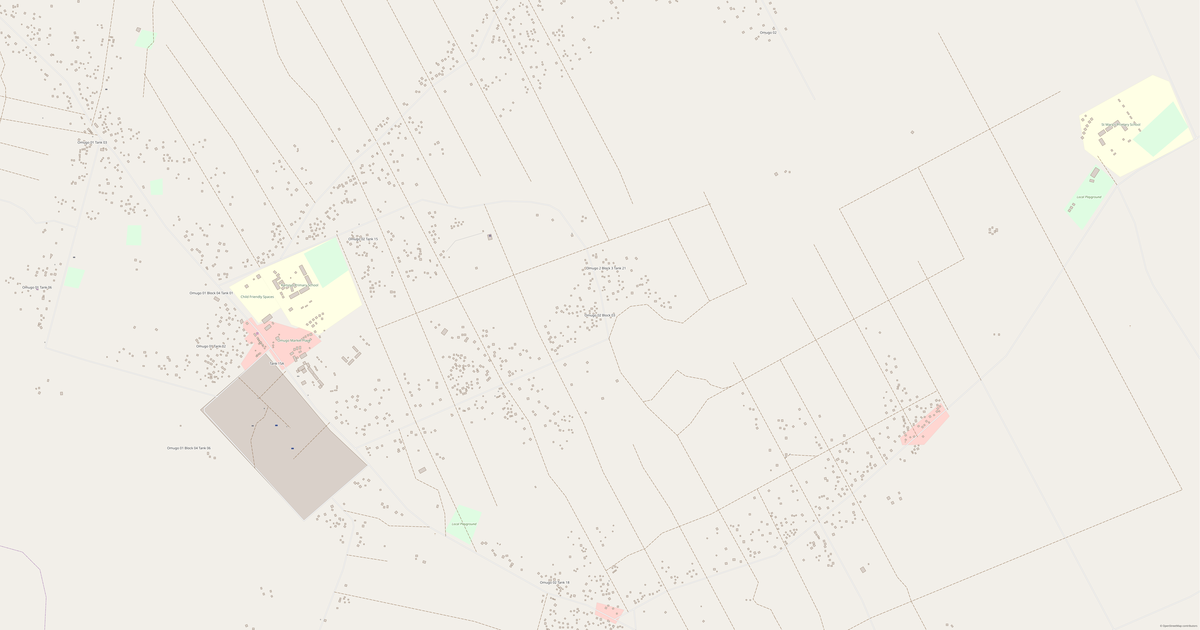
Map of Katiku 3
Village · Terego
A ready-made vector map with buildings, roads and features — for CAD, GIS and print. Download after signing in.
Katiku 3 spreads across the hills — the ground around it is uneven, full of climbs and descents; the slopes nearby open onto wide panoramas. At the same time Katiku 3 is modest: a quiet village of a few streets.
Map passport
Open the area of Katiku 3 in the constructor and change layers, style, format and coordinate system for your task.
Open in constructorMap defaults
This is how the map is built by default — every parameter can be changed in the constructor.
Download the map of Katiku 3 in 140 formats
The same OpenStreetMap dataset — in the format for your software. Pick by task: CAD, vector, GIS, 3D or print.
Location of Katiku 3
Distance and direction to the nearest centres
Katiku 3 lies 9.7 km to the west of Uriama.
- Nearest city
- Uriama — 9.7 km to the west
- Region centre
- Terego — 13.6 km to the north-west
Maps of Terego
Nearby cities and districts — every map is ready to download.




Neighbouring places and regions
Browse to neighbouring cities, districts and regions — each has a ready-made vector map in the same formats.

About Katiku 3
Analytical Portrait: Katiku 3 Katiku 3 is a spacious area of 2.0 km², where buildings alternate with open spaces. Strengths 28/100 Connectivity Poorly connected road network 7/100 Education Few educational institutions
What's inside the map of Katiku 3
The map covers the entire area of Katiku 3 within administrative boundaries. Each layer can be turned on or off before download.
What's around
Forest, water, services and roads nearby
🌳 Nature
- 🌲Forest7.1 km
- 💧River7.3 km
- 🌊Lake6.7 km
- 🏖️Sea coast50 km
🏢 Services
- 🏫School1.5 km
- 🧸Kindergarten5 km
- 🛒Shop1.8 km
- 💊Pharmacy7.2 km
- 🏥Hospital4.3 km
🛣️ Road
- 🏙️City Uriama9.7 km W
- 🚉Railway station50 km
Relief
★ new · from relief mapsElevation and terrain character
Elevations are computed from digital elevation models (Copernicus GLO-30). Elevation drop — 36 m.
What the map of Katiku 3 looks like
The same place in three render styles. Buildings, roads, water and greenery carry over into every format losslessly.
How the map is used
The same dataset for Katiku 3 — for different tasks: from drafting to 3D printing.
Streets and roads
Roads classified by type — according to OpenStreetMap data.
The street network of Katiku 3 — 50 km of roads according to OpenStreetMap data, classified by type.
What's on the map
Each layer of the Katiku 3 map can be turned on or off before download.
Key figures
A summary based on OpenStreetMap data for Katiku 3.
Compared to neighbours
How the place compares to neighbours within a 30-kilometre radius.
871 places within a 30 km radius to compare.