osm2cdr.com
Ready map · OSM data

Map of Split

City · Split-Dalmatia County · 149K · 23 km2

A ready-made vector map with buildings, roads and features — for CAD, GIS and print. Download after signing in.

Choose a format
Download · PDF, ≈ 5.7 MB
All 140 formats Customize your area
140 formatsOSM datadownload after signing in
N
© OpenStreetMap
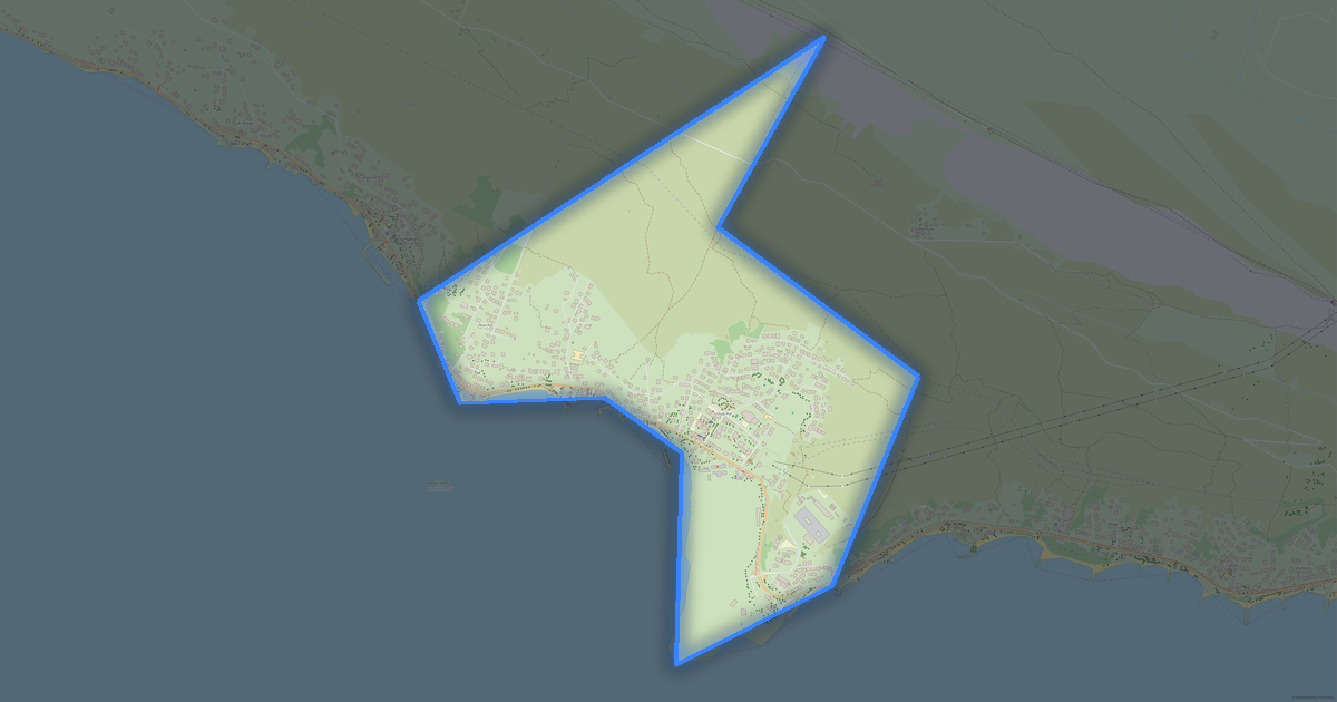
Boundary · Split · OpenStreetMap
BuildingsRoadsWaterGreeneryBoundary

Map passport

23 km2
Area
11 206
Buildings
439 km
Roads
2 945
Points of interest
Typecity
Population149K
Coordinates43.51° N, 16.46° E
Elevation≈30 m
OSM data2026-10-05
Customize the map for yourself

Open the area of Split in the constructor and change layers, style, format and coordinate system for your task.

Open in constructor

Map defaults

This is how the map is built by default — every parameter can be changed in the constructor.

Format
PDF choose
Layers
Roads, Buildings, Water, Greenery, POIchange
Style
Standard (colour)change
Detail
auto · by area sizechange
House numbers
off — can be enabled in the editorchange
Points of interest
all but cafés, shops and services — the editor adds thosechange
Coordinate system
WGS 84 (auto)change
Sheet size
Relief and grid

Download the map of Split in 140 formats

The same OpenStreetMap dataset — in the format for your software. Pick by task: CAD, vector, GIS, 3D or print.

Popular formatsthe most common formats
MOST COMMON
PDFfor printing and viewing.pdf · ≈ 2.6 MB
CDRfor CorelDRAW.cdr · ≈ 461 KB
SVGfor Illustrator, Inkscape, web.svg · ≈ 529 KB
GeoJSONfor QGIS and web maps.geojson · ≈ 816 KB
DWGfor AutoCAD, nanoCAD, BricsCAD.dwg · ≈ 395 KB
CADdrafting and design
DWGFREE
AutoCAD.dwg · ≈ 13.8 MB
DXFFREE
CAD exchange.dxf · ≈ 16.7 MB
CDRFREE
CorelDRAW.cdr · ≈ 1.3 MB
DGNFREE
MicroStation.dgn · ≈ 5.7 MB
Vectorillustration and web
SVGFREE
Web · vector.svg · ≈ 9.8 MB
AIFREE
Illustrator.ai · ≈ 8.1 MB
EPSFREE
Print production.eps · ≈ 7.9 MB
PDFFREE
Vector · print.pdf · ≈ 8.4 MB
GISgeo-referenced data
GeoJSONFREE
GIS · data.geojson · ≈ 14 MB
ShapefileFREE
QGIS · ArcGIS.shp · ≈ 3.5 MB
KMLFREE
Google Earth.kml · ≈ 26.4 MB
GeoPackageFREE
GeoPackage.gpkg · ≈ 8.8 MB
3Dvolume and models
STLFREE
3D printing.stl · ≈ 563 KB
OBJFREE
3D model.obj · ≈ 219 KB
glTFFREE
3D · web.gltf · ≈ 406 KB
DAEFREE
Collada.dae · ≈ 375 KB
Printraster and layouts
PNGFREE
Raster · transparency.png · ≈ 6.6 MB
JPGFREE
Raster.jpg · ≈ 1.7 MB
PDFFREE
Print layout.pdf · ≈ 8.4 MB
TIFFFREE
Print production.tif · ≈ 15.7 MB
Open all 140 formats

Maps of Split-Dalmatia County

Nearby cities and districts — every map is ready to download.

Neighbouring places and regions

Browse to neighbouring cities, districts and regions — each has a ready-made vector map in the same formats.

Nearby

Zagreb663 592 · 260 km · CityPerugia162 527 · 331 km · CityTiranë557 422 · 367 km · CityRome2 848 084 · 374 km · CityBrescia187 567 · 542 km · CityMilan1 394 798 · 617 km · CityBrno380 127 · 633 km · CityCluj-Napoca324 576 · 668 km · City
Map of Split
Split
Split-Dalmatia County · 149K

About Split

Analytical Portrait: Split Split spans 23.2 km² and contains 11,206 buildings. Green areas cover 13.7% of the city. An extensive public transport network (250 stops) provides high mobility.

Strengths 97/100 Connectivity Highly connected street network 95/100 Commerce Well-developed commercial infrastructure 82/100 Education High density of educational institutions Interesting Facts 🛣️ The total road length of Split is 438 km. 🏗️ There are 0.07 buildings per resident in Split. 🌳 Each resident of Split has 39 m² of green space.

🍽️ Split has ~441 restaurants and cafes — 2.9 per 1,000 residents.

11 206buildings
439 kmroads and streets
2 945features
140formats
WGS 84coordinate system

What's inside the map of Split

The map covers the entire area of Split within administrative boundaries — 23 km2. Green areas cover 13.7% of the territory. Each layer can be turned on or off before download.

11 206buildings
Buildings on separate layers
commercial109
industrial69
439km
Roads with classification
trunk roads14 km
primary roads17 km
service roads160 km
2 945POI
Points of interest
ATMs110
bars56
banks47
Main streets
Vukovarska ulicaPoljička cestaUlica Domovinskog rataVelebitska ulicaSolinska ulicaHercegovačka ulica
Landmarks · 6
›Hrvatski Pomorski muzej
›Muzej grada Splita
›Galerija Emanuela Vidovića
›Hajduk Split Museum
›Prirodoslovni muzej
›Etnografski muzej

What the map of Split looks like

The same place in three render styles. Buildings, roads, water and greenery carry over into every format losslessly.

Blueprint (CAD) — map of Split
Blueprint (CAD)
Outlines on a dark background — for DWG and DXF
Standard vector — map of Split
Standard vector
A colour map with buildings, roads and greenery
Print layout — map of Split
Print layout
A ready layout for PDF and print production

Infrastructure of Split

What's on the territory according to OpenStreetMap data.

640
Dining
1 139
Shops
15
Hotels
250
Transport
5
Parks
2
Water

Density and saturation

How many features there are per square kilometre — according to OpenStreetMap data.

482
bld/km²
18,9
km/km²
127
POI/km²
13,7%
greenery

How the map is used

The same dataset for Split — for different tasks: from drafting to 3D printing.

Architecture and design
An underlay and building outlines for drawings and layouts.
DWG / DXF
Design and illustration
A vector map base for posters, schemes and identity design.
SVG / AI
GIS and analysis
Geo-referenced layers for QGIS, ArcGIS and spatial analysis.
GeoJSON / SHP
3D printing and models
Relief of buildings and terrain for printing and visualization.
STL
Navigation and tracks
Map data for navigators and route apps.
Garmin
Print and publishing
A ready map layout for print production.
PDF

Landmarks

Museums, monuments and notable places of Split according to OpenStreetMap data — each with a link to the map.

🏛️
Hrvatski Pomorski muzej
Museum
🏛️
Muzej grada Splita
Museum
🏛️
Galerija Emanuela Vidovića
Museum
🏛️
Hajduk Split Museum
Museum
🏛️
Prirodoslovni muzej
Museum
🏛️
Etnografski muzej
Museum
🏛️
Stara gradska vijećnica
Museum
🏛️
Game of Thrones Museum Split
Museum
🏛️
Muzej Iluzija
Museum
🏛️
Diocletians Dream Virtual Reality
Museum
⭐
Eremitaža
Attraction
⭐
FKK Beach
Attraction
⭐
Velika Papalićeva palača
Attraction
⭐
Labirint
Attraction
⭐
Bračka ovca
Attraction

Nature and green areas

Parks, squares and water bodies of Split according to OpenStreetMap data — everything is carried into the map as separate layers.

5,9
km² of greenery
13,7%
green coverage
5
parks
2
water bodies
Parks and squares
›Zvončac · 3 ha
›Sustipan · 2 ha
›Park Emanuela Vidovića · 1 ha
›Park pomoraca · 1 ha
›Park Lazarica · 1 ha
Water bodies
›Trstenik · stream
›Radoševac · stream

Public transport

Stops and stations according to OpenStreetMap data.

240
bus stops
3
rail stations
7
tram stops

Public transport of Split includes 240 bus stops, 3 rail stations and 7 tram stops. All stops and stations are included in the map as a separate layer.

Streets and roads

Roads classified by type — according to OpenStreetMap data.

160 km
service roads
138,8 km
residential streets
41,2 km
unclassified roads
30 km
tertiary roads
23,7 km
pedestrian zones
17,2 km
primary roads
14,1 km
trunk roads
9,9 km
secondary roads

The street network of Split — 439 km of roads according to OpenStreetMap data, classified by type.

Named streets
›Vukovarska ulica · 8 km
›Poljička cesta · 5,2 km
›Ulica Domovinskog rata · 4,8 km
›Velebitska ulica · 3,5 km
›Solinska ulica · 2,8 km
›Hercegovačka ulica · 2,3 km
›Ulica Antuna Mihanovića · 2,2 km
›Mosećka ulica · 2,2 km

Restaurants and cafés

Food and drink venues according to OpenStreetMap data.

262
cafés
70
bars
109
fast food

In Split, OpenStreetMap records 640 food and drink venues — restaurants, cafés, bars and fast-food outlets.

Shops and retail

Retail according to OpenStreetMap data.

1 139
shops

In Split, OpenStreetMap records 1 139 shops and retail outlets. Main categories: Hairdressers, Convenience, Bakeries, Clothes, Kiosks, Supermarkets.

Hairdressers137Convenience130Bakeries112Clothes79Kiosks52Supermarkets50Travel Agencies40Butchers33Beauty25Jewelry23

Education

Schools, universities and libraries according to OpenStreetMap data.

33
schools
17
universities
4
libraries
39
kindergartens

Schools: Privatna srednja škola Wallner, Škola likovnih umjetnosti, Prirodoslovno tehnička škola Split, Škola za dizajn, grafiku i održivu gradnju, III. gimnazija, Graditeljsko-geodetska tehnička škola, Srednja zdravstvena škola Split, Centar za odgoj i obrazovanje "Slava Raškaj". Universities: Pučko otvoreno učilište "Žižić", Filozofski fakultet, Sveučilište u Splitu, Sveučilišni odjel za forenzične znanosti, Pomorski fakultet u Splitu, Fakultet građevinarstva, arhitekture i geodezije u Splitu, Dentalna medicina - MEFST, Pučko otvoreno učilište. Libraries: Knjižnica Bol, Knjižnica Meje, Trstenik, Knjižnica Ravne njive.

Healthcare

Hospitals, pharmacies and clinics according to OpenStreetMap data.

45
pharmacies
132
clinics

Where to stay

Hotels, hostels and guest houses according to OpenStreetMap data.

15
accommodation places
Hotels and guest houses
›Ilirija · Hotel
›As'S · Apartments
›Apartman "Ivan & Toma" · Apartments
›Hostel Dioklecijan Delux · Hostel
›Dioklecijan · Hotel
›OT Hostel · Hostel
›Apartment Vakter · Apartments
›jupiter Apartman · Apartments

What's on the map

Each layer of the Split map can be turned on or off before download.

Map layers
›Buildings: 11 206
›Roads: 439 km
›Points of interest: 2 945
›Green areas: 5,9 km²

Key figures

A summary based on OpenStreetMap data for Split.

Buildings11 206
Commercial buildings109
Roads439 km
Green areas5,9 km²
Green coverage13,7%
Food and drink venues640
Shops1 139
Points of interest2 945
Bus stops240
Rail stations3
Pharmacies45
Landmarks15

Compared to neighbours

How the place compares to neighbours within a 30-kilometre radius.

1427 places within a 30 km radius to compare.

🌿 Greenerypercentile 6 of 100
🏠 Built-uppercentile 96 of 100
🛣️ Roadspercentile 74 of 100

Frequently asked questions

Open osm2cdr.com, select the target area on the map, choose a format, and start export. Most maps are ready in a few seconds.
Map of Split is available in 140 formats: CDR, DWG, DXF, SVG, AI, EPS, PDF, PNG, GeoJSON, KML, Shapefile, GeoTIFF and others.
Pick a format: all 140 formats are available, with no area limits. Download after signing in to the site; you see the price before you pay.
The service uses OpenStreetMap data, updated monthly.
Generation time depends on the area size. You will receive an email notification when ready.