Map of Angles
City · Pays de la Loire · 2K · 33 km2
A ready-made vector map with buildings, roads and features — for CAD, GIS and print. Download after signing in.
Map passport
Open the area of Angles in the constructor and change layers, style, format and coordinate system for your task.
Open in constructorMap defaults
This is how the map is built by default — every parameter can be changed in the constructor.
Download the map of Angles in 140 formats
The same OpenStreetMap dataset — in the format for your software. Pick by task: CAD, vector, GIS, 3D or print.
Maps of Pays de la Loire
Nearby cities and districts — every map is ready to download.




Neighbouring places and regions
Browse to neighbouring cities, districts and regions — each has a ready-made vector map in the same formats.

About Angles
Analytical Portrait: Angles Angles spans 33.4 km² and contains 5,396 buildings. Strengths 58/100 Green Coverage Moderate green coverage 19/100 Connectivity Poorly connected road network 3/100 Public Transit Limited public transport Interesting Facts 🏗️ There are 1.84 buildings per resident in Angles. 🍽️ Angles has ~39 restaurants and cafes — 13.3 per 1,000 residents.
What's inside the map of Angles
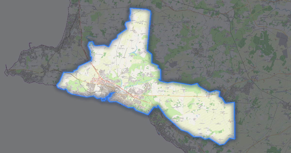
The map covers the entire area of Angles within administrative boundaries — 33 km2. Green areas cover 72.7% of the territory. Each layer can be turned on or off before download.
What the map of Angles looks like
The same place in three render styles. Buildings, roads, water and greenery carry over into every format losslessly.
Infrastructure of Angles
What's on the territory according to OpenStreetMap data.
Density and saturation
How many features there are per square kilometre — according to OpenStreetMap data.
How the map is used
The same dataset for Angles — for different tasks: from drafting to 3D printing.
Landmarks
Museums, monuments and notable places of Angles according to OpenStreetMap data — each with a link to the map.
Nature and green areas
Parks, squares and water bodies of Angles according to OpenStreetMap data — everything is carried into the map as separate layers.
Public transport
Stops and stations according to OpenStreetMap data.
Public transport of Angles includes 21 bus stops. All stops and stations are included in the map as a separate layer.
Streets and roads
Roads classified by type — according to OpenStreetMap data.
The street network of Angles — 95 km of roads according to OpenStreetMap data, classified by type.
Restaurants and cafés
Food and drink venues according to OpenStreetMap data.
In Angles, OpenStreetMap records 7 food and drink venues — restaurants, cafés, bars and fast-food outlets.
Shops and retail
Retail according to OpenStreetMap data.
In Angles, OpenStreetMap records 23 shops and retail outlets. Main categories: Bakeries, Car Repair, Convenience, Gas, Paint, Beauty.
Education
Schools, universities and libraries according to OpenStreetMap data.
Schools: École maternelle du Dauphin Bleu, École primaire du Dauphin Bleu, École primaire privée Sainte-Thérèse. Libraries: Médiathèque d'Angles.
Healthcare
Hospitals, pharmacies and clinics according to OpenStreetMap data.
Where to stay
Hotels, hostels and guest houses according to OpenStreetMap data.
What's on the map
Each layer of the Angles map can be turned on or off before download.
Key figures
A summary based on OpenStreetMap data for Angles.
Compared to neighbours
How the place compares to neighbours within a 30-kilometre radius.
77 places within a 30 km radius to compare.