
TIFF (Tagged Image File Format)
Price before paymentTIFF হলো ক্ষতিহীন কম্প্রেশনসহ একটি উচ্চ-মানের রাস্টার ফরম্যাট। পেশাদার মুদ্রণ ও আর্কাইভাল মানচিত্র সংরক্ষণের জন্য আদর্শ। উচ্চ রেজোলিউশন ও CMYK রং সমর্থন করে।
OpenStreetMap data as of 26 October 2026 · 24 days ago
মূল বৈশিষ্ট্য
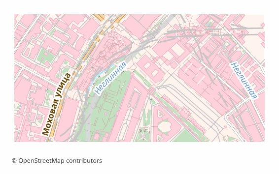
TIFF ফরম্যাট সম্পর্কে
TIFF is a raster format that has stayed the working standard of print and archives since the 1980s: lossless compression, any image dimensions, support for high resolutions. It is opened by Photoshop, GIMP, Affinity Photo, the standard macOS viewer and just about any image editor.
A map is exported to TIFF when you need a final shot for printing or long-term storage: a poster for the wall, an illustration for a book, an appendix to a report. Unlike JPEG, TIFF loses no pixels when re-saved, so the file calmly survives several rounds of edits.
The output is a single .tiff rendered through QGIS at 300 DPI (the value can be changed at export time). This is an image and nothing more: layers, labels and objects are already flattened and cannot be edited. There is no georeferencing inside — if the map has to go into a GIS on top of other data, take GeoTIFF.
কোন প্রোগ্রাম TIFF ফাইল খোলে
নিম্নলিখিত প্রোগ্রাম ও অ্যাপ্লিকেশনগুলি OSM2CDR থেকে এক্সপোর্ট করা TIFF (Tagged Image File Format) (.tiff) ফাইল খুলতে, সম্পাদনা করতে ও এর সাথে কাজ করতে পারে:
Format specifications
- Open standard
- 2D only
- Lossless (no quality loss)
- No attributes
- Output: 1 file
- TIFF 6.0 baseline (no georeferencing). For high-resolution print exports. Opens in Photoshop, GIMP, Lightroom.
কারা TIFF মানচিত্র ব্যবহার করেন
কীভাবে TIFF এক্সপোর্ট করবেন
এক্সপোর্টের পর কীভাবে খুলবেন
- Photoshop and Affinity Photo — File → Open; check the size in pixels and the resolution, and for a print house convert the file to CMYK or simply download a CMYK TIFF from us.
- GIMP — opens TIFF with no plugins; handy for adding a caption, an inset or a frame before printing.
- InDesign, Word, LibreOffice — place it as an illustration; make sure the picture is not stretched beyond 100%, otherwise the effective resolution drops.
- The print house — check their requirements in advance: usually CMYK and 300 DPI at the final size are needed; an RGB file gets converted by the printer itself and the color may drift.
- QGIS — if georeferencing turns out to be needed, a TIFF can be referenced by hand (Raster → Georeferencer), or the map can be re-downloaded as GeoTIFF.
TIFF (Tagged Image File Format) মানচিত্র এক্সপোর্ট পান
OpenStreetMap থেকে পেশাদার মানের TIFF মানচিত্র ডাউনলোড করুন। যেকোনো এলাকার জন্য তাৎক্ষণিক প্রস্তুতি।
প্রায়শই জিজ্ঞাসিত প্রশ্ন
What people who already downloaded say
Finally, maps can be downloaded as vectors. Thanks to the author!
Map: Ufa, AI
everything is really cool, I didn't expect I'd just come and download a piece of the map! thanks!!!
Map: Nizhny Novgorod, PMTiles
HUGE THANKS!!! A VERY GOOD PROGRAM!!! I was looking for a vector map where 3 countries meet - it helped a lot!!
Map: Kazakhstan and Altai, PDF
Well done! You've done a big and much-needed job!
Map: Roshchino, Leningrad Region, GeoTIFF
Ivan, thank you so much! Not just a man - a Great Man!
Map: Saratov Region, GeoJSON
ivan, you're simply a wonder. Thank you for an incredibly cool service
Map: Bogashevo near Tomsk, DXF
সম্পর্কিত ফরম্যাট
প্রায়ই একসাথে এক্সপোর্ট করা হয়
Related Articles
TIFF — Aldus and Adobe Extensible Raster Format for Print and Archival
TIFF is a tag-based raster format from Aldus (1986, Adobe 1994): TIFF 6.0 (1992), multi-page, lossless LZW/Deflate, BigT
guideDownload a GeoTIFF by coordinates: a base map for exactly the area you need
How to download a GeoTIFF map by coordinates: what a georeferenced raster is, how to set the area bounds, choose a coord
usecaseMaps for Academic Papers: Standards and Formats
How to prepare maps for dissertations: scale, legends, PDF/SVG format, fonts. Step-by-step guide with examples for acade