Simferopol地图 G-code格式
基于 OpenStreetMap 数据构建的地图,可供下载
地图档案
关于 G-code
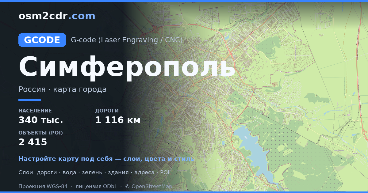
Simferopol 的地图,G-code 格式 — 所选区域真实 OpenStreetMap 数据的导出。
G-code is a CNC and laser engraver control language. Maps are converted to toolpaths for laser cutting or engraving.
文件中包含哪些图层
所选区域的该文件包含:
- 道路
- 建筑物
- 水域
- 绿地
- 兴趣点
坐标系
WGS 84 (EPSG:4326),可在向导中选择
兼容性
单位
米(在所选坐标系中投影)
| 类别 | GIS |
| 文件扩展名 | .gcode |
| 级别 | 免费 |
What's in the G-code map of Simferopol
46,360 buildings (3,021 residential, 215 commercial, 53 industrial, 18 religious), 1,116.7 km of roads, 2,415 points of interest, 30 landmarks.
The area covers 70 km², with about 659 buildings per km².
Mostly service roads 450.5 km, residential streets 418.2 km, secondary roads 86.5 km.
11.8% of the area is green space.
The map marks 21 parks and 13 water bodies.
Key amenities: schools — 55, kindergartens — 68, pharmacies — 129.
Public transport: 265 bus stops, 11 tram stops, 1 rail stations.
Main streets: Киевская улица, проспект Победы, Севастопольская улица, улица Беспалова, улица Гагарина
Landmarks: Симферопольский художественный музей, Музей истории города, Музей Шоколада, Историко-этнографический музей крымчаков, ЖД музей на мосту
如何为 Simferopol 使用 G-code
- 在主页选择 Simferopol 的地图区域
- 选择 G-code 格式并配置导出设置
- 点击「导出」并等待处理完成
- 下载生成的文件并在所需程序中使用


