阿尔巴尼亚地图 G-code格式
基于 OpenStreetMap 数据构建的地图,可供下载
地图档案
关于 G-code
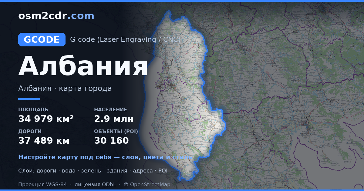
阿尔巴尼亚 的地图,G-code 格式 — 所选区域真实 OpenStreetMap 数据的导出。
G-code is a CNC and laser engraver control language. Maps are converted to toolpaths for laser cutting or engraving.
文件中包含哪些图层
所选区域的该文件包含:
- 道路
- 建筑物
- 水域
- 绿地
- 兴趣点
坐标系
WGS 84 (EPSG:4326),可在向导中选择
兼容性
单位
米(在所选坐标系中投影)
| 类别 | GIS |
| 文件扩展名 | .gcode |
| 级别 | Free |
What's in the G-code map of 阿尔巴尼亚
228,130 buildings (10,685 residential, 875 commercial, 1,242 industrial, 180 religious), 37,489.3 km of roads, 30,160 points of interest, 100 landmarks.
Mostly residential streets 14,645.3 km, unclassified roads 8,885.0 km, service roads 5,102.4 km.
Key amenities: schools — 874, pharmacies — 800, supermarkets — 1,074.
Main streets: Librazhd - Çerenec, Rruga e Arbërit, Rruga Nacionale Fier-Berat, Rruga e Lumit të Vlorës, Superstradë Qukës–Qafë Plloçë
Landmarks: Muzeu i Shkollës Normale të Elbasanit, Muzeu Kombëtar Ikonografik Onufri, Muzeu Arkeologjik Durrës, Muzeu Historik,Bajram Curri, Muzeu Etnografik Kukës
如何为 阿尔巴尼亚 使用 G-code
- 在主页选择 阿尔巴尼亚 的地图区域
- 选择 G-code 格式并配置导出设置
- 点击「导出」并等待处理完成
- 下载生成的文件并在所需程序中使用
