Mureș地图 G-code格式
基于 OpenStreetMap 数据构建的地图,可供下载
地图档案
关于 G-code
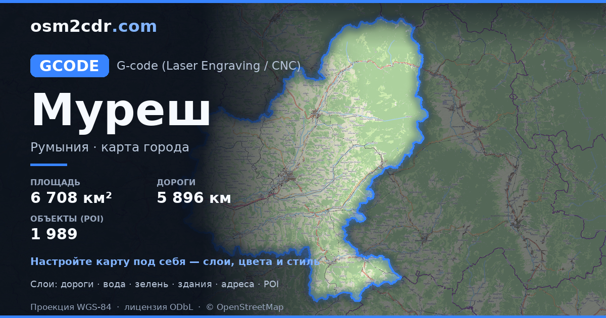
Mureș 的地图,G-code 格式 — 所选区域真实 OpenStreetMap 数据的导出。
G-code is a CNC and laser engraver control language. Maps are converted to toolpaths for laser cutting or engraving.
文件中包含哪些图层
所选区域的该文件包含:
- 道路
- 建筑物
- 水域
- 绿地
- 兴趣点
坐标系
WGS 84 (EPSG:4326),可在向导中选择
兼容性
单位
米(在所选坐标系中投影)
| 类别 | GIS |
| 文件扩展名 | .gcode |
| 级别 | Free |
What's in the G-code map of Mureș
62,612 buildings (8,351 residential, 91 commercial, 366 industrial, 233 religious), 5,896.3 km of roads, 1,989 points of interest, 15 landmarks.
Mostly residential streets 2,324.0 km, tertiary roads 837.8 km, secondary roads 734.5 km.
Key amenities: schools — 51, pharmacies — 96, supermarkets — 66.
Main streets: Strada Principală, Strada Principală, Strada Gheorghe Doja, Strada Principală, Strada Târnavelor
Landmarks: Muzeul de Istorie Sighișoara, Casa Memorială "N. D. Cocea", Muzeul Evreiesc, Muzeul Județean Mureș, Castelul Bánffy
如何为 Mureș 使用 G-code
- 在主页选择 Mureș 的地图区域
- 选择 G-code 格式并配置导出设置
- 点击「导出」并等待处理完成
- 下载生成的文件并在所需程序中使用


