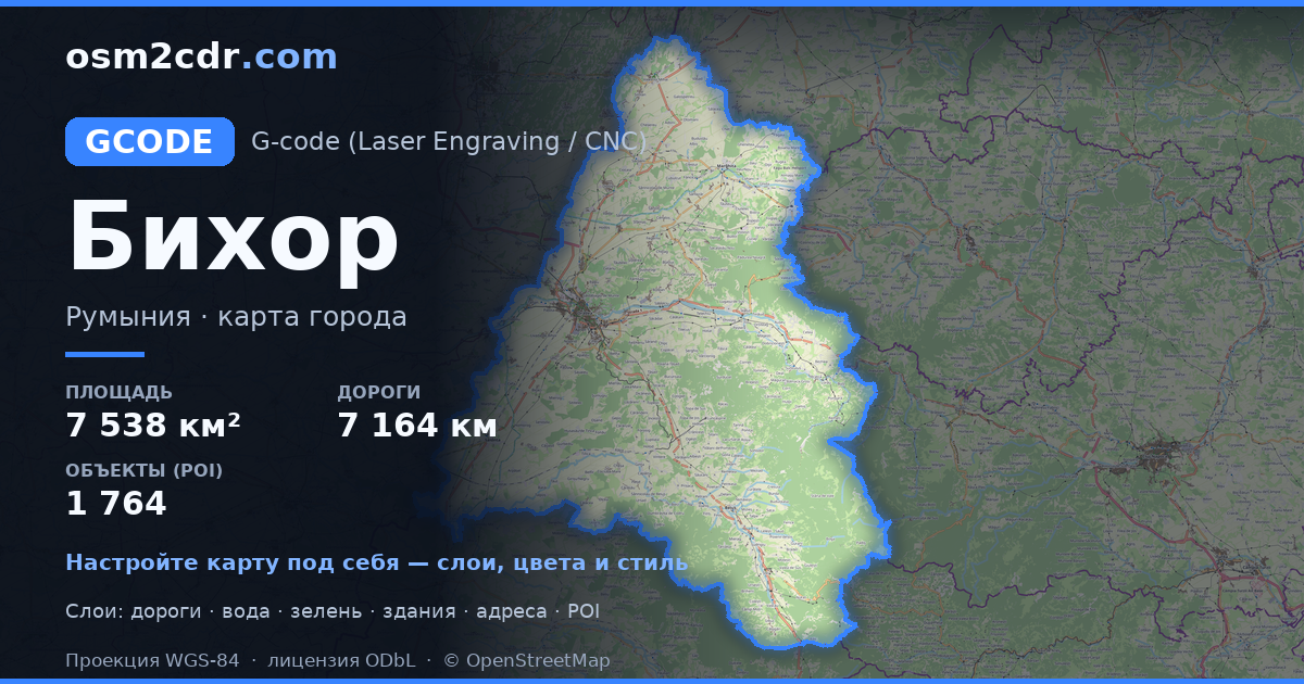
Bihor地图 G-code格式
基于 OpenStreetMap 数据构建的地图,可供下载
地图档案
关于 G-code
Bihor 的地图,G-code 格式 — 所选区域真实 OpenStreetMap 数据的导出。
G-code is a CNC and laser engraver control language. Maps are converted to toolpaths for laser cutting or engraving.
文件中包含哪些图层
所选区域的该文件包含:
- 道路
- 建筑物
- 水域
- 绿地
- 兴趣点
坐标系
WGS 84 (EPSG:4326),可在向导中选择
兼容性
单位
米(在所选坐标系中投影)
| 类别 | GIS |
| 文件扩展名 | .gcode |
| 级别 | Free |
What's in the G-code map of Bihor
94,105 buildings (39,757 residential, 104 commercial, 979 industrial, 155 religious), 7,164.0 km of roads, 1,764 points of interest, 15 landmarks.
Mostly residential streets 2,776.7 km, tertiary roads 1,173.4 km, secondary roads 988.1 km.
Key amenities: pharmacies — 72, supermarkets — 90, convenience stores — 65.
Main streets: Inelul Metropolitan Oradea, Calea Borșului, Strada Mihai Eminescu, Strada Horea, Strada Crișului
Landmarks: Muzeul Țării Crișurilor, Colecția Muzeală de Istorie, Arheologie și Etnografie a Văii Ierului, Colecția muzeală a Episcopiei Romano-Catolice Oradea, Arany János Emlékmúzeum, Muzeul Militar National Regele Ferdinand I Filiala Oradea
如何为 Bihor 使用 G-code
- 在主页选择 Bihor 的地图区域
- 选择 G-code 格式并配置导出设置
- 点击「导出」并等待处理完成
- 下载生成的文件并在所需程序中使用


