瑙鲁 / 諾魯地图 OBJ格式
基于 OpenStreetMap 数据构建的地图,可供下载
地图档案
关于 OBJ
瑙鲁 / 諾魯 的地图,OBJ 格式 — 所选区域真实 OpenStreetMap 数据的导出。
Wavefront OBJ is a universal 3D model format with material support. Buildings are exported with texture coordinates and groups by type.
文件中包含哪些图层
所选区域的该文件包含:
- 道路
- 建筑物
- 水域
- 绿地
- 兴趣点
坐标系
WGS 84 (EPSG:4326),可在向导中选择
兼容性
单位
米(在所选坐标系中投影)
| 类别 | 3D |
| 文件扩展名 | .obj |
| 级别 | Free |
What's in the OBJ map of 瑙鲁 / 諾魯
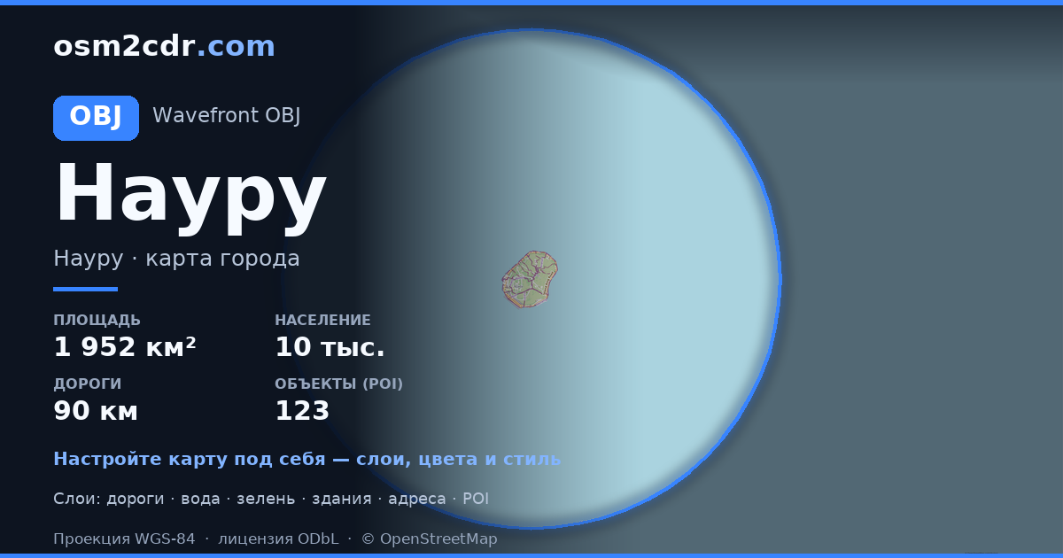
831 buildings (39 residential, 2 commercial, 7 industrial, 3 religious), 90.0 km of roads, 123 points of interest, 24 landmarks.
The area covers 1,952 km², with about 0 buildings per km².
Mostly service roads 27.1 km, primary roads 19.6 km, residential streets 18.0 km.
0.8% of the area is green space.
The map marks 1 parks and 3 water bodies.
Key amenities: schools — 4, convenience stores — 3, attractions — 7.
3D scene with 831 buildings for Blender, Cinema 4D, and other 3D editors.
Main streets: Island Ring Road, Waterfront Drive
Landmarks: Naoero Museum, Church of Christ the King, Broken Down Cantilever Cranes, Japanese WWII Prison, Japanese WWII Gun
如何为 瑙鲁 / 諾魯 使用 OBJ
- 在主页选择 瑙鲁 / 諾魯 的地图区域
- 选择 OBJ 格式并配置导出设置
- 点击「导出」并等待处理完成
- 下载生成的文件并在所需程序中使用
