Manabí地图 G-code格式
基于 OpenStreetMap 数据构建的地图,可供下载
地图档案
关于 G-code
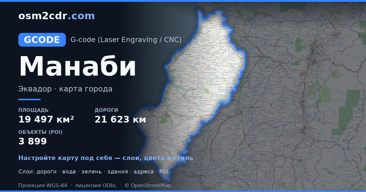
Manabí 的地图,G-code 格式 — 所选区域真实 OpenStreetMap 数据的导出。
G-code is a CNC and laser engraver control language. Maps are converted to toolpaths for laser cutting or engraving.
文件中包含哪些图层
所选区域的该文件包含:
- 道路
- 建筑物
- 水域
- 绿地
- 兴趣点
坐标系
WGS 84 (EPSG:4326),可在向导中选择
兼容性
单位
米(在所选坐标系中投影)
| 类别 | GIS |
| 文件扩展名 | .gcode |
| 级别 | Free |
What's in the G-code map of Manabí
281,224 buildings (31,837 residential, 485 commercial, 335 industrial, 79 religious), 21,623.9 km of roads, 3,899 points of interest, 15 landmarks.
Mostly unclassified roads 10,376.6 km, residential streets 4,880.4 km, tertiary roads 2,494.9 km.
6% of the area is green space.
Key amenities: schools — 1,009, pharmacies — 202, supermarkets — 127.
Main streets: Vía El Carmen - Pedernales, Via a Olmedo, Vía Noboa, Via Garrabanete, Vía Bramadora - Santa María
Landmarks: Hojas Jaboncillo, Museo de Eloy Alfaro, Museo Municipal de Jama, Centro cultural Museo Orígenes Arte Café, Museo Bahia de Caraquez
如何为 Manabí 使用 G-code
- 在主页选择 Manabí 的地图区域
- 选择 G-code 格式并配置导出设置
- 点击「导出」并等待处理完成
- 下载生成的文件并在所需程序中使用


