District of Myjava地图 G-code格式
基于 OpenStreetMap 数据构建的地图,可供下载
地图档案
关于 G-code
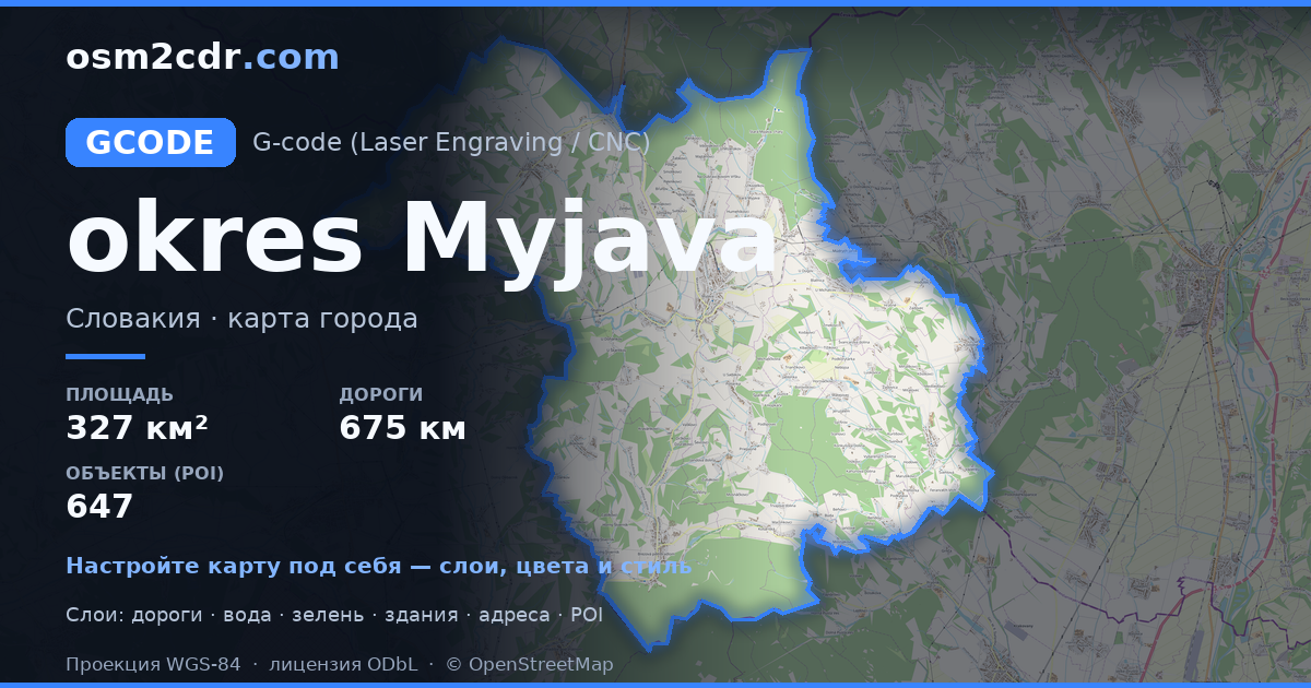
District of Myjava 的地图,G-code 格式 — 所选区域真实 OpenStreetMap 数据的导出。
G-code is a CNC and laser engraver control language. Maps are converted to toolpaths for laser cutting or engraving.
文件中包含哪些图层
所选区域的该文件包含:
- 道路
- 建筑物
- 水域
- 绿地
- 兴趣点
坐标系
WGS 84 (EPSG:4326),可在向导中选择
兼容性
单位
米(在所选坐标系中投影)
| 类别 | GIS |
| 文件扩展名 | .gcode |
| 级别 | 免费 |
What's in the G-code map of District of Myjava
18,697 buildings (411 residential, 27 commercial, 1 industrial, 15 religious), 675.3 km of roads, 647 points of interest, 30 landmarks.
The area covers 327 km², with about 57 buildings per km².
Mostly service roads 217.4 km, tertiary roads 182.3 km, residential streets 143.9 km.
53.2% of the area is green space.
The map marks 40 water bodies.
Key amenities: schools — 13, libraries — 10, supermarkets — 10.
Public transport: 205 bus stops, 6 tram stops, 7 rail stations.
Main streets: Žriedlová dolina, Jablonská, Staromyjavská, Moravská, Minárčiných
Landmarks: Múzeum Dušana Samuela Jurkoviča v Brezovej pod Bradlom, Múzeum Milana Rastislava Štefánika, Vrbovčianska izba, Múzeum SNR, Partizánske bunkre Zemľanky
如何为 District of Myjava 使用 G-code
- 在主页选择 District of Myjava 的地图区域
- 选择 G-code 格式并配置导出设置
- 点击「导出」并等待处理完成
- 下载生成的文件并在所需程序中使用


