Koror地图 G-code格式
基于 OpenStreetMap 数据构建的地图,可供下载
地图档案
关于 G-code
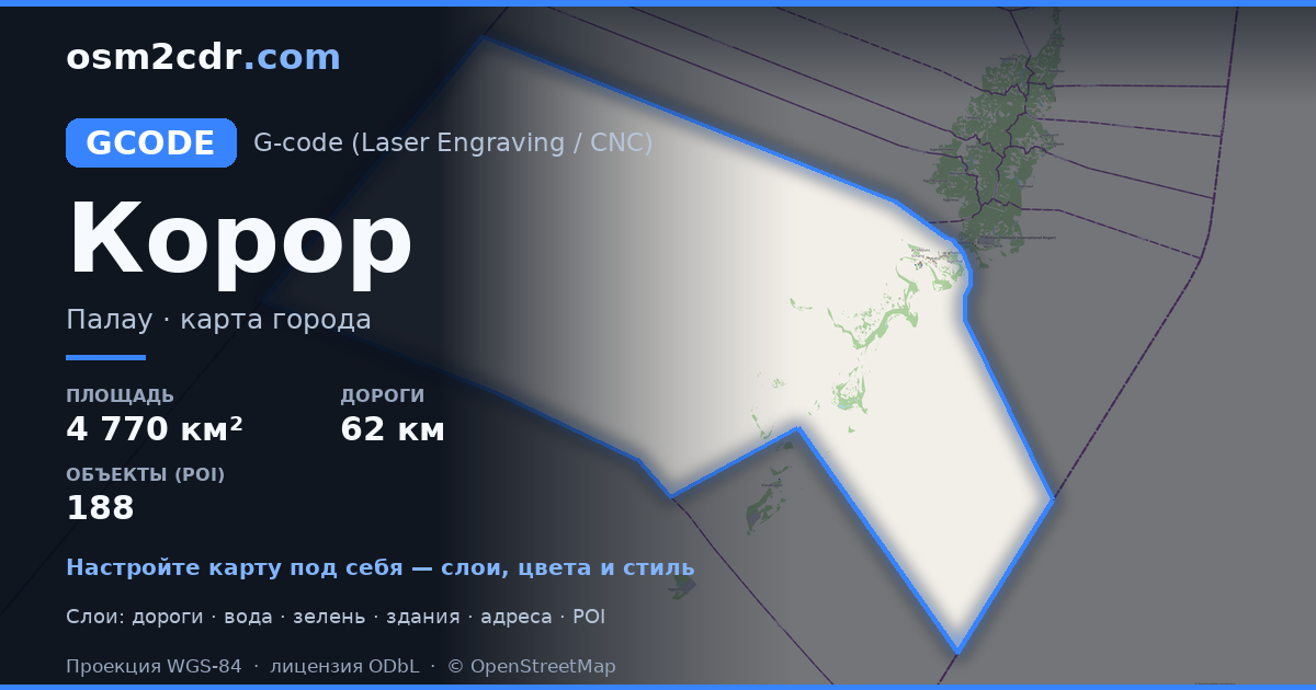
Koror 的地图,G-code 格式 — 所选区域真实 OpenStreetMap 数据的导出。
G-code is a CNC and laser engraver control language. Maps are converted to toolpaths for laser cutting or engraving.
文件中包含哪些图层
所选区域的该文件包含:
- 道路
- 建筑物
- 水域
- 绿地
- 兴趣点
坐标系
WGS 84 (EPSG:4326),可在向导中选择
兼容性
单位
米(在所选坐标系中投影)
| 类别 | GIS |
| 文件扩展名 | .gcode |
| 级别 | 免费 |
What's in the G-code map of Koror
1,963 buildings (8 residential, 2 commercial, 1 industrial, 1 religious), 62.5 km of roads, 188 points of interest, 15 landmarks.
The area covers 4,770 km², with about 0 buildings per km².
Mostly residential streets 33.4 km, service roads 14.9 km, secondary roads 9.2 km.
0.7% of the area is green space.
The map marks 2 parks and 6 water bodies.
Key amenities: schools — 4, convenience stores — 21, attractions — 12.
Public transport: 1 bus stops.
Main streets: Main Street, Ngerekebesang Road, Ngermid Road, Ngesaol Road, Didall Bridge
Landmarks: Natural Arch, Ngemelis Wall, Skylight cave, Omekang Islands, Virgin Blue Hole
如何为 Koror 使用 G-code
- 在主页选择 Koror 的地图区域
- 选择 G-code 格式并配置导出设置
- 点击「导出」并等待处理完成
- 下载生成的文件并在所需程序中使用


