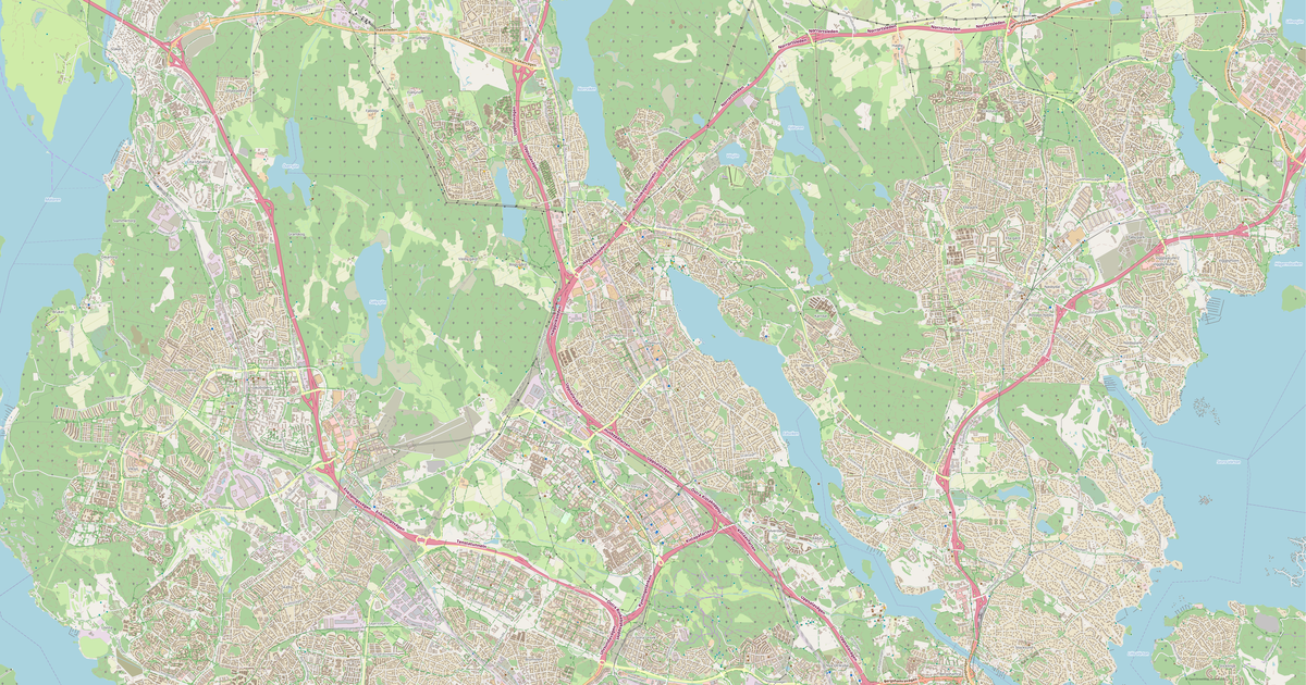
Map of Sollentuna in G-code format
แผนที่ที่สร้างจากข้อมูล OpenStreetMap พร้อมดาวน์โหลด
ปรับแต่งแผนที่ตามต้องการ
เปิดพื้นที่ของสถานที่นี้ในตัวสร้างแล้วปรับทุกอย่างให้เหมาะกับงานของคุณ
เปิดในตัวสร้าง →ข้อมูลแผนที่
แผนที่นี้มีอะไรเป็นค่าเริ่มต้น
นี่คือวิธีที่แผนที่ถูกสร้าง «ตามที่เป็น» — ทุกการตั้งค่าสามารถเปลี่ยนได้ในตัวสร้าง
.gcode
เกี่ยวกับ G-code
แผนที่ Sollentuna ในรูปแบบ G-code — การส่งออกข้อมูล OpenStreetMap จริงสำหรับพื้นที่ที่เลือก
G-code is a CNC and laser engraver control language. Maps are converted to toolpaths for laser cutting or engraving.
เลเยอร์ใดบ้างที่อยู่ในไฟล์
ไฟล์นี้สำหรับพื้นที่ที่เลือกประกอบด้วย:
- ถนน
- อาคาร
- น้ำ
- พื้นที่สีเขียว
- จุดสนใจ
ระบบพิกัด
WGS 84 (EPSG:4326) เลือกได้ในตัวช่วยสร้าง
ความเข้ากันได้
หน่วยวัด
เมตร (ฉายภาพในระบบพิกัดที่เลือก)
| หมวดหมู่ | GIS |
| นามสกุลไฟล์ | .gcode |
| ระดับ | Open Beta |
What's in the G-code map of Sollentuna
17,984 buildings (8,297 residential, 178 commercial, 53 industrial, 14 religious), 753.7 km of roads, 3,224 points of interest, 30 landmarks.
The area covers 58 km², with about 308 buildings per km².
Mostly residential streets 201.2 km, cycleways 200.4 km, service roads 162.9 km.
100% of the area is green space.
The map marks 41 parks and 14 water bodies.
Key amenities: schools — 67, kindergartens — 50, restaurants — 116.
Public transport: 267 bus stops, 10 tram stops, 4 metro stations, 4 rail stations.
Main streets: Sollentunavägen, Hanstavägen, Norrvikenleden, Danderydsvägen, Frestavägen
Landmarks: Statarmuseet, Klasro skolmuseum, Lillhersby Hembygdsgård, Edsbergs slott, Marathonpaviljongen
วิธีใช้ G-code สำหรับ Sollentuna
- เลือกพื้นที่แผนที่ Sollentuna บนหน้าหลัก
- เลือกรูปแบบ G-code แล้วกำหนดค่าการส่งออก
- คลิก «ส่งออก» แล้วรอจนเสร็จ
- ดาวน์โหลดไฟล์ที่พร้อมแล้วใช้ในโปรแกรมที่ต้องการ