Mandal地图 G-code格式
基于 OpenStreetMap 数据构建的地图,可供下载
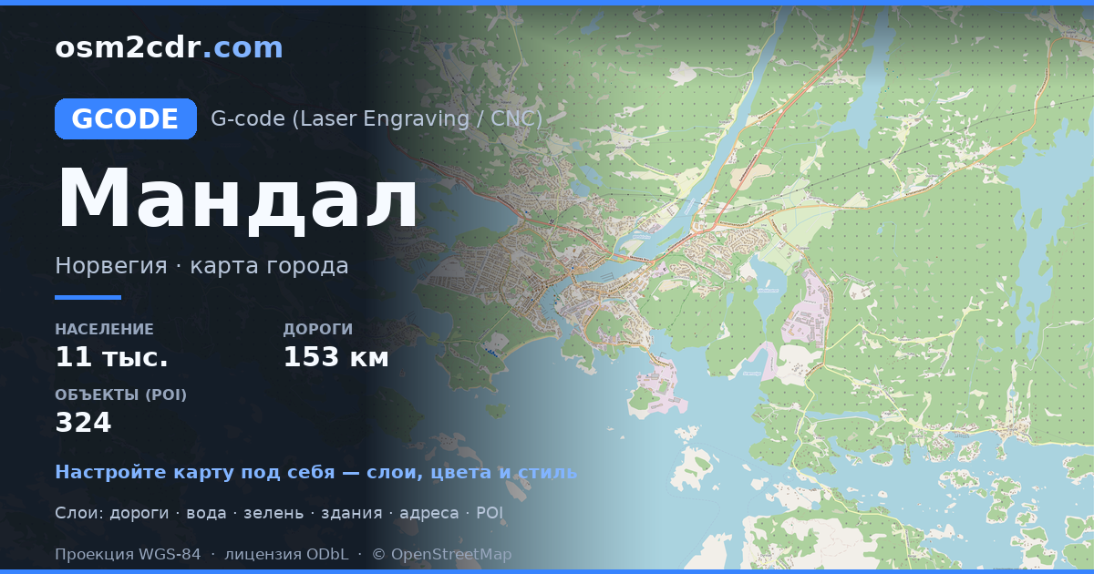
地图档案
面积24 平方公里
建筑物4 960
道路154 公里
兴趣点324
关于 G-code
Mandal 的地图,G-code 格式 — 所选区域真实 OpenStreetMap 数据的导出。
G-code is a CNC and laser engraver control language. Maps are converted to toolpaths for laser cutting or engraving.
文件中包含哪些图层
所选区域的该文件包含:
- 道路
- 建筑物
- 水域
- 绿地
- 兴趣点
坐标系
WGS 84 (EPSG:4326),可在向导中选择
兼容性
LightBurnLaserGRBLFusion 360Inkscape (gcodetools)UGS
单位
米(在所选坐标系中投影)
| 类别 | GIS |
| 文件扩展名 | .gcode |
| 级别 | Free |
What's in the G-code map of Mandal
4,960 buildings (2,308 residential, 206 commercial, 92 industrial, 15 religious), 153.9 km of roads, 324 points of interest, 14 landmarks.
Mostly residential streets 52.7 km, service roads 24.0 km, secondary roads 17.4 km.
100% of the area is green space.
Key amenities: schools — 8, supermarkets — 11, restaurants — 8.
Main streets: Gjervoldstadveien, Daleveien, Heslandsveien, Gismerøyveien, Livegen
Landmarks: Vigeland Hus, Ballastbrygga industrihistoriske senter, Mandal museum, Hobdeheia, Kastellet
如何为 Mandal 使用 G-code
- 在主页选择 Mandal 的地图区域
- 选择 G-code 格式并配置导出设置
- 点击「导出」并等待处理完成
- 下载生成的文件并在所需程序中使用
可打开 G-code 的程序
LightBurnLaserGRBLFusion 360Inkscape (gcodetools)UGS


