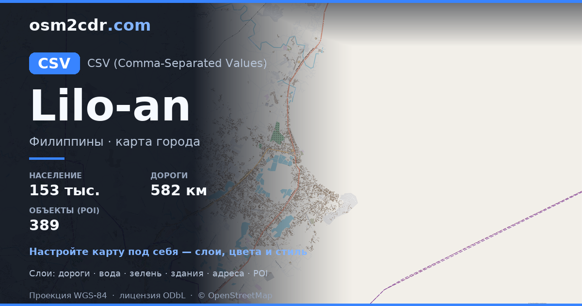
Mapa Liburon ve formatu CSV
A map built from OpenStreetMap data, ready to download

Customize the map
Open this place's area in the constructor and adjust everything to your needs
Map passport
What this map contains by default
This is how the map is built as-is — every setting can be changed in the constructor.
O formátu CSV
Map of Liburon in CSV — an export of real OpenStreetMap data for the selected area.
Text-based tabular format with coordinates in columns. A universal way to export geodata for spreadsheet analysis and data processing scripts.
Which layers are in the file
This file for the selected area contains:
- Roads
- Buildings
- Water
- Greenery
- Points of interest
Coordinate systems
WGS 84 (EPSG:4326), selectable in the wizard
Compatibility
Units
Meters (projected in the chosen coordinate system)
| Kategorie | GIS |
| Přípona souboru | .csv |
| Úroveň | Free |
What's in the CSV map of Liburon
433 buildings (20 residential, 16 commercial, 1 industrial, 2 religious), 223.6 km of roads, 152 points of interest, 18 landmarks.
Mostly residential streets 112.1 km, unclassified roads 37.4 km, tertiary roads 26.6 km.
Among the objects: schools — 19, yes — 14, sports pitches — 13.
Table with 152 points of interest and coordinates. Opens in Excel, Google Sheets, and any GIS.
Main streets: Carcar-Aloguinsan Road, Carcar Diversion Road, Awayan Road, Glenrose Avenue, General Luna Street
Landmarks: Carcar Museum and former Dispensary, Capilla de Cofradia de San Jose de Luanluan, The big dipper, Balay ni Badang, Jose Rizal Monument
How to use CSV for Liburon
- Select the Liburon map area on the main page
- Choose CSV format and configure export settings
- Click Export and wait for processing
- Download the file and use in your application