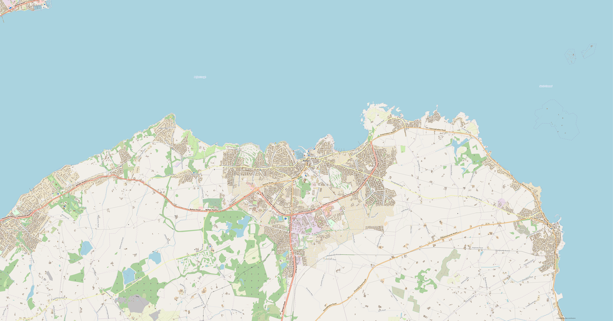
Map of Killyleagh in glTF format
OpenStreetMap డేటా నుండి నిర్మించిన మ్యాప్, డౌన్లోడ్కు సిద్ధంగా ఉంది
మ్యాప్ను మీకు తగినట్లుగా అమర్చండి
ఈ ప్రదేశ ప్రాంతాన్ని కన్స్ట్రక్టర్లో తెరిచి మీ అవసరాలకు అనుగుణంగా అన్నీ సర్దుబాటు చేయండి
కన్స్ట్రక్టర్లో తెరవండి →మ్యాప్ పాస్పోర్ట్
ఈ మ్యాప్లో డిఫాల్ట్గా ఏమి ఉంది
మ్యాప్ «ఉన్నది ఉన్నట్లుగా» ఇలా నిర్మించబడుతుంది — ప్రతి సెట్టింగ్ను కన్స్ట్రక్టర్లో మార్చవచ్చు.
.gltf
glTF గురించి
Killyleagh మ్యాప్ glTF ఫార్మాట్లో — ఎంచుకున్న ప్రాంతం కోసం నిజమైన OpenStreetMap డేటా ఎగుమతి.
glTF (GL Transmission Format) is the Khronos open standard for 3D scenes. Compact, with PBR material and animation support.
ఫైల్లో ఏ పొరలు ఉన్నాయి
ఎంచుకున్న ప్రాంతం కోసం ఈ ఫైల్లో ఉన్నవి:
- రోడ్లు
- భవనాలు
- నీరు
- పచ్చదనం
- ఆసక్తి బిందువులు
నిర్దేశాంక వ్యవస్థలు
WGS 84 (EPSG:4326), విజార్డ్లో ఎంచుకోదగినది
అనుకూలత
కొలత యూనిట్లు
మీటర్లు (ఎంచుకున్న నిర్దేశాంక వ్యవస్థలో ప్రొజెక్ట్ చేయబడింది)
| వర్గం | 3D |
| ఫైల్ పొడిగింపు | .gltf |
| స్థాయి | ఉచితం |
What's in the glTF map of Killyleagh
1,871 buildings (1,251 residential, 16 commercial, 3 industrial, 5 religious), 34.1 km of roads, 173 points of interest, 6 landmarks.
The area covers 6.4 km², with about 290 buildings per km².
Mostly residential streets 10.9 km, service roads 10.3 km, primary roads 4.7 km.
20.8% of the area is green space.
The map marks 2 parks and 1 water bodies.
Key amenities: fast food — 4, information points — 14, sports pitches — 10.
Public transport: 12 bus stops.
WebGL-compatible 3D model with 1,871 buildings. Ready for three.js, Cesium, and web visualization.
Main streets: Comber Road, Downpatrick Road, Shrigley Road, Inishmore, Clea Lough Road
Landmarks: Killyleagh Castle, Killyleagh First Presbyterian Church, rath, rath, Killyleagh Presbyterian Church
Killyleagh కోసం glTF ను ఎలా ఉపయోగించాలి
- హోమ్ పేజీలో Killyleagh మ్యాప్ ప్రాంతాన్ని ఎంచుకోండి
- glTF ఫార్మాట్ను ఎంచుకుని ఎగుమతి సెట్టింగ్లను కాన్ఫిగర్ చేయండి
- «Export» నొక్కి ప్రాసెసింగ్ పూర్తయ్యే వరకు వేచి ఉండండి
- సిద్ధమైన ఫైల్ను డౌన్లోడ్ చేసి మీ అప్లికేషన్లో ఉపయోగించండి