osm2cdr.com
Ready map · OSM data

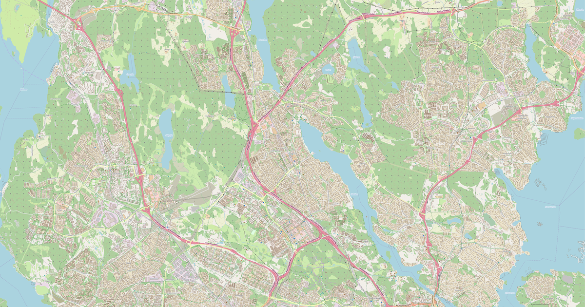
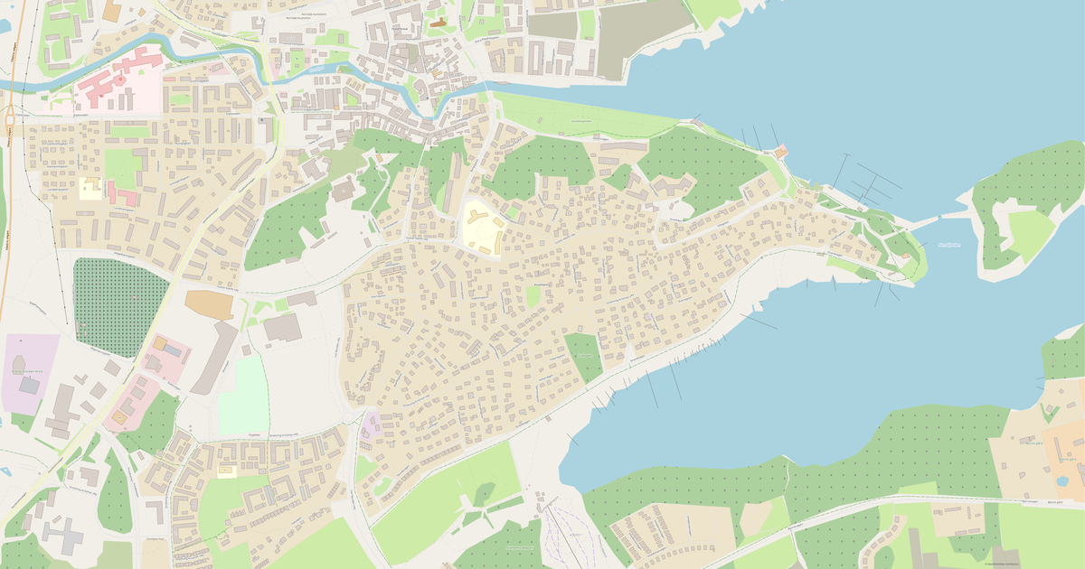
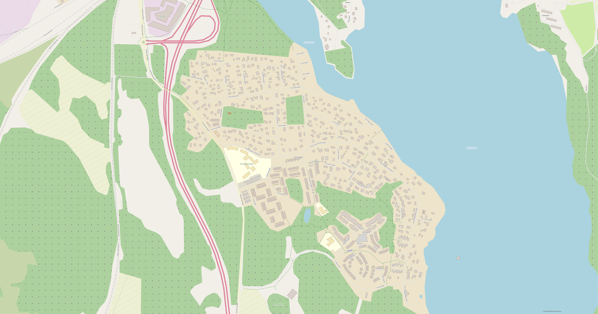
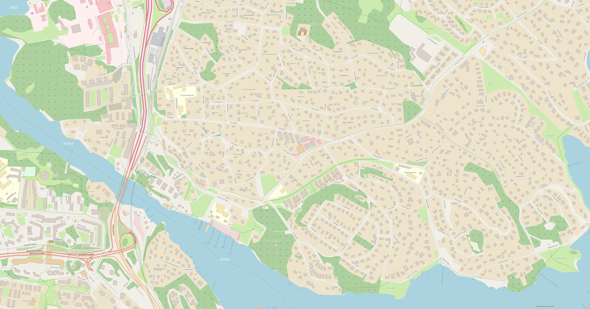
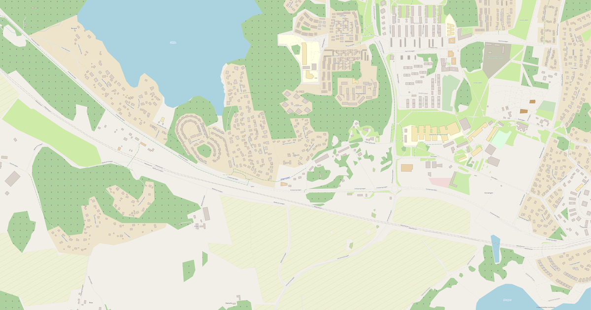
Map of Ekerö

City · Stockholm County · 10K · 386 km2

A ready-made vector map with buildings, roads and features — for CAD, GIS and print. Download after signing in.

Choose a format
Download · PDF, ≈ 975 KB
All 140 formats Customize your area
133 formatsOSM datadownload after signing in
N
© OpenStreetMap
Boundary · Ekerö · OpenStreetMap
BuildingsRoadsWaterGreeneryBoundary

Map passport

386 km2
Area
3 703
Buildings
141 km
Roads
158
Points of interest
Typecity
Population10K
Coordinates59.29° N, 17.81° E
Elevation≈15 m
OSM data2026-08-24
Customize the map for yourself

Open the area of Ekerö in the constructor and change layers, style, format and coordinate system for your task.

Open in constructor

Map defaults

This is how the map is built by default — every parameter can be changed in the constructor.

Format
PDF choose
Layers
Roads, Buildings, Water, Greenery, POIchange
Style
Standard (colour)change
Detail
auto · by area sizechange
House numbers
not visible at this scalechange
Points of interest
major objects onlychange
Coordinate system
WGS 84 (auto)change
Sheet size
Relief and grid

Download the map of Ekerö in 140 formats

The same OpenStreetMap dataset — in the format for your software. Pick by task: CAD, vector, GIS, 3D or print.

Popular formatsthe most common formats
MOST COMMON
PDFfor printing and viewing.pdf · 7.3 MB
CDRfor CorelDRAW.cdr · ≈ 1.4 MB
SVGfor Illustrator, Inkscape, web.svg · ≈ 1.6 MB
GeoJSONfor QGIS and web maps.geojson · ≈ 4.1 MB
DWGfor AutoCAD, nanoCAD, BricsCAD.dwg · ≈ 818 KB
CADdrafting and design
DWGFREE
AutoCAD.dwg · ≈ 3.1 MB
DXFFREE
CAD exchange.dxf · ≈ 3.7 MB
CDRFREE
CorelDRAW.cdr · ≈ 218 KB
DGNFREE
MicroStation.dgn · ≈ 975 KB
Vectorillustration and web
SVGFREE
Web · vector.svg · ≈ 1.6 MB
AIFREE
Illustrator.ai · ≈ 1.3 MB
EPSFREE
Print production.eps · ≈ 1.3 MB
PDFFREE
Vector · print.pdf · 7.3 MB
GISgeo-referenced data
GeoJSONFREE
GIS · data.geojson · ≈ 3.1 MB
ShapefileFREE
QGIS · ArcGIS.shp · ≈ 792 KB
KMLFREE
Google Earth.kml · ≈ 5.9 MB
GeoPackageFREE
GeoPackage.gpkg · ≈ 2 MB
3Dvolume and models
STLFREE
3D printing.stl · ≈ 93 KB
OBJFREE
3D model.obj · ≈ 36 KB
glTFFREE
3D · web.gltf · ≈ 67 KB
DAEFREE
Collada.dae · ≈ 62 KB
Printraster and layouts
PNGFREE
Raster · transparency.png · ≈ 1.1 MB
JPGFREE
Raster.jpg · ≈ 285 KB
PDFFREE
Print layout.pdf · 7.3 MB
TIFFFREE
Print production.tif · ≈ 2.6 MB
Open all 140 formats

Maps of Stockholm County

Nearby cities and districts — every map is ready to download.

Neighbouring places and regions

Browse to neighbouring cities, districts and regions — each has a ready-made vector map in the same formats.

Regions of Sweden

Västra Götaland County1 757 225Skåne County1 413 080Östergötland County471 797Västerbotten County276 136Uppsala County400 070Norrbotten County249 285Dalarna County288 343Jönköping County368 963Gävleborg County287 431Värmland County283 951Västernorrland County243 334Halland County342 658Kalmar County247 791Örebro County307 656Södermanland County302 473Västmanland County280 584Jämtland County132 484Kronoberg County204 257Blekinge County158 876Gotland County61 167
Sweden — all regions

Nearby

Stockholm County2 437 158 · 52 km · RegionUppsala166 698 · 56 km · CityVästerås110 877 · 70 km · CityEskilstuna69 948 · 67 km · City

Similar cities worldwide

Zwettl10 908Lyakhavichy10 908Cabildo10 909Pervomayskiy10 904Groaíras10 910Bueno Brandão10 911

Major cities nearby

Hammarland131 kmJomala137 kmLemland141 kmEckerö143 km
Map of Ekerö
Ekerö
Stockholm County · 10K

About Ekerö

Analytical Portrait: Ekerö Ekerö is a spacious city spanning 386.3 km², where buildings alternate with open spaces. Green areas cover 100.0% of the territory — one of the best figures among major cities. Strengths 80/100 Commerce Well-developed commercial infrastructure 72/100 Connectivity Highly connected street network 63/100 Green Coverage Moderate green coverage Interesting Facts 🛣️ The total road length of Ekerö is 141 km.

🏗️ There are 0.34 buildings per resident in Ekerö. 🌳 Each resident of Ekerö has 8,267 m² of green space. 🍽️ Ekerö has ~23 restaurants and cafes — 2.1 per 1,000 residents.

3 703buildings
141 kmroads and streets
158features
140formats
WGS 84coordinate system

What's inside the map of Ekerö

The map covers the entire area of Ekerö within administrative boundaries — 386 km2. Green areas cover 100% of the territory. Each layer can be turned on or off before download.
3 703buildings
Buildings on separate layers
residential1528
commercial10
industrial5
141km
Roads with classification
service roads21 km
cycleways29 km
tertiary roads9 km
158POI
Points of interest
cafes3
parks5
sports pitches16
Main streets
EkerövägenVällingevägenJungfrusundsvägenBryggavägenBjörkuddsvägenFärentunavägen
Landmarks · 4
›Wallenberg-mausoleum
›Ekebyhovs slott
›Ekebyhovskyrkan
›Mälarökyrkan

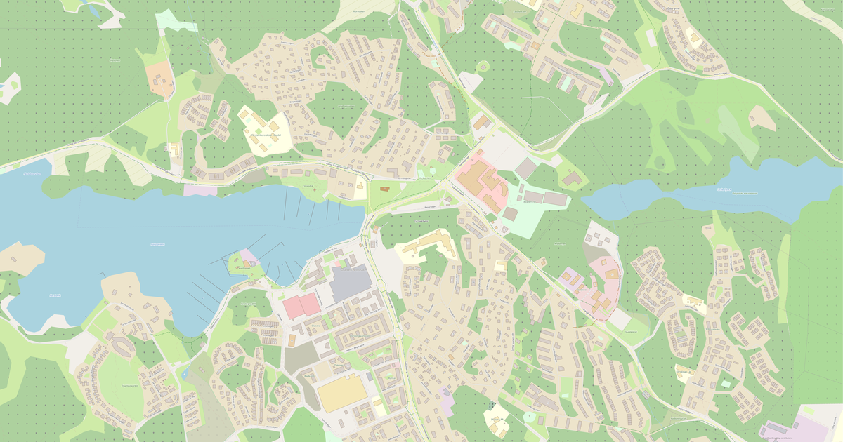
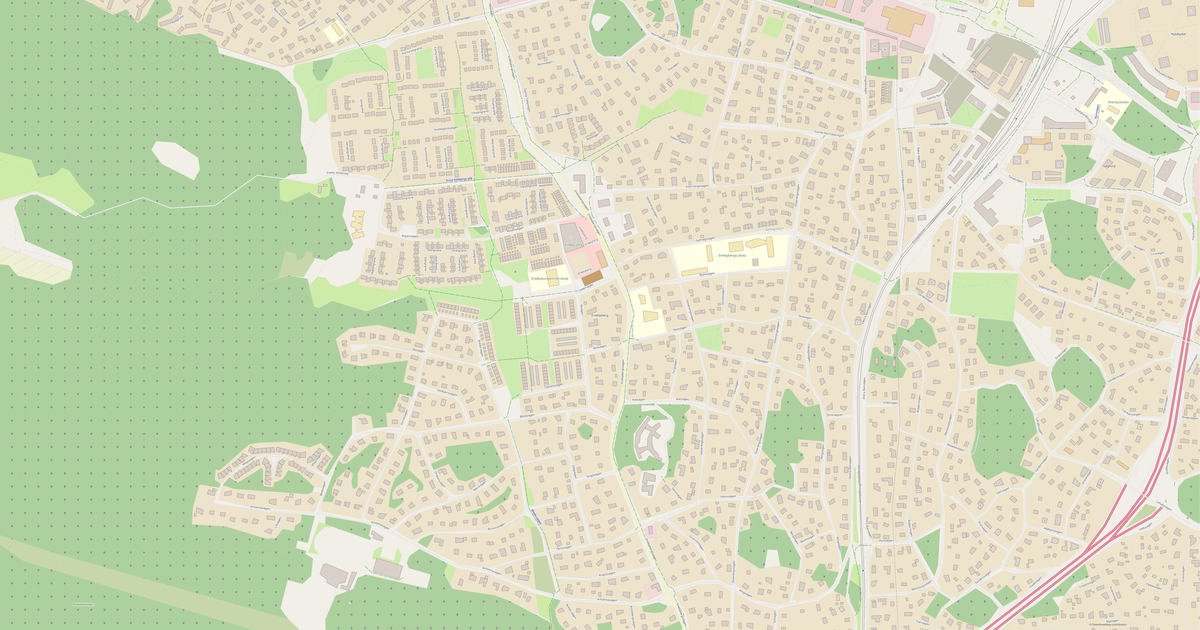
What the map of Ekerö looks like

The same place in three render styles. Buildings, roads, water and greenery carry over into every format losslessly.

Blueprint (CAD) — map of Ekerö
Blueprint (CAD)
Outlines on a dark background — for DWG and DXF
Standard vector — map of Ekerö
Standard vector
A colour map with buildings, roads and greenery
Print layout — map of Ekerö
Print layout
A ready layout for PDF and print production

Infrastructure of Ekerö

What's on the territory according to OpenStreetMap data.

12
Dining
27
Shops
66
Transport
2
Parks
1
Water

Density and saturation

How many features there are per square kilometre — according to OpenStreetMap data.

10
bld/km²
0,4
km/km²
0
POI/km²
100%
greenery

How the map is used

The same dataset for Ekerö — for different tasks: from drafting to 3D printing.

Architecture and design
An underlay and building outlines for drawings and layouts.
DWG / DXF
Design and illustration
A vector map base for posters, schemes and identity design.
SVG / AI
GIS and analysis
Geo-referenced layers for QGIS, ArcGIS and spatial analysis.
GeoJSON / SHP
3D printing and models
Relief of buildings and terrain for printing and visualization.
STL
Navigation and tracks
Map data for navigators and route apps.
Garmin
Print and publishing
A ready map layout for print production.
PDF

Landmarks

Museums, monuments and notable places of Ekerö according to OpenStreetMap data — each with a link to the map.

⭐
Wallenberg-mausoleum
AttractionOSM
📍
Ekebyhovs slott
OSM
⛪
Ekebyhovskyrkan
Place of worshipOSM
⛪
Mälarökyrkan
Place of worshipOSM

Nature and green areas

Parks, squares and water bodies of Ekerö according to OpenStreetMap data — everything is carried into the map as separate layers.

90,2
km² of greenery
100%
green coverage
2
parks
1
water bodies
Parks and squares
›Malmvik · 11 ha
›Filippaparken · 2 ha
Water bodies
›Mälaren · lake

Public transport

Stops and stations according to OpenStreetMap data.

66
bus stops

Public transport of Ekerö includes 66 bus stops. All stops and stations are included in the map as a separate layer.

Streets and roads

Roads classified by type — according to OpenStreetMap data.

50,2 km
residential streets
29,1 km
cycleways
21,1 km
service roads
12,5 km
unclassified roads
12,3 km
secondary roads
9,2 km
tertiary roads
6,9 km
living streets

The street network of Ekerö — 141 km of roads according to OpenStreetMap data, classified by type.

Named streets
›Ekerövägen · 6,5 km
›Vällingevägen · 4,7 km
›Jungfrusundsvägen · 3,9 km
›Bryggavägen · 2,8 km
›Björkuddsvägen · 2,3 km
›Färentunavägen · 2,3 km
›Närlundavägen · 1,6 km
›Väsbyvägen · 1,4 km

Restaurants and cafés

Food and drink venues according to OpenStreetMap data.

6
restaurants
3
cafés
3
fast food

In Ekerö, OpenStreetMap records 12 food and drink venues — restaurants, cafés, bars and fast-food outlets.

Notable venues
›Viki's deli
›Väringgården
›Lilla Venedig
›Ekerögrillen
›Ekerö Centrum Thai Wok & Sushi
›Pizzeria Tappström

Shops and retail

Retail according to OpenStreetMap data.

27
shops

In Ekerö, OpenStreetMap records 27 shops and retail outlets. Main categories: Supermarkets, Toys, DIY, Pet Shops, Books, Kiosks.

Supermarkets3Toys2DIY2Pet Shops1Books1Kiosks1Shoes1Alcohol1Bicycles1Clothes1

Education

Schools, universities and libraries according to OpenStreetMap data.

5
schools
1
libraries
12
kindergartens

Schools: Ekebyhovskolan, Närlundaskolan, Tappströmsskolan, Träkvista skola. Libraries: Ekerö Bibliotek.

Healthcare

Hospitals, pharmacies and clinics according to OpenStreetMap data.

2
pharmacies
5
clinics

What's on the map

Each layer of the Ekerö map can be turned on or off before download.

Map layers
›Buildings: 3 703
›Roads: 141 km
›Points of interest: 158
›Green areas: 90,2 km²

Key figures

A summary based on OpenStreetMap data for Ekerö.

Buildings3 703
Residential buildings1 528
Commercial buildings10
Roads141 km
Green areas90,2 km²
Green coverage100%
Food and drink venues12
Shops27
Points of interest158
Bus stops66
Pharmacies2
Landmarks4

Compared to neighbours

How the place compares to neighbours within a 30-kilometre radius.

553 places within a 30 km radius to compare.

🏠 Built-uppercentile 85 of 100
🛣️ Roadspercentile 28 of 100

Frequently asked questions

Open osm2cdr.com, select the target area on the map, choose a format, and start export. Most maps are ready in a few seconds.
Map of Ekerö is available in 140 formats: CDR, DWG, DXF, SVG, AI, EPS, PDF, PNG, GeoJSON, KML, Shapefile, GeoTIFF and others.
Pick a format: all 140 formats are available, with no area limits. Download after signing in to the site; you see the price before you pay.
The service uses OpenStreetMap data, updated monthly.
Generation time depends on the area size. You will receive an email notification when ready.