osm2cdr.com
Ready map · OSM data

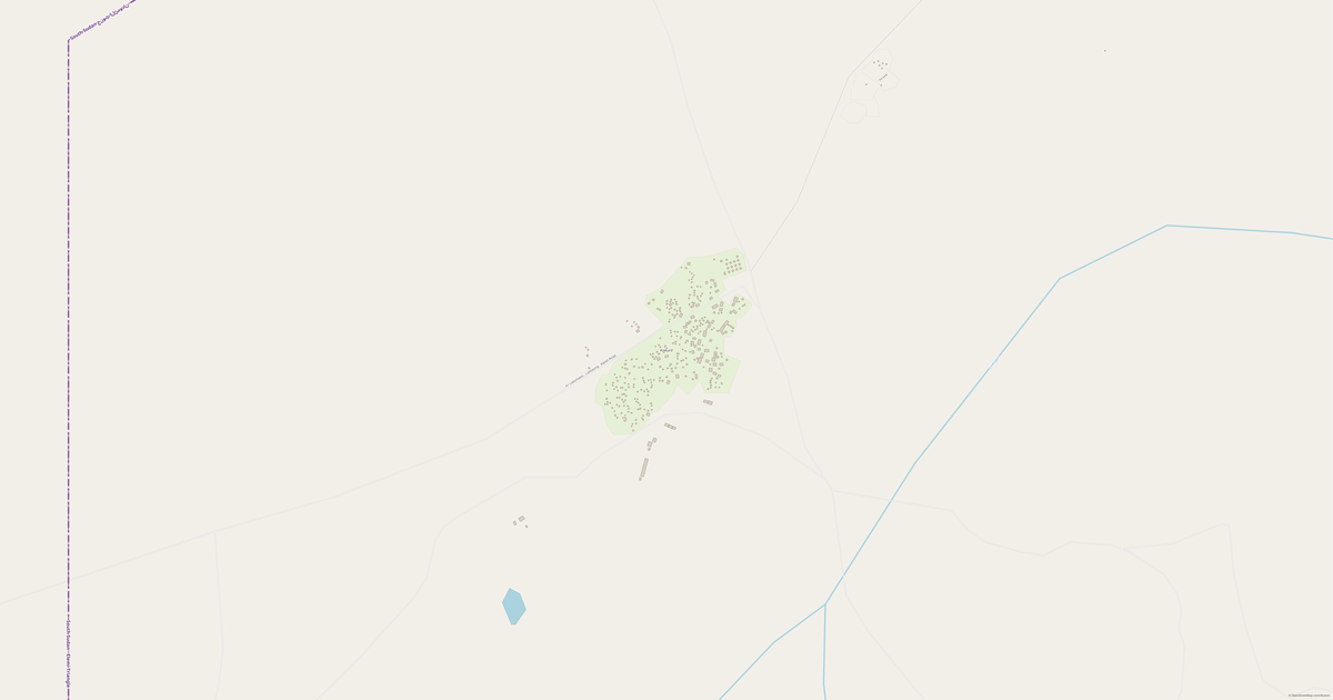
Map of South Sudan

Country · 653,295 km2

A ready-made vector map with buildings, roads and features — for CAD, GIS and print. Free, no registration.

Choose a format
Download · PDF, ≈ 7 MB
All 135 formats Customize your area
133 formatsOSM datano registrationfree
N
© OpenStreetMap
Boundary · South Sudan · OpenStreetMap
BuildingsRoadsWaterGreeneryBoundary

Map passport

653,295 km2
Area
24 273
Buildings
57 436 km
Roads
4 123
Points of interest
Customize the map for yourself

Open the area of South Sudan in the constructor and change layers, style, format and coordinate system for your task.

Open in constructor

Map defaults

This is how the map is built by default — every parameter can be changed in the constructor.

Format
PDF choose
Layers
Roads, Buildings, Water, Greenery, POIchange
Style
Standard (colour)change
Detail
overview (auto)change
House numbers
not visible at this scalechange
Points of interest
not visible at this scalechange
Coordinate system
WGS 84 (auto)change
Sheet size
Relief and grid

Download the map of South Sudan in 135 formats

The same OpenStreetMap dataset — in the format for your software. Pick by task: CAD, vector, GIS, 3D or print.

Popular formatsthe most common formats
MOST COMMON
PDFfor printing and viewing.pdf · ≈ 10.2 MB
CDRfor CorelDRAW.cdr · ≈ 1.6 MB
SVGfor Illustrator, Inkscape, web.svg · ≈ 12 MB
GeoJSONfor QGIS and web maps.geojson · ≈ 15.3 MB
DWGfor AutoCAD, nanoCAD, BricsCAD.dwg · 5.3 MB
CADdrafting and design
DWGFREE
AutoCAD.dwg · 5.3 MB
DXFFREE
CAD exchange.dxf · ≈ 36.7 MB
CDRFREE
CorelDRAW.cdr · ≈ 1.6 MB
DGNFREE
MicroStation.dgn · ≈ 7 MB
Vectorillustration and web
SVGFREE
Web · vector.svg · ≈ 12 MB
AIFREE
Illustrator.ai · ≈ 9.8 MB
EPSFREE
Print production.eps · ≈ 9.6 MB
PDFFREE
Vector · print.pdf · ≈ 10.2 MB
GISgeo-referenced data
GeoJSONFREE
GIS · data.geojson · ≈ 15.3 MB
ShapefileFREE
QGIS · ArcGIS.shp · ≈ 1.9 MB
KMLFREE
Google Earth.kml · ≈ 14.8 MB
GeoPackageFREE
GeoPackage.gpkg · ≈ 8.4 MB
3Dvolume and models
STLFREE
3D printing.stl · ≈ 686 KB
OBJFREE
3D model.obj · ≈ 267 KB
glTFFREE
3D · web.gltf · ≈ 495 KB
DAEFREE
Collada.dae · ≈ 457 KB
Printraster and layouts
PNGFREE
Raster · transparency.png · ≈ 8 MB
JPGFREE
Raster.jpg · ≈ 2 MB
PDFFREE
Print layout.pdf · ≈ 10.2 MB
TIFFFREE
Print production.tif · ≈ 19.1 MB
Open all 135 formats

Maps of South Sudan

All places within the territory — every map is ready to download.

Regions · 12

Major cities · 100

Neighbouring places and regions

Browse to neighbouring cities, districts and regions — each has a ready-made vector map in the same formats.

Nearby

Dablual61 km · VillageMirnyal65 km · VillagePayak67 km · VillageGiel 268 km · VillageGiel 168 km · VillageJaguar69 km · Village

Neighboring countries

Uganda787 km · CountrySudan905 km · CountryCentral African Republic1028 km · CountryEthiopia1096 km · CountryKenya1226 km · CountryDemocratic Republic of the Congo68 692 542 · 1364 km · Country
Map of South Sudan
South Sudan

About South Sudan

South Sudan is a ready-made vector map based on OpenStreetMap data. It is not an image but structured layers of buildings, roads, water bodies, greenery and points of interest that can be edited in any professional software. The map territory covers an area of 653,295 km2 within administrative boundaries.

The map includes 24 273 buildings, 57 436 km of roads and streets and 4 123 points of interest. Each layer can be turned on or off before download, and the data preserves the original OpenStreetMap classification. Green areas cover about 7.8% of the territory.

The map works well as an underlay in AutoCAD and CorelDRAW, for loading layers into QGIS and ArcGIS, preparing printed schemes and plans, or as a basis for design and navigation. More than 130 formats are available — from DWG, DXF and SVG to GeoJSON, Shapefile and 3D models, in the WGS 84 coordinate system.

24 273buildings
57 436 kmroads and streets
4 123features
135formats
WGS 84coordinate system

What's inside the map of South Sudan

The map covers the entire area of South Sudan within administrative boundaries — 653,295 km2. Green areas cover 7.8% of the territory. Each layer can be turned on or off before download.

24 273buildings
Buildings on separate layers
residential513
commercial51
industrial110
57 436km
Roads with classification
trunk roads89 km
primary roads6 235 km
service roads1 214 km
4 123POI
Points of interest
fuel stations66
hotels113
sports pitches159
Main streets
Juba-Bor-Malakal HighwayJuba-Rumbek-Bentiu HighwayWau - RajaRenk-Melut West RoadJuba - KapoetaNarus-Boma
Landmarks · 6
Nyakuron Exhibition Center
Fr. Leopoldo Anywar Museum
Nyakuron Cultural Center
St. John ECS, Aweil
SPC-Akuem
Tank wreck

What the map of South Sudan looks like

The same place in three render styles. Buildings, roads, water and greenery carry over into every format losslessly.

Blueprint (CAD) — map of South Sudan
Blueprint (CAD)
Outlines on a dark background — for DWG and DXF
Standard vector — map of South Sudan
Standard vector
A colour map with buildings, roads and greenery
Print layout — map of South Sudan
Print layout
A ready layout for PDF and print production

Infrastructure of South Sudan

What's on the territory according to OpenStreetMap data.

125
Dining
135
Shops
340
Hotels
1 076
Transport
13
Parks
252
Water

Density and saturation

How many features there are per square kilometre — according to OpenStreetMap data.

0
bld/km²
0,1
km/km²
0
POI/km²
7,8%
greenery

How the map is used

The same dataset for South Sudan — for different tasks: from drafting to 3D printing.

Architecture and design
An underlay and building outlines for drawings and layouts.
DWG / DXF
Design and illustration
A vector map base for posters, schemes and identity design.
SVG / AI
GIS and analysis
Geo-referenced layers for QGIS, ArcGIS and spatial analysis.
GeoJSON / SHP
3D printing and models
Relief of buildings and terrain for printing and visualization.
STL
Navigation and tracks
Map data for navigators and route apps.
Garmin
Print and publishing
A ready map layout for print production.
PDF

Landmarks

Museums, monuments and notable places of South Sudan according to OpenStreetMap data — each with a link to the map.

🏛️
Nyakuron Exhibition Center
MuseumOSM
🏛️
Fr. Leopoldo Anywar Museum
MuseumOSM
🏛️
Nyakuron Cultural Center
MuseumOSM
🏰
St. John ECS, Aweil
CastleOSM
🏰
SPC-Akuem
CastleOSM
Tank wreck
AttractionOSM
Gold Panning
AttractionOSM
Gold Panning
AttractionOSM
Rock Formations
AttractionOSM
Old man's house
AttractionOSM
Rajaf training centre.
AttractionOSM
IGAD,Liason Office. Intergovernmental mental authority of development
AttractionOSM
Acces gate
AttractionOSM
Acces Gate
AttractionOSM
Back gate of SSCC
AttractionOSM
Sarra's homr
AttractionOSM
Good Shepherd
AttractionOSM
Movcon Unmiss tomping
AttractionOSM
Radam National Park
AttractionOSM
South Sudan Liberation Movement Youth League
AttractionOSM
Back side gate
AttractionOSM
JICA
AttractionOSM
JICA. IO 2.
AttractionOSM
Shortcut
AttractionOSM

Nature and green areas

Parks, squares and water bodies of South Sudan according to OpenStreetMap data — everything is carried into the map as separate layers.

104912,3
km² of greenery
7,8%
green coverage
13
parks
252
water bodies
Parks and squares
Täb Dɛŋ Payɔc · 22 ha
John Garang Mausoleum Park · 8 ha
State Garden · 5 ha
#Nr143 · 5 ha
Rumbek Freedom Square · 4 ha
Water bodies
Albert Nile · lake
Lake Tayer · lake
Lake No · lake
Yakuach · lake
Lake Shambe · lake
Bahr al Jabal (Mountain Nile) · river
Nahr al Jur · river
Bahr al 'Arab · river

Public transport

Stops and stations according to OpenStreetMap data.

1 074
bus stops
2
rail stations

Public transport of South Sudan includes 1 074 bus stops and 2 rail stations. All stops and stations are included in the map as a separate layer.

Streets and roads

Roads classified by type — according to OpenStreetMap data.

28201,8 km
unclassified roads
10394,4 km
residential streets
7404,1 km
tertiary roads
6235,7 km
primary roads
3887,8 km
secondary roads
1214,4 km
service roads
89,4 km
trunk roads
5,9 km
living streets

The street network of South Sudan — 57 436 km of roads according to OpenStreetMap data, classified by type.

Named streets
Juba-Bor-Malakal Highway · 498,3 km
Juba-Rumbek-Bentiu Highway · 492,1 km
Wau - Raja · 307,5 km
Renk-Melut West Road · 269,3 km
Juba - Kapoeta · 241,4 km
Narus-Boma · 223,6 km
Juba - Yei - DR Congo Border Road · 201,3 km
Tambura-Wau · 188 km

Restaurants and cafés

Food and drink venues according to OpenStreetMap data.

81
restaurants
13
cafés
26
bars
5
fast food

In South Sudan, OpenStreetMap records 125 food and drink venues — restaurants, cafés, bars and fast-food outlets.

Notable venues
Terrain
Local Tukul
ES-CO Restaurant
Ciano Tukul
Aroma
Il Paradiso
Rock City Restaurant
Juba Grand

Shops and retail

Retail according to OpenStreetMap data.

135
shops

In South Sudan, OpenStreetMap records 135 shops and retail outlets. Main categories: Supermarkets, Shops, Convenience, Bakeries, Butchers, Mobile Phones.

Supermarkets40Shops18Convenience9Bakeries7Butchers4Mobile Phones4Car Dealers3General3Hardware3Beverages3

Education

Schools, universities and libraries according to OpenStreetMap data.

464
schools
23
universities
2
libraries
5
kindergartens

Schools: ABC, AIC NEW FOUNDATION Primary School, AMREF Nurse & Midwifery Training, Adotic primary school, Africano Mande Academy, Ageer Gum Primary School, Agonk bek Secondary School, Akande Primary School. Universities: Aciek Agriculture Training centre, Auxilium Basic School, Bishop Gwynne School of Theology, CWEP ITC, Crop Training Centre (CTC), GRA, Roman Catholic College (Kajo Keji City), Saint Joseph Basic School. Libraries: International Christian Assembly, Main Library.

Healthcare

Hospitals, pharmacies and clinics according to OpenStreetMap data.

160
hospitals
24
pharmacies
306
clinics

Where to stay

Hotels, hostels and guest houses according to OpenStreetMap data.

340
accommodation places
Hotels and guest houses
House of Director of National Archives · Apartments
German residence · Apartments
Shortcut · Apartments
The Nest.British compound 2. · Apartments
Garden City Apartment · Apartments
Acces gate · Apartments
NPTC Warehouse · Apartments
Aida International Hotel · Hotel

What's on the map

Each layer of the South Sudan map can be turned on or off before download.

Map layers
Buildings: 24 273
Roads: 57 436 km
Points of interest: 4 123
Green areas: 104912,3 km²

Key figures

A summary based on OpenStreetMap data for South Sudan.

Buildings24 273
Residential buildings513
Commercial buildings51
Roads57 436 km
Green areas104912,3 km²
Green coverage7,8%
Food and drink venues125
Shops135
Points of interest4 123
Bus stops1 074
Rail stations2
Hospitals160
Pharmacies24
Landmarks198

Compared to neighbours

How the place compares to neighbours within a 30-kilometre radius.

0 places within a 30 km radius to compare.

Frequently asked questions

Open osm2cdr.com, select the target area on the map, choose a format, and start export. Most maps are ready in 1-5 minutes.
Map of South Sudan is available in 135 formats: CDR, DWG, DXF, SVG, AI, EPS, PDF, PNG, GeoJSON, KML, Shapefile, GeoTIFF and others.
Yes. The full map of South Sudan is free to export during Open Beta — all 135 formats, no area limits, no registration.
The service uses OpenStreetMap data, updated monthly.
Generation time depends on the area size. You will receive an email notification when ready.