Mapa Bataan ve formatu OBJ
A map built from OpenStreetMap data, ready to download

Customize the map
Open this place's area in the constructor and adjust everything to your needs
Map passport
What this map contains by default
This is how the map is built as-is — every setting can be changed in the constructor.
O formátu OBJ
Map of Bataan in OBJ — an export of real OpenStreetMap data for the selected area.
Wavefront OBJ is a universal 3D model format with material support. Buildings are exported with texture coordinates and groups by type.
Which layers are in the file
This file for the selected area contains:
- Roads
- Buildings
- Water
- Greenery
- Points of interest
Coordinate systems
WGS 84 (EPSG:4326), selectable in the wizard
Compatibility
Units
Meters (projected in the chosen coordinate system)
| Kategorie | 3D |
| Přípona souboru | .obj |
| Úroveň | Free |
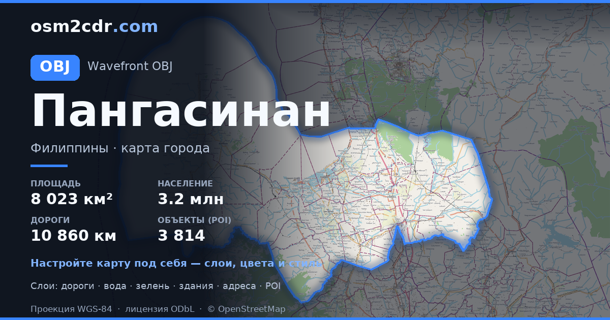
What's in the OBJ map of Bataan
169,673 buildings (5,088 residential, 83 commercial, 110 industrial, 59 religious), 3,133.4 km of roads, 722 points of interest, 15 landmarks.
Mostly residential streets 1,456.3 km, unclassified roads 513.6 km, service roads 494.5 km.
3.8% of the area is green space.
Among the objects: variety_store — 107, convenience stores — 87, restaurants — 61.
3D scene with 169,673 buildings for Blender, Cinema 4D, and other 3D editors.
Main streets: Roman Superhighway, Governor J. J. Linao National Road, Mariveles-Bagac Road, Old National Road, Sitio Malaking Bato
Landmarks: Dambana ng Kagitingan Museum, Bataan World War II Museum, Auspina Eco Resort, Nagbintana Arch, Bats
How to use OBJ for Bataan
- Select the Bataan map area on the main page
- Choose OBJ format and configure export settings
- Click Export and wait for processing
- Download the file and use in your application