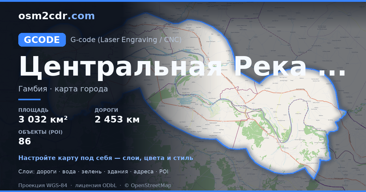
Map of Central River Division in G-code format
A map built from OpenStreetMap data, ready to download
Customize the map
Open this place's area in the constructor and adjust everything to your needs
Open in constructor →Map passport
What this map contains by default
This is how the map is built as-is — every setting can be changed in the constructor.
About G-code
Map of Central River Division in G-code — an export of real OpenStreetMap data for the selected area.
G-code is a CNC and laser engraver control language. Maps are converted to toolpaths for laser cutting or engraving.
Which layers are in the file
This file for the selected area contains:
- Roads
- Buildings
- Water
- Greenery
- Points of interest
Coordinate systems
WGS 84 (EPSG:4326), selectable in the wizard
Compatibility
Units
Meters (projected in the chosen coordinate system)
| Category | GIS |
| File extension | .gcode |
| Tier | Free |
What's in the G-code map of Central River Division
33,962 buildings (30,052 residential, 2 religious), 2,453.2 km of roads, 86 points of interest, 4 landmarks.
The area covers 3,032 km², with about 11 buildings per km².
Mostly unclassified roads 1,537.3 km, residential streets 441.3 km, trunk roads 288.8 km.
9.7% of the area is green space.
The map marks 5 parks and 6 water bodies.
Key amenities: schools — 20, hospitals — 2, marketplaces — 2.
Public transport: 13 bus stops.
Main streets: Janjanbureh Road, John Street
Landmarks: Embarquement Chimpanzees & Hippos, Stone circles, Epic view of Gambia river, heard a Hippo, didn’t see it…, Wassu Stone Circles Quarry Site
How to use G-code for Central River Division
- Select the Central River Division map area on the main page
- Choose G-code format and configure export settings
- Click Export and wait for processing
- Download the file and use in your application


