Map of Angers in G-code format
A map built from OpenStreetMap data, ready to download
Customize the map
Open this place's area in the constructor and adjust everything to your needs
Open in constructor →Map passport
What this map contains by default
This is how the map is built as-is — every setting can be changed in the constructor.
About G-code
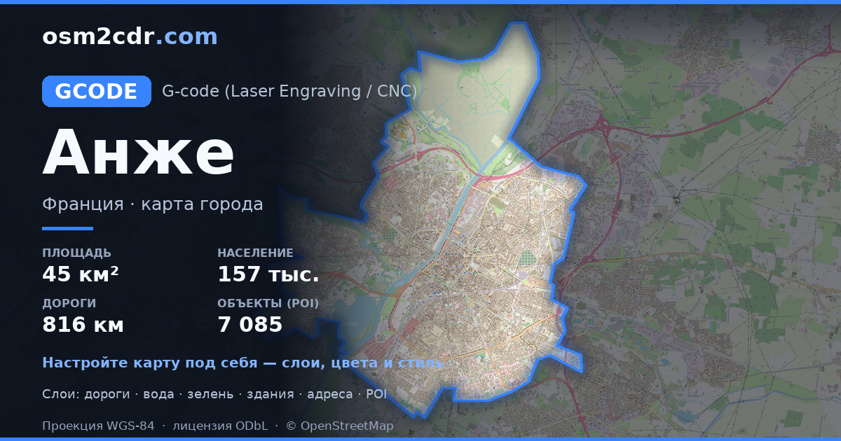
Map of Angers in G-code — an export of real OpenStreetMap data for the selected area.
G-code is a CNC and laser engraver control language. Maps are converted to toolpaths for laser cutting or engraving.
Which layers are in the file
This file for the selected area contains:
- Roads
- Buildings
- Water
- Greenery
- Points of interest
Coordinate systems
WGS 84 (EPSG:4326), selectable in the wizard
Compatibility
Units
Meters (projected in the chosen coordinate system)
| Category | GIS |
| File extension | .gcode |
| Tier | Free |
What's in the G-code map of Angers
49,915 buildings (9,203 residential, 362 commercial, 102 industrial, 50 religious), 816.2 km of roads, 7,085 points of interest, 15 landmarks.
The area covers 45 km², with about 1,121 buildings per km².
Mostly residential streets 288.3 km, service roads 274.2 km, tertiary roads 78.1 km.
10.9% of the area is green space.
The map marks 5 parks and 8 water bodies.
Key amenities: doctors — 57, convenience stores — 54, bakeries — 71.
Public transport: 572 bus stops, 78 tram stops, 2 rail stations.
Main streets: Boulevard Robert d'Arbrissel, Avenue du Général Patton, Avenue Montaigne, Avenue du Lac de Maine, Avenue Victor Châtenay
Landmarks: Musée François Cacheux, Musée de la tapisserie Contemporaine, Musée Jean-Lurçat et de la tapisserie contemporaine, Galerie Sonore, Musée Pincé
How to use G-code for Angers
- Select the Angers map area on the main page
- Choose G-code format and configure export settings
- Click Export and wait for processing
- Download the file and use in your application


