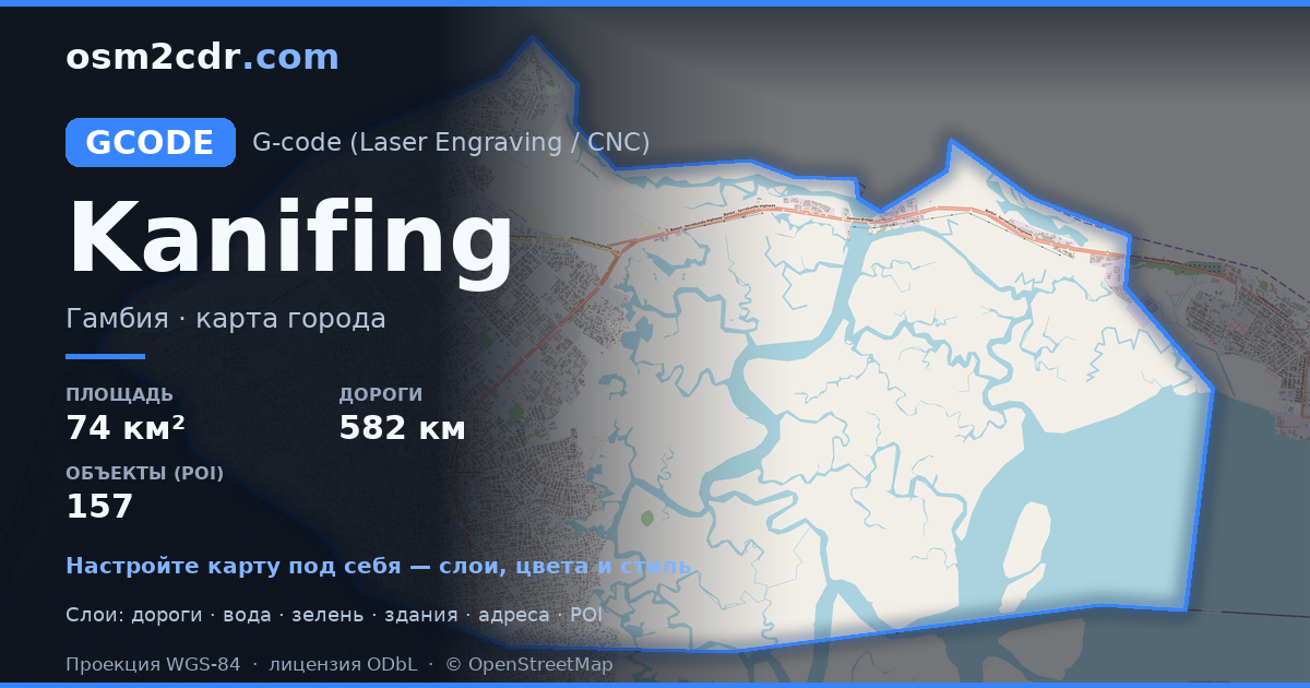
Kanifing Municipal Council G-code 형식 지도
OpenStreetMap 데이터로 만든 지도, 다운로드 가능
지도 사용자 지정
이 장소의 영역을 구성기에서 열고 필요에 맞게 모든 것을 조정하세요
구성기에서 열기 →지도 여권
G-code 정보
Kanifing Municipal Council의 지도를 G-code 형식으로 — 선택한 영역의 실제 OpenStreetMap 데이터 내보내기입니다.
G-code is a CNC and laser engraver control language. Maps are converted to toolpaths for laser cutting or engraving.
파일에 포함된 레이어
선택한 영역의 이 파일에는 다음이 포함됩니다:
- 도로
- 건물
- 수역
- 녹지
- 관심 지점
좌표계
WGS 84(EPSG:4326), 마법사에서 선택 가능
호환성
단위
미터(선택한 좌표계로 투영)
| 카테고리 | GIS |
| 파일 확장자 | .gcode |
| 등급 | Free |
What's in the G-code map of Kanifing Municipal Council
29,324 buildings (20,399 residential, 84 commercial, 2 industrial, 10 religious), 582.7 km of roads, 157 points of interest, 7 landmarks.
Mostly residential streets 422.5 km, tertiary roads 49.5 km, trunk roads 44.2 km.
45.3% of the area is green space.
Key amenities: colleges — 12, schools — 11, supermarkets — 5.
Main streets: Bertil Harding Highway, Kairaba Avenue, Kotu Highway, Old Cape Road, Sayerjobe Avenue
Landmarks: Kachikally Crocodile Pool, Kachikally Crocodile Pool, Tallinding Sitokoto, st kizito, Masjid Bilal
Kanifing Municipal Council에서 G-code 사용 방법
- 메인 페이지에서 Kanifing Municipal Council 지도 영역을 선택하세요
- G-code 형식을 선택하고 내보내기 설정을 조정하세요
- 「내보내기」를 클릭하고 처리가 완료될 때까지 기다리세요
- 완성된 파일을 다운로드하여 원하는 프로그램에서 사용하세요


