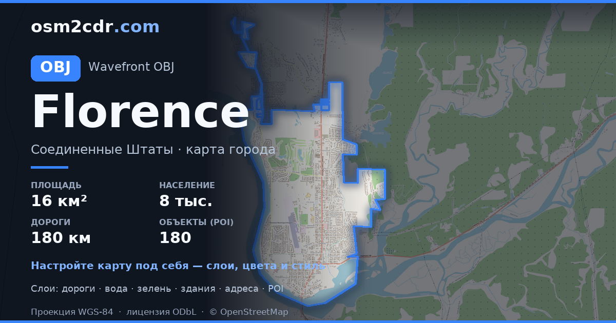
Florence OBJ 형식 지도
OpenStreetMap 데이터로 만든 지도, 다운로드 가능
지도 사용자 지정
이 장소의 영역을 구성기에서 열고 필요에 맞게 모든 것을 조정하세요
구성기에서 열기 →지도 여권
OBJ 정보
Florence의 지도를 OBJ 형식으로 — 선택한 영역의 실제 OpenStreetMap 데이터 내보내기입니다.
Wavefront OBJ is a universal 3D model format with material support. Buildings are exported with texture coordinates and groups by type.
파일에 포함된 레이어
선택한 영역의 이 파일에는 다음이 포함됩니다:
- 도로
- 건물
- 수역
- 녹지
- 관심 지점
좌표계
WGS 84(EPSG:4326), 마법사에서 선택 가능
호환성
단위
미터(선택한 좌표계로 투영)
| 카테고리 | 3D |
| 파일 확장자 | .obj |
| 등급 | Free |
What's in the OBJ map of Florence
5,169 buildings (59 residential, 34 commercial, 1 industrial, 2 religious), 180.9 km of roads, 180 points of interest, 12 landmarks.
Mostly residential streets 77.8 km, service roads 44.0 km, tertiary roads 29.2 km.
16.4% of the area is green space.
Key amenities: schools — 7, pharmacies — 4, convenience stores — 5.
3D scene with 5,169 buildings for Blender, Cinema 4D, and other 3D editors.
Main streets: North Fork Siuslaw Road, Kingwood Street, North Rhododendron Drive, Rhododendron Drive, Heceta Beach Road
Landmarks: Oregon Coast Military Museum, Siuslaw Pioneer Museum, C.R.O.W. Center for the Performing Arts, The River Gallery, The Laughing Crab Gallery & Tasting Room
Florence에서 OBJ 사용 방법
- 메인 페이지에서 Florence 지도 영역을 선택하세요
- OBJ 형식을 선택하고 내보내기 설정을 조정하세요
- 「내보내기」를 클릭하고 처리가 완료될 때까지 기다리세요
- 완성된 파일을 다운로드하여 원하는 프로그램에서 사용하세요


