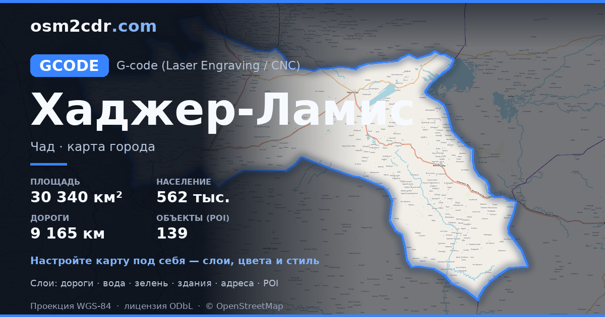
Hadjer-LamisのG-code形式マップ
OpenStreetMap データから作成された地図、ダウンロード可能
地図をカスタマイズ
この場所のエリアをコンストラクターで開き、目的に合わせてすべてを調整できます
コンストラクターで開く →地図パスポート
G-codeについて
Hadjer-Lamis の地図を G-code 形式で — 選択したエリアの実際の OpenStreetMap データのエクスポートです。
G-code is a CNC and laser engraver control language. Maps are converted to toolpaths for laser cutting or engraving.
ファイルに含まれるレイヤー
選択したエリアのこのファイルには次が含まれます:
- 道路
- 建物
- 水域
- 緑地
- ポイント・オブ・インタレスト
座標系
WGS 84(EPSG:4326)、ウィザードで選択可能
互換性
単位
メートル(選択した座標系での投影)
| カテゴリ | GIS |
| ファイル拡張子 | .gcode |
| レベル | Free |
What's in the G-code map of Hadjer-Lamis
82,387 buildings (1,360 residential, 29 commercial, 3 religious), 9,165.7 km of roads, 139 points of interest, 8 landmarks.
Mostly unclassified roads 5,466.0 km, residential streets 1,510.9 km, tertiary roads 982.6 km.
1.2% of the area is green space.
Key amenities: schools — 4, hospitals — 10, clinics — 17.
Main streets: Route nationale N'Djaména - Massakory - Faya-Largeau
Landmarks: Jardin Ambourou, Rond point 100ans, المسجد الدعوة, مسجد الشيخ ناصر الشيباني, Dilema Mosque
Hadjer-Lamis で G-code を使う方法
- メインページで Hadjer-Lamis の地図エリアを選択します
- G-code 形式を選んでエクスポート設定を調整します
- 「エクスポート」をクリックして処理が完了するのを待ちます
- 完成したファイルをダウンロードして目的のプログラムで使用します


